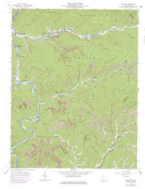
Mallory Topo Map West Virginia
To zoom in, hover over the map of Mallory
USGS Topo Quad 37081f7 - 1:24,000 scale
| Topo Map Name: | Mallory |
| USGS Topo Quad ID: | 37081f7 |
| Print Size: | ca. 21 1/4" wide x 27" high |
| Southeast Coordinates: | 37.625° N latitude / 81.75° W longitude |
| Map Center Coordinates: | 37.6875° N latitude / 81.8125° W longitude |
| U.S. State: | WV |
| Filename: | o37081f7.jpg |
| Download Map JPG Image: | Mallory topo map 1:24,000 scale |
| Map Type: | Topographic |
| Topo Series: | 7.5´ |
| Map Scale: | 1:24,000 |
| Source of Map Images: | United States Geological Survey (USGS) |
| Alternate Map Versions: |
Mallory WV 1963, updated 1965 Download PDF Buy paper map Mallory WV 1963, updated 1978 Download PDF Buy paper map Mallory WV 1996, updated 2003 Download PDF Buy paper map Mallory WV 2011 Download PDF Buy paper map Mallory WV 2014 Download PDF Buy paper map Mallory WV 2016 Download PDF Buy paper map |
1:24,000 Topo Quads surrounding Mallory
> Back to 37081e1 at 1:100,000 scale
> Back to 37080a1 at 1:250,000 scale
> Back to U.S. Topo Maps home
Mallory topo map: Gazetteer
Mallory: Populated Places
Bruno elevation 230m 754′Christian elevation 233m 764′
Claypool elevation 256m 839′
Combs Addition elevation 264m 866′
Davin elevation 246m 807′
Emmett elevation 256m 839′
Gillman Bottom elevation 268m 879′
Greenville elevation 230m 754′
Guyan elevation 330m 1082′
Huff Junction elevation 229m 751′
Landville elevation 230m 754′
Mallory elevation 241m 790′
Mineral City elevation 248m 813′
Slabtown elevation 249m 816′
Verner elevation 238m 780′
Wylo elevation 230m 754′
Mallory: Post Offices
Bruno Post Office elevation 231m 757′Davin Post Office elevation 246m 807′
Emmett Post Office elevation 256m 839′
Hunt Post Office elevation 230m 754′
Verner Post Office elevation 248m 813′
Mallory: Streams
Bear Branch elevation 271m 889′Big Springs Branch elevation 240m 787′
Bills Branch elevation 226m 741′
Bum Fork elevation 238m 780′
Canebrake Branch elevation 237m 777′
Christian Branch elevation 261m 856′
Deep Ford Branch elevation 229m 751′
Dingess Run elevation 317m 1040′
Dolliver Branch elevation 255m 836′
Elk Creek elevation 228m 748′
Elk Trace Branch elevation 332m 1089′
Green Branch elevation 228m 748′
Harrys Branch elevation 259m 849′
Hollow Log Branch elevation 273m 895′
Huff Creek elevation 222m 728′
Laurel Branch elevation 229m 751′
Lick Branch elevation 287m 941′
Mill Branch elevation 383m 1256′
Moore Fork elevation 264m 866′
Morgan Fork elevation 344m 1128′
Mossy Branch elevation 352m 1154′
Muddy Bridge Branch elevation 282m 925′
Oldhouse Branch elevation 257m 843′
Orchard Branch elevation 247m 810′
Pointlick Fork elevation 358m 1174′
Pound Mill Branch elevation 225m 738′
Riddle Branch elevation 241m 790′
Right Hand Fork Elk Creek elevation 277m 908′
Road Branch elevation 332m 1089′
Rockhouse Branch elevation 391m 1282′
Sandlick Branch elevation 264m 866′
Sandlick Creek elevation 226m 741′
Spice Creek elevation 235m 770′
Stonecoal Branch elevation 381m 1250′
Sturgeon Branch elevation 321m 1053′
Sugarcamp Branch elevation 286m 938′
Sugartree Branch elevation 305m 1000′
Sycamore Branch elevation 340m 1115′
Sylvia Branch elevation 231m 757′
Turkeypen Branch elevation 288m 944′
Wallace Fork elevation 324m 1062′
Mallory: Valleys
Buckeye Hollow elevation 418m 1371′He Hollow elevation 394m 1292′
Poplar Log Hollow elevation 369m 1210′
Walnut Hollow elevation 352m 1154′
Mallory digital topo map on disk
Buy this Mallory topo map showing relief, roads, GPS coordinates and other geographical features, as a high-resolution digital map file on DVD:
Western Virginia & Southern West Virginia
Buy digital topo maps: Western Virginia & Southern West Virginia


