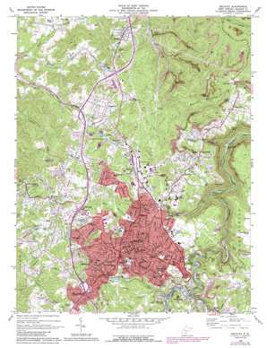
Beckley Topo Map West Virginia
To zoom in, hover over the map of Beckley
USGS Topo Quad 37081g2 - 1:24,000 scale
| Topo Map Name: | Beckley |
| USGS Topo Quad ID: | 37081g2 |
| Print Size: | ca. 21 1/4" wide x 27" high |
| Southeast Coordinates: | 37.75° N latitude / 81.125° W longitude |
| Map Center Coordinates: | 37.8125° N latitude / 81.1875° W longitude |
| U.S. State: | WV |
| Filename: | o37081g2.jpg |
| Download Map JPG Image: | Beckley topo map 1:24,000 scale |
| Map Type: | Topographic |
| Topo Series: | 7.5´ |
| Map Scale: | 1:24,000 |
| Source of Map Images: | United States Geological Survey (USGS) |
| Alternate Map Versions: |
Beckley WV 1969, updated 1973 Download PDF Buy paper map Beckley WV 1969, updated 1977 Download PDF Buy paper map Beckley WV 1969, updated 1989 Download PDF Buy paper map Beckley WV 2011 Download PDF Buy paper map Beckley WV 2014 Download PDF Buy paper map Beckley WV 2016 Download PDF Buy paper map |
1:24,000 Topo Quads surrounding Beckley
> Back to 37081e1 at 1:100,000 scale
> Back to 37080a1 at 1:250,000 scale
> Back to U.S. Topo Maps home
Beckley topo map: Gazetteer
Beckley: Airports
Appalachian Regional Hospital Heliport elevation 719m 2358′Ramada Inn Heliport elevation 747m 2450′
Beckley: Crossings
Interchange 124 elevation 708m 2322′Interchange 125 elevation 774m 2539′
Interchange 42 elevation 751m 2463′
Interchange 44 elevation 739m 2424′
Interchange 46 elevation 724m 2375′
Beckley: Dams
Unnamed Tributary of Piney Creek Dam elevation 705m 2312′Beckley: Mines
Exhibition Mine elevation 727m 2385′Beckley: Parks
Babe Ruth Park elevation 715m 2345′New River Park elevation 719m 2358′
Beckley: Populated Places
Beckley elevation 738m 2421′Beckley Junction elevation 692m 2270′
Bradley elevation 676m 2217′
Cabell elevation 742m 2434′
Cranberry elevation 717m 2352′
Dry Hill elevation 753m 2470′
East Beckley elevation 725m 2378′
Glen Morgan elevation 645m 2116′
Harper Heights elevation 732m 2401′
James Crest Farms elevation 732m 2401′
Johnstown elevation 724m 2375′
Lanark elevation 706m 2316′
Mabscott elevation 699m 2293′
MacArthur elevation 742m 2434′
Maple Fork elevation 626m 2053′
Morgan Hills elevation 721m 2365′
Mount Tabor elevation 758m 2486′
Old Mill Village elevation 751m 2463′
Oswald (historical) elevation 583m 1912′
Pine Hills elevation 732m 2401′
Pinepoca (historical) elevation 557m 1827′
Piney View elevation 713m 2339′
Prosperity elevation 752m 2467′
Raleigh elevation 679m 2227′
Riley elevation 718m 2355′
Rodes (historical) elevation 582m 1909′
Skelton elevation 703m 2306′
Sprague elevation 722m 2368′
Stanaford elevation 734m 2408′
Stonewall (historical) elevation 445m 1459′
Tamroy (historical) elevation 611m 2004′
Warden elevation 731m 2398′
White Stick (historical) elevation 519m 1702′
Whorley (historical) elevation 608m 1994′
Wickham elevation 736m 2414′
Beckley: Post Offices
Beaver Post Office elevation 651m 2135′Beckley Post Office elevation 732m 2401′
Bradley Post Office elevation 671m 2201′
Cranberry Post Office elevation 712m 2335′
East Beckley Post Office elevation 722m 2368′
Mabscott Post Office elevation 707m 2319′
MacArthur Post Office elevation 721m 2365′
Piney View Post Office elevation 716m 2349′
Prosperity Post Office elevation 758m 2486′
Beckley: Streams
Beaver Creek elevation 633m 2076′Cranberry Creek elevation 510m 1673′
Griffith Branch elevation 508m 1666′
Little Whitestick Creek elevation 652m 2139′
Maple Fork elevation 563m 1847′
Stanaford Branch elevation 448m 1469′
Tamarack Branch elevation 722m 2368′
Tank Branch elevation 637m 2089′
Whitestick Creek elevation 645m 2116′
Beckley: Summits
Batoff Mountain elevation 790m 2591′Beckley digital topo map on disk
Buy this Beckley topo map showing relief, roads, GPS coordinates and other geographical features, as a high-resolution digital map file on DVD:
Western Virginia & Southern West Virginia
Buy digital topo maps: Western Virginia & Southern West Virginia


