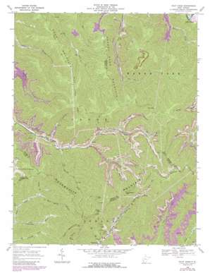
Pilot Knob Topo Map West Virginia
To zoom in, hover over the map of Pilot Knob
USGS Topo Quad 37081g5 - 1:24,000 scale
| Topo Map Name: | Pilot Knob |
| USGS Topo Quad ID: | 37081g5 |
| Print Size: | ca. 21 1/4" wide x 27" high |
| Southeast Coordinates: | 37.75° N latitude / 81.5° W longitude |
| Map Center Coordinates: | 37.8125° N latitude / 81.5625° W longitude |
| U.S. State: | WV |
| Filename: | o37081g5.jpg |
| Download Map JPG Image: | Pilot Knob topo map 1:24,000 scale |
| Map Type: | Topographic |
| Topo Series: | 7.5´ |
| Map Scale: | 1:24,000 |
| Source of Map Images: | United States Geological Survey (USGS) |
| Alternate Map Versions: |
Pilot Knob WV 1968, updated 1971 Download PDF Buy paper map Pilot Knob WV 1968, updated 1977 Download PDF Buy paper map Pilot Knob WV 1968, updated 1989 Download PDF Buy paper map Pilot Knob WV 2011 Download PDF Buy paper map Pilot Knob WV 2014 Download PDF Buy paper map Pilot Knob WV 2016 Download PDF Buy paper map |
1:24,000 Topo Quads surrounding Pilot Knob
> Back to 37081e1 at 1:100,000 scale
> Back to 37080a1 at 1:250,000 scale
> Back to U.S. Topo Maps home
Pilot Knob topo map: Gazetteer
Pilot Knob: Areas
Jarrolds Field elevation 986m 3234′Pilot Knob: Dams
Johns Branch Number One Dam elevation 739m 2424′Johns Branch Number Two Dam elevation 739m 2424′
Low Gap Branch Two Impoundment Dam elevation 613m 2011′
Mill Branch Coal Refuse Dam elevation 646m 2119′
Pilot Knob: Flats
Jarrells Flats elevation 809m 2654′Pilot Knob: Gaps
Hazy Gap elevation 724m 2375′Indian Gap elevation 830m 2723′
Walnut Gap elevation 832m 2729′
Pilot Knob: Populated Places
Echart (historical) elevation 407m 1335′Pettry Bottom elevation 324m 1062′
Pilot Knob: Reservoirs
Kopperston Number Four Slurry Pond elevation 646m 2119′Kopperston Number Three Impoundment Number One elevation 739m 2424′
Kopperston Number Three Impoundment Number Two elevation 739m 2424′
Low Gap Branch Number Two Impoundment elevation 613m 2011′
Pilot Knob: Ridges
Jarrells Ridge elevation 824m 2703′Pilot Knob: Springs
Kimbrell Water Works Spring elevation 559m 1833′Pilot Knob: Streams
Bear Spring Branch elevation 522m 1712′Brushy Fork elevation 450m 1476′
Burnt Camp Branch elevation 424m 1391′
Farley Branch elevation 512m 1679′
Lacey Branch elevation 463m 1519′
Laurel Branch elevation 474m 1555′
Rich Branch elevation 534m 1751′
Skin Fork elevation 432m 1417′
Spring Branch elevation 535m 1755′
Pilot Knob: Summits
Cherry Pond Mountain elevation 843m 2765′Cook Mountain elevation 773m 2536′
Kopperston Mountain elevation 993m 3257′
Pilot Knob elevation 1036m 3398′
Pilot Knob digital topo map on disk
Buy this Pilot Knob topo map showing relief, roads, GPS coordinates and other geographical features, as a high-resolution digital map file on DVD:
Western Virginia & Southern West Virginia
Buy digital topo maps: Western Virginia & Southern West Virginia


