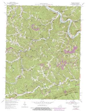
Hellier Topo Map Kentucky
To zoom in, hover over the map of Hellier
USGS Topo Quad 37082c4 - 1:24,000 scale
| Topo Map Name: | Hellier |
| USGS Topo Quad ID: | 37082c4 |
| Print Size: | ca. 21 1/4" wide x 27" high |
| Southeast Coordinates: | 37.25° N latitude / 82.375° W longitude |
| Map Center Coordinates: | 37.3125° N latitude / 82.4375° W longitude |
| U.S. States: | KY, VA |
| Filename: | o37082c4.jpg |
| Download Map JPG Image: | Hellier topo map 1:24,000 scale |
| Map Type: | Topographic |
| Topo Series: | 7.5´ |
| Map Scale: | 1:24,000 |
| Source of Map Images: | United States Geological Survey (USGS) |
| Alternate Map Versions: |
Hellier KY 1954, updated 1956 Download PDF Buy paper map Hellier KY 1954, updated 1968 Download PDF Buy paper map Hellier KY 1954, updated 1978 Download PDF Buy paper map Hellier KY 2011 Download PDF Buy paper map Hellier KY 2013 Download PDF Buy paper map Hellier KY 2016 Download PDF Buy paper map |
| FStopo: | US Forest Service topo Hellier is available: Download FStopo PDF Download FStopo TIF |
1:24,000 Topo Quads surrounding Hellier
> Back to 37082a1 at 1:100,000 scale
> Back to 37082a1 at 1:250,000 scale
> Back to U.S. Topo Maps home
Hellier topo map: Gazetteer
Hellier: Mines
Allegheny Mine elevation 398m 1305′Greenough Mine (historical) elevation 363m 1190′
Hellier: Populated Places
Allegheny (historical) elevation 432m 1417′Ashcamp elevation 329m 1079′
Big Branch elevation 326m 1069′
Draffin elevation 226m 741′
Dry Fork elevation 248m 813′
Edgewater elevation 396m 1299′
Hellier elevation 383m 1256′
Henry Clay elevation 310m 1017′
Kettlecamp elevation 354m 1161′
Lookout elevation 308m 1010′
Marrowbone elevation 231m 757′
Ratliff elevation 262m 859′
Road Junction elevation 227m 744′
Rockhouse elevation 309m 1013′
Venters elevation 250m 820′
Wolfpit elevation 224m 734′
Hellier: Post Offices
Alka Post Office (historical) elevation 295m 967′Big Branch Post Office (historical) elevation 325m 1066′
Carmen Post Office (historical) elevation 249m 816′
Cedar Post Office (historical) elevation 212m 695′
Drafin Post Office (historical) elevation 279m 915′
Lookout Post Office (historical) elevation 297m 974′
Mancho Post Office (historical) elevation 395m 1295′
Marrowbone - Regina Post Office elevation 231m 757′
Pond Post Office (historical) elevation 228m 748′
Regina Post Office elevation 231m 757′
Wolf Pit Post Office (historical) elevation 228m 748′
Hellier: Streams
Adams Branch elevation 286m 938′Ashcamp Branch elevation 324m 1062′
Bad Fork elevation 285m 935′
Big Branch elevation 312m 1023′
Bowling Fork elevation 318m 1043′
Brushy Branch elevation 353m 1158′
Camp Branch elevation 331m 1085′
Coal Fork Branch elevation 317m 1040′
Deadening Fork elevation 361m 1184′
Dry Fork elevation 246m 807′
Earns Branch elevation 211m 692′
Ferrell Creek elevation 226m 741′
Garden Branch elevation 428m 1404′
Gum Branch elevation 324m 1062′
Harless Creek elevation 222m 728′
Hurricane Branch elevation 312m 1023′
Jackson Branch elevation 311m 1020′
Jessie Branch elevation 229m 751′
Jimmie Creek elevation 215m 705′
Joe Brown Fork elevation 285m 935′
Johnson Branch elevation 210m 688′
Johnson Fork elevation 275m 902′
Kettlecamp Branch elevation 287m 941′
Laurel Branch elevation 251m 823′
Laurel Fork elevation 348m 1141′
Left Fork Dry Creek elevation 287m 941′
Left Fork Rockhouse Creek elevation 328m 1076′
Left Fork Sycamore Creek elevation 372m 1220′
Left Fork Wolfpit Branch elevation 264m 866′
Lick Branch elevation 350m 1148′
Lick Branch elevation 277m 908′
Lick Branch elevation 304m 997′
Little Branch elevation 299m 980′
Lower Field Branch elevation 327m 1072′
Marion Branch elevation 340m 1115′
Marrowbone Creek elevation 209m 685′
Meadow Branch elevation 329m 1079′
Mill Branch elevation 303m 994′
Mill Branch elevation 324m 1062′
Mountain Branch elevation 292m 958′
Nance Branch elevation 307m 1007′
Old House Branch elevation 340m 1115′
Old House Branch elevation 343m 1125′
Plymale Branch elevation 212m 695′
Polerack Branch elevation 272m 892′
Pond Creek elevation 217m 711′
Poor Bottom Fork elevation 294m 964′
Right Fork Rockhouse Creek elevation 345m 1131′
Road Creek elevation 216m 708′
Rockhouse Creek elevation 265m 869′
Rough Branch elevation 268m 879′
Seng Branch elevation 296m 971′
Shop Branch elevation 301m 987′
Snake Branch elevation 315m 1033′
Staggerweed Branch elevation 375m 1230′
Sycamore Creek elevation 351m 1151′
Toms Branch elevation 333m 1092′
Water Branch elevation 281m 921′
Wolfpit Branch elevation 228m 748′
Hellier: Summits
Skeet Rock Knob elevation 909m 2982′Skeet Rock Knob elevation 905m 2969′
Hellier: Valleys
Childers Hollow elevation 375m 1230′Dave Hollow elevation 375m 1230′
Goose Hollow elevation 307m 1007′
Graveyard Hollow elevation 328m 1076′
Narrow Hollow elevation 334m 1095′
Orchard Hollow elevation 266m 872′
Oscar Right Hollow elevation 328m 1076′
Uppertwin Hollow elevation 330m 1082′
Hellier digital topo map on disk
Buy this Hellier topo map showing relief, roads, GPS coordinates and other geographical features, as a high-resolution digital map file on DVD:
Western Virginia & Southern West Virginia
Buy digital topo maps: Western Virginia & Southern West Virginia


