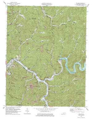
Millard Topo Map Kentucky
To zoom in, hover over the map of Millard
USGS Topo Quad 37082d4 - 1:24,000 scale
| Topo Map Name: | Millard |
| USGS Topo Quad ID: | 37082d4 |
| Print Size: | ca. 21 1/4" wide x 27" high |
| Southeast Coordinates: | 37.375° N latitude / 82.375° W longitude |
| Map Center Coordinates: | 37.4375° N latitude / 82.4375° W longitude |
| U.S. State: | KY |
| Filename: | o37082d4.jpg |
| Download Map JPG Image: | Millard topo map 1:24,000 scale |
| Map Type: | Topographic |
| Topo Series: | 7.5´ |
| Map Scale: | 1:24,000 |
| Source of Map Images: | United States Geological Survey (USGS) |
| Alternate Map Versions: |
Millard KY 1954, updated 1956 Download PDF Buy paper map Millard KY 1978, updated 1979 Download PDF Buy paper map Millard KY 2010 Download PDF Buy paper map Millard KY 2013 Download PDF Buy paper map Millard KY 2016 Download PDF Buy paper map |
1:24,000 Topo Quads surrounding Millard
> Back to 37082a1 at 1:100,000 scale
> Back to 37082a1 at 1:250,000 scale
> Back to U.S. Topo Maps home
Millard topo map: Gazetteer
Millard: Dams
Fishtrap Dam elevation 257m 843′Millard: Flats
Justice Bottom elevation 231m 757′Millard: Gaps
Chloe Gap elevation 329m 1079′Millard: Lakes
Chloe Lake elevation 248m 813′Millard: Parks
Fishtrap Lake State Park elevation 293m 961′Millard: Populated Places
Axtell elevation 206m 675′Branham Heights elevation 223m 731′
Crooked Creek elevation 210m 688′
Daniels Creek elevation 227m 744′
East Shelbiana elevation 204m 669′
Fishtrap (historical) elevation 220m 721′
Garden Village elevation 215m 705′
Greasy Creek elevation 273m 895′
Hurricane Branch elevation 261m 856′
Jonkan elevation 267m 875′
Justiceville elevation 212m 695′
Lake Helen Residence elevation 222m 728′
Levisa Junction elevation 208m 682′
Liberty (historical) elevation 215m 705′
Lower Greasy Creek elevation 209m 685′
Lower Pompey elevation 335m 1099′
Millard elevation 214m 702′
Nelse elevation 222m 728′
Raccoon elevation 266m 872′
Red Creek elevation 250m 820′
Shelbiana elevation 247m 810′
Sutton elevation 211m 692′
Upper Chloe elevation 254m 833′
Upper Pompey elevation 236m 774′
Millard: Post Offices
Alka Post Office (historical) elevation 267m 875′Bass Post Office (historical) elevation 245m 803′
Enterprise Post Office (historical) elevation 215m 705′
Fishtrap Post Office (historical) elevation 220m 721′
Greasy Post Office (historical) elevation 279m 915′
Hamitons Store Post Office (historical) elevation 212m 695′
Jettie Post Office (historical) elevation 215m 705′
Lower Pompey Post Office (historical) elevation 331m 1085′
Millard Post Office (historical) elevation 210m 688′
Powell's Mill Post Office (historical) elevation 210m 688′
Raccoon Post Office (historical) elevation 276m 905′
Raystore Post Office (historical) elevation 214m 702′
Shelbiana Post Office (historical) elevation 224m 734′
Sulton Post Office (historical) elevation 220m 721′
Sword Post Office (historical) elevation 210m 688′
Millard: Reservoirs
Fishtrap Lake elevation 237m 777′Millard: Springs
Sulpher Spring elevation 231m 757′Millard: Streams
Bevins Fork elevation 231m 757′Bishop Branch elevation 304m 997′
Buck Branch elevation 222m 728′
Camp Branch elevation 274m 898′
Damron Branch elevation 206m 675′
Daniels Branch elevation 207m 679′
Dry Branch elevation 259m 849′
Dry Creek elevation 206m 675′
Dry Fork elevation 227m 744′
Fife Fork elevation 253m 830′
Fiftyeight Branch elevation 276m 905′
Gardiner Fork elevation 269m 882′
Gillespi Branch elevation 227m 744′
Greasy Creek elevation 205m 672′
Hopkins Creek elevation 205m 672′
Hurricane Creek elevation 220m 721′
Ivy Fork elevation 266m 872′
James Fork elevation 230m 754′
Jonican Branch elevation 220m 721′
Lick Branch elevation 226m 741′
Lower Lick elevation 285m 935′
Lower Pompey Branch elevation 205m 672′
Morris Branch elevation 352m 1154′
Opossum Branch elevation 324m 1062′
Peter Fork elevation 230m 754′
Peyton Branch elevation 204m 669′
Pompey Branch elevation 205m 672′
Powell Creek elevation 205m 672′
Ramey Branch elevation 293m 961′
Red Creek elevation 204m 669′
Riggs Creek elevation 204m 669′
Right Fork Harless Creek elevation 272m 892′
Right Fork Red Creek elevation 238m 780′
Right Fork Upper Chloe Creek elevation 254m 833′
Road Fork elevation 234m 767′
Russell Fork elevation 204m 669′
Shelby Creek elevation 207m 679′
Slones Branch elevation 205m 672′
Slones Branch elevation 340m 1115′
Upper Chloe Creek elevation 204m 669′
Upper Lick elevation 288m 944′
Upper Pompey Branch elevation 220m 721′
Williams Branch elevation 255m 836′
Winston Branch elevation 204m 669′
Wolfpen Fork elevation 267m 875′
Millard: Summits
Ripley Knob elevation 550m 1804′Stratton Knob elevation 572m 1876′
Millard: Valleys
Bearwater Hollow elevation 243m 797′Burnt Tree Hollow elevation 327m 1072′
Cox Hollow elevation 219m 718′
Johnson Hollow elevation 263m 862′
McCoy Hollow elevation 266m 872′
Narrow Hollow elevation 216m 708′
Powell Hollow elevation 336m 1102′
Wheatfield Hollow elevation 302m 990′
Millard digital topo map on disk
Buy this Millard topo map showing relief, roads, GPS coordinates and other geographical features, as a high-resolution digital map file on DVD:
Western Virginia & Southern West Virginia
Buy digital topo maps: Western Virginia & Southern West Virginia


