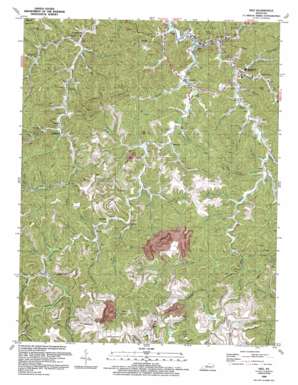
Inez Topo Map Kentucky
To zoom in, hover over the map of Inez
USGS Topo Quad 37082g5 - 1:24,000 scale
| Topo Map Name: | Inez |
| USGS Topo Quad ID: | 37082g5 |
| Print Size: | ca. 21 1/4" wide x 27" high |
| Southeast Coordinates: | 37.75° N latitude / 82.5° W longitude |
| Map Center Coordinates: | 37.8125° N latitude / 82.5625° W longitude |
| U.S. State: | KY |
| Filename: | o37082g5.jpg |
| Download Map JPG Image: | Inez topo map 1:24,000 scale |
| Map Type: | Topographic |
| Topo Series: | 7.5´ |
| Map Scale: | 1:24,000 |
| Source of Map Images: | United States Geological Survey (USGS) |
| Alternate Map Versions: |
Inez KY 1954, updated 1955 Download PDF Buy paper map Inez KY 1954, updated 1971 Download PDF Buy paper map Inez KY 1954, updated 1978 Download PDF Buy paper map Inez KY 1992, updated 1992 Download PDF Buy paper map Inez KY 2010 Download PDF Buy paper map Inez KY 2013 Download PDF Buy paper map Inez KY 2016 Download PDF Buy paper map |
1:24,000 Topo Quads surrounding Inez
> Back to 37082e1 at 1:100,000 scale
> Back to 37082a1 at 1:250,000 scale
> Back to U.S. Topo Maps home
Inez topo map: Gazetteer
Inez: Populated Places
Davella elevation 211m 692′Davisport elevation 213m 698′
Debord elevation 205m 672′
Inez elevation 194m 636′
Tomahawk elevation 204m 669′
Inez: Post Offices
Preece Post Office (historical) elevation 224m 734′Tomahawk Post Office (historical) elevation 202m 662′
Wendle Post Office (historical) elevation 207m 679′
Inez: Streams
Apple Orchard Branch elevation 205m 672′Apple Tree Branch elevation 224m 734′
Beech Fork elevation 218m 715′
Bent Branch elevation 219m 718′
Big Rough Branch elevation 216m 708′
Blacklog Fork elevation 194m 636′
Brushy Forks elevation 215m 705′
Camp Branch elevation 201m 659′
Carter Branch elevation 198m 649′
Cassady Branch elevation 211m 692′
Cecil Branch elevation 218m 715′
Coldwater Fork elevation 188m 616′
Collins Branch elevation 207m 679′
Coon Creek elevation 229m 751′
Crum Branch elevation 200m 656′
Davis Branch elevation 198m 649′
DeLong Branch elevation 214m 702′
Duty Branch elevation 200m 656′
Henry C Mills Branch elevation 208m 682′
High Bottom Branch elevation 227m 744′
Horse Branch elevation 204m 669′
Horsepen Branch elevation 213m 698′
House Seat Branch elevation 219m 718′
Hurricane Branch elevation 206m 675′
Jones Branch elevation 204m 669′
Kingfisher Branch elevation 194m 636′
Laurel Fork elevation 228m 748′
Left Fork Bent Branch elevation 218m 715′
Lick Branch elevation 213m 698′
Lick Branch elevation 197m 646′
Little Beech Fork elevation 224m 734′
Little Blacklog Fork elevation 195m 639′
Little Petercave Branch elevation 201m 659′
Long Branch elevation 219m 718′
Low Gap Fork elevation 239m 784′
Lower Heights Branch elevation 214m 702′
Lower Twin Branch elevation 217m 711′
Lower Twin Branch elevation 206m 675′
Lower Wolf Branch elevation 201m 659′
Lynn Bark Fork elevation 212m 695′
McGinnis Branch elevation 212m 695′
Meade Branch elevation 191m 626′
Meadow Branch elevation 238m 780′
Messer Branch elevation 213m 698′
Middle Fork Rockcastle Creek elevation 188m 616′
Mill Branch elevation 201m 659′
Moore Branch elevation 203m 666′
Muddy Branch elevation 208m 682′
Mudlick Branch elevation 209m 685′
Mullet Branch elevation 206m 675′
Mullet Branch elevation 214m 702′
Ned Branch elevation 227m 744′
Old Road Fork elevation 214m 702′
Oxstock Branch elevation 221m 725′
Panther Branch elevation 205m 672′
Parsons Branch elevation 216m 708′
Peg Fork elevation 226m 741′
Perry Branch elevation 217m 711′
Porter Branch elevation 215m 705′
Preston Branch elevation 191m 626′
Right Branch of Middle Branch elevation 206m 675′
Right Fork Whitecabin Branch elevation 201m 659′
Saltwell Branch elevation 203m 666′
Sandlick Branch elevation 216m 708′
Scaffold Lick Branch elevation 232m 761′
Setser Branch elevation 213m 698′
Stafford Fork elevation 201m 659′
Straight Fork elevation 249m 816′
Sulphur Branch elevation 204m 669′
Tomahawk Branch elevation 206m 675′
Trace Branch elevation 211m 692′
Trace Fork elevation 215m 705′
Upper Twin Branch elevation 206m 675′
Upper Twin Branch elevation 213m 698′
Upper Wolf Branch elevation 210m 688′
Venters Branch elevation 204m 669′
Walnut Fork elevation 212m 695′
Ward Branch elevation 216m 708′
Wildcat Branch elevation 212m 695′
Wolf Fork elevation 231m 757′
Wooten Fork elevation 218m 715′
Inez: Valleys
Short Hollow elevation 218m 715′Inez digital topo map on disk
Buy this Inez topo map showing relief, roads, GPS coordinates and other geographical features, as a high-resolution digital map file on DVD:
Western Virginia & Southern West Virginia
Buy digital topo maps: Western Virginia & Southern West Virginia


