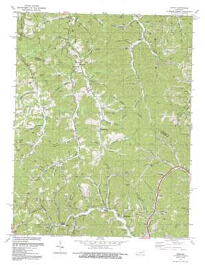
Sitka Topo Map Kentucky
To zoom in, hover over the map of Sitka
USGS Topo Quad 37082h7 - 1:24,000 scale
| Topo Map Name: | Sitka |
| USGS Topo Quad ID: | 37082h7 |
| Print Size: | ca. 21 1/4" wide x 27" high |
| Southeast Coordinates: | 37.875° N latitude / 82.75° W longitude |
| Map Center Coordinates: | 37.9375° N latitude / 82.8125° W longitude |
| U.S. State: | KY |
| Filename: | o37082h7.jpg |
| Download Map JPG Image: | Sitka topo map 1:24,000 scale |
| Map Type: | Topographic |
| Topo Series: | 7.5´ |
| Map Scale: | 1:24,000 |
| Source of Map Images: | United States Geological Survey (USGS) |
| Alternate Map Versions: |
Sitka KY 1954, updated 1955 Download PDF Buy paper map Sitka KY 1954, updated 1968 Download PDF Buy paper map Sitka KY 1971, updated 1973 Download PDF Buy paper map Sitka KY 1971, updated 1979 Download PDF Buy paper map Sitka KY 1992, updated 1992 Download PDF Buy paper map Sitka KY 2010 Download PDF Buy paper map Sitka KY 2013 Download PDF Buy paper map Sitka KY 2016 Download PDF Buy paper map |
1:24,000 Topo Quads surrounding Sitka
> Back to 37082e1 at 1:100,000 scale
> Back to 37082a1 at 1:250,000 scale
> Back to U.S. Topo Maps home
Sitka topo map: Gazetteer
Sitka: Populated Places
Chandlerville elevation 262m 859′Davisville elevation 236m 774′
Kerz elevation 257m 843′
Sip elevation 255m 836′
Sitka elevation 217m 711′
Tarklin elevation 250m 820′
Wilbur elevation 215m 705′
Winifred elevation 256m 839′
Sitka: Post Offices
Davisville Post Office (historical) elevation 236m 774′Tarkiln Post Office (historical) elevation 266m 872′
Sitka: Streams
Bear Branch elevation 219m 718′Brafford Fork elevation 204m 669′
Browns Fork elevation 205m 672′
Browns Fork elevation 225m 738′
Burnt Cabin Branch elevation 193m 633′
Castle Fork elevation 204m 669′
Caudill Branch elevation 250m 820′
Cave Fork elevation 211m 692′
Daniels Branch elevation 240m 787′
Davis Branch elevation 231m 757′
Dogwood Fork elevation 206m 675′
Fairchild Branch elevation 261m 856′
Fitch Branch elevation 239m 784′
Frank Vanhoose Branch elevation 199m 652′
Frogonery Branch elevation 193m 633′
Goose Fork elevation 205m 672′
Gray Mare Branch elevation 254m 833′
Green Branch elevation 244m 800′
Hawes Fork elevation 219m 718′
Hunterscamp Branch elevation 244m 800′
Jim Stambaugh Fork elevation 225m 738′
Jim Sturgill Branch elevation 230m 754′
Left Fork Brushy Creek elevation 218m 715′
Lick Branch elevation 233m 764′
Lick Fork elevation 218m 715′
Lick Fork elevation 191m 626′
Meadow Fork elevation 252m 826′
Nat Pickle Fork elevation 233m 764′
Peter Branch elevation 224m 734′
Puncheon Fork elevation 254m 833′
Ramey Branch elevation 218m 715′
Ramey Branch elevation 201m 659′
Rockhouse Fork elevation 223m 731′
Ross Branch elevation 221m 725′
Shop Branch elevation 260m 853′
Sloane Branch elevation 232m 761′
Sparks Branch elevation 219m 718′
Stonecoal Branch elevation 211m 692′
Tarkiln Branch elevation 212m 695′
Tick Vanhoose Branch elevation 199m 652′
Travis Branch elevation 229m 751′
Well Branch elevation 188m 616′
Sitka: Summits
Lettered Rocks elevation 332m 1089′Sitka: Valleys
Barn Hollow elevation 228m 748′Broad Hollow elevation 216m 708′
Sitka digital topo map on disk
Buy this Sitka topo map showing relief, roads, GPS coordinates and other geographical features, as a high-resolution digital map file on DVD:
Western Virginia & Southern West Virginia
Buy digital topo maps: Western Virginia & Southern West Virginia


