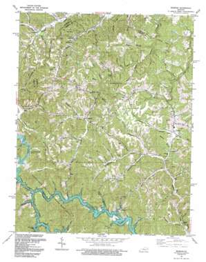
Redbush Topo Map Kentucky
To zoom in, hover over the map of Redbush
USGS Topo Quad 37082h8 - 1:24,000 scale
| Topo Map Name: | Redbush |
| USGS Topo Quad ID: | 37082h8 |
| Print Size: | ca. 21 1/4" wide x 27" high |
| Southeast Coordinates: | 37.875° N latitude / 82.875° W longitude |
| Map Center Coordinates: | 37.9375° N latitude / 82.9375° W longitude |
| U.S. State: | KY |
| Filename: | o37082h8.jpg |
| Download Map JPG Image: | Redbush topo map 1:24,000 scale |
| Map Type: | Topographic |
| Topo Series: | 7.5´ |
| Map Scale: | 1:24,000 |
| Source of Map Images: | United States Geological Survey (USGS) |
| Alternate Map Versions: |
Redbush KY 1954, updated 1955 Download PDF Buy paper map Redbush KY 1962, updated 1964 Download PDF Buy paper map Redbush KY 1962, updated 1975 Download PDF Buy paper map Redbush KY 1962, updated 1978 Download PDF Buy paper map Redbush KY 1992, updated 1992 Download PDF Buy paper map Redbush KY 2010 Download PDF Buy paper map Redbush KY 2014 Download PDF Buy paper map Redbush KY 2016 Download PDF Buy paper map |
1:24,000 Topo Quads surrounding Redbush
> Back to 37082e1 at 1:100,000 scale
> Back to 37082a1 at 1:250,000 scale
> Back to U.S. Topo Maps home
Redbush topo map: Gazetteer
Redbush: Oilfields
Martha Pool Gas and Oil Field elevation 244m 800′Redbush: Parks
Paintsville Lake Wildlife Area elevation 318m 1043′Redbush: Populated Places
Elna elevation 267m 875′Flatgap elevation 248m 813′
Fuget elevation 251m 823′
Keaton elevation 227m 744′
Redbush elevation 263m 862′
Relief elevation 223m 731′
Terryville elevation 231m 757′
Redbush: Post Offices
Ayersville Post Office (historical) elevation 239m 784′Brig Post Office (historical) elevation 304m 997′
Elna Post Office (historical) elevation 268m 879′
Relief Post Office (historical) elevation 222m 728′
Terryville Post Office (historical) elevation 224m 734′
Win Post Office (historical) elevation 266m 872′
Redbush: Ridges
Martha Ridge elevation 308m 1010′Redbush: Streams
Alum Dirt Branch elevation 222m 728′Andylick Branch elevation 214m 702′
Barker Branch elevation 253m 830′
Barnrock Branch elevation 227m 744′
Beech Branch elevation 227m 744′
Big Mine Fork elevation 214m 702′
Biglick Branch elevation 226m 741′
Billy Cox Branch elevation 244m 800′
Brier Fork elevation 281m 921′
Browns Branch elevation 216m 708′
Cantrell Branch elevation 230m 754′
Coal Creek elevation 214m 702′
Conley Branch elevation 247m 810′
Cox Branch elevation 256m 839′
Cuba Branch elevation 214m 702′
Dick Branch elevation 252m 826′
Drakes Creek elevation 233m 764′
Dyer Branch elevation 214m 702′
Franks Creek elevation 218m 715′
Gillum Branch elevation 272m 892′
Hamilton Branch elevation 253m 830′
Joe Salyer Branch elevation 214m 702′
Joes Creek elevation 218m 715′
Keaton Fork elevation 213m 698′
Kelly Branch elevation 240m 787′
Lester Branch elevation 249m 816′
Lewis Creek elevation 223m 731′
Lewis Fork elevation 226m 741′
Little Paint Creek elevation 214m 702′
Lost Creek elevation 214m 702′
Low Gap Fork elevation 214m 702′
Lower Sandlick Creek elevation 214m 702′
Lyons Branch elevation 247m 810′
McKenzie Branch elevation 215m 705′
Meadow Branch elevation 223m 731′
Meadow Branch elevation 231m 757′
Mill Branch elevation 214m 702′
Noisy Branch elevation 239m 784′
Open Fork Paint Creek elevation 214m 702′
Osborne Branch elevation 214m 702′
Patoker Branch elevation 216m 708′
Patterson Creek elevation 229m 751′
Prince Branch elevation 218m 715′
Robinson Branch elevation 222m 728′
Ross Creek elevation 239m 784′
Salyer Branch elevation 250m 820′
Spicelick Branch elevation 214m 702′
Stone Coal Branch elevation 247m 810′
Sturgeon Branch elevation 204m 669′
Thomas Branch elevation 232m 761′
Travis Branch elevation 230m 754′
Upper Sandlick Creek elevation 215m 705′
Vaughan Branch elevation 207m 679′
Williams Branch elevation 216m 708′
Wolfpen Branch elevation 259m 849′
Redbush digital topo map on disk
Buy this Redbush topo map showing relief, roads, GPS coordinates and other geographical features, as a high-resolution digital map file on DVD:
Western Virginia & Southern West Virginia
Buy digital topo maps: Western Virginia & Southern West Virginia


