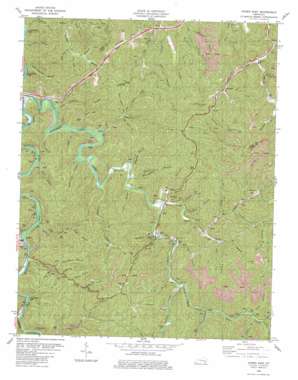
Hyden East Topo Map Kentucky
To zoom in, hover over the map of Hyden East
USGS Topo Quad 37083b3 - 1:24,000 scale
| Topo Map Name: | Hyden East |
| USGS Topo Quad ID: | 37083b3 |
| Print Size: | ca. 21 1/4" wide x 27" high |
| Southeast Coordinates: | 37.125° N latitude / 83.25° W longitude |
| Map Center Coordinates: | 37.1875° N latitude / 83.3125° W longitude |
| U.S. State: | KY |
| Filename: | o37083b3.jpg |
| Download Map JPG Image: | Hyden East topo map 1:24,000 scale |
| Map Type: | Topographic |
| Topo Series: | 7.5´ |
| Map Scale: | 1:24,000 |
| Source of Map Images: | United States Geological Survey (USGS) |
| Alternate Map Versions: |
Hyden East KY 1954, updated 1955 Download PDF Buy paper map Hyden East KY 1961, updated 1963 Download PDF Buy paper map Hyden East KY 1980, updated 1980 Download PDF Buy paper map Hyden East KY 2011 Download PDF Buy paper map Hyden East KY 2013 Download PDF Buy paper map Hyden East KY 2016 Download PDF Buy paper map |
| FStopo: | US Forest Service topo Hyden East is available: Download FStopo PDF Download FStopo TIF |
1:24,000 Topo Quads surrounding Hyden East
> Back to 37083a1 at 1:100,000 scale
> Back to 37082a1 at 1:250,000 scale
> Back to U.S. Topo Maps home
Hyden East topo map: Gazetteer
Hyden East: Flats
Dixon Bottom elevation 274m 898′Hyden East: Populated Places
Avawam elevation 297m 974′Grassy elevation 319m 1046′
Hendrix elevation 296m 971′
Hyden elevation 281m 921′
Little Beech (historical) elevation 354m 1161′
Lower McIntosh elevation 262m 859′
Smilax elevation 280m 918′
Toulouse elevation 386m 1266′
Wendover elevation 276m 905′
Whitaker elevation 311m 1020′
Wooton elevation 267m 875′
Hyden East: Post Offices
Avawam Post Office elevation 274m 898′Coon Creek Post Office (historical) elevation 274m 898′
Cutshin Post Office (historical) elevation 260m 853′
Hyden Post Office elevation 263m 862′
Mad Dog Post Office (historical) elevation 260m 853′
Orchard Post Office (historical) elevation 291m 954′
Road Fork elevation 312m 1023′
Smilax Post Office elevation 289m 948′
Toulouse Post Office (historical) elevation 313m 1026′
Wendover Post Office elevation 284m 931′
Wooten Post Office (historical) elevation 274m 898′
Hyden East: Streams
Aces Branch elevation 259m 849′Bailey Branch elevation 280m 918′
Baker Fork elevation 314m 1030′
Banger Branch elevation 291m 954′
Bear Fork elevation 312m 1023′
Beech Oak Branch elevation 290m 951′
Betty Branch elevation 248m 813′
Big Branch elevation 286m 938′
Big Peavine Branch elevation 273m 895′
Big Two Branch elevation 303m 994′
Boar Branch elevation 276m 905′
Brewer Branch elevation 261m 856′
Browning Fork elevation 310m 1017′
Bubbyroot Branch elevation 300m 984′
Buzzard Branch elevation 276m 905′
Camp Branch elevation 290m 951′
Cane Branch elevation 298m 977′
Caudill Fork elevation 297m 974′
Collins Branch elevation 301m 987′
Cutshin Creek elevation 245m 803′
Davis Branch elevation 361m 1184′
Deep Ford Branch elevation 253m 830′
Dicks Branch elevation 299m 980′
Dixon Branch elevation 274m 898′
Ellis Branch elevation 261m 856′
Flackey Branch elevation 256m 839′
Hensley Branch elevation 277m 908′
Horseshoe Branch elevation 328m 1076′
Hurts Creek elevation 259m 849′
Indian Grave Branch elevation 271m 889′
Leadmine Branch elevation 265m 869′
Lewis Branch elevation 244m 800′
Lick Branch elevation 279m 915′
Lick Fork elevation 301m 987′
Little Peavine Branch elevation 278m 912′
Long Branch elevation 297m 974′
Looney Branch elevation 270m 885′
Lower Jones Fork elevation 326m 1069′
MacIntosh Creek elevation 251m 823′
Maggard Branch elevation 260m 853′
Meetinghouse Branch elevation 263m 862′
Mudlick Fork elevation 300m 984′
Muncy Creek elevation 261m 856′
Oldhouse Branch elevation 239m 784′
Owlsnest Branch elevation 260m 853′
Pace Branch elevation 312m 1023′
Pied Branch elevation 250m 820′
Pleasure Woods Branch elevation 244m 800′
Polls Creek elevation 275m 902′
Polly Morrill Branch elevation 241m 790′
Poundmill Branch elevation 266m 872′
Preston Fork elevation 268m 879′
Raccoon Creek elevation 274m 898′
Right Fork Big Creek elevation 276m 905′
Rockhouse Branch elevation 266m 872′
Rockhouse Creek elevation 263m 862′
Rough Branch elevation 339m 1112′
Roundhole Branch elevation 281m 921′
Saw Branch elevation 273m 895′
Second Fork elevation 291m 954′
Steepfield Fork elevation 299m 980′
Tar Kiln Branch elevation 301m 987′
Upper Jones Fork elevation 329m 1079′
Wooton Creek elevation 264m 866′
Hyden East: Valleys
Dark Hollow elevation 325m 1066′Davis Hollow elevation 326m 1069′
Persimmon Hollow elevation 329m 1079′
Winding Star Hollow elevation 306m 1003′
Hyden East digital topo map on disk
Buy this Hyden East topo map showing relief, roads, GPS coordinates and other geographical features, as a high-resolution digital map file on DVD:
Western Virginia & Southern West Virginia
Buy digital topo maps: Western Virginia & Southern West Virginia


