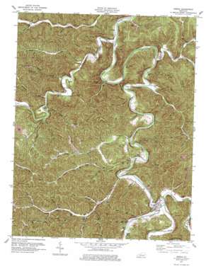
Oneida Topo Map Kentucky
To zoom in, hover over the map of Oneida
USGS Topo Quad 37083c6 - 1:24,000 scale
| Topo Map Name: | Oneida |
| USGS Topo Quad ID: | 37083c6 |
| Print Size: | ca. 21 1/4" wide x 27" high |
| Southeast Coordinates: | 37.25° N latitude / 83.625° W longitude |
| Map Center Coordinates: | 37.3125° N latitude / 83.6875° W longitude |
| U.S. State: | KY |
| Filename: | o37083c6.jpg |
| Download Map JPG Image: | Oneida topo map 1:24,000 scale |
| Map Type: | Topographic |
| Topo Series: | 7.5´ |
| Map Scale: | 1:24,000 |
| Source of Map Images: | United States Geological Survey (USGS) |
| Alternate Map Versions: |
Oneida KY 1953, updated 1954 Download PDF Buy paper map Oneida KY 1953, updated 1966 Download PDF Buy paper map Oneida KY 1979, updated 1979 Download PDF Buy paper map Oneida KY 2011 Download PDF Buy paper map Oneida KY 2013 Download PDF Buy paper map Oneida KY 2016 Download PDF Buy paper map |
| FStopo: | US Forest Service topo Oneida is available: Download FStopo PDF Download FStopo TIF |
1:24,000 Topo Quads surrounding Oneida
> Back to 37083a1 at 1:100,000 scale
> Back to 37082a1 at 1:250,000 scale
> Back to U.S. Topo Maps home
Oneida topo map: Gazetteer
Oneida: Bends
Bishop Bend elevation 216m 708′Grapevine Bend elevation 262m 859′
Oneida: Gaps
Felty Gap elevation 310m 1017′Oneida: Populated Places
Alger elevation 251m 823′Ammie elevation 252m 826′
Bishop Bend elevation 216m 708′
Felty elevation 308m 1010′
Oneida elevation 237m 777′
Shephard Neighborhood elevation 240m 787′
Taft elevation 218m 715′
Teges elevation 233m 764′
Trixie elevation 231m 757′
Oneida: Post Offices
Alger Post Office (historical) elevation 235m 770′Ammy Post Office (historical) elevation 241m 790′
Barger Post Office (historical) elevation 251m 823′
Felty Post Office (historical) elevation 308m 1010′
Joshua Post Office (historical) elevation 227m 744′
Joshua Post Office (historical) elevation 235m 770′
Narrows Post Office (historical) elevation 235m 770′
Newfound Post Office (historical) elevation 265m 869′
Oneida Post Office elevation 237m 777′
Pancone Post Office (historical) elevation 251m 823′
Road Run Post Office (historical) elevation 235m 770′
Taft Post Office (historical) elevation 222m 728′
Taft Post Office (historical) elevation 214m 702′
Teges Post Office (historical) elevation 238m 780′
Trixie Post Office (historical) elevation 239m 784′
Oneida: Ridges
The Narrows elevation 342m 1122′Oneida: Streams
Anglin Creek elevation 218m 715′Bear Gap Branch elevation 217m 711′
Bee Branch elevation 274m 898′
Bee Branch elevation 230m 754′
Big Branch elevation 251m 823′
Big Branch elevation 213m 698′
Big Paul Bailey Branch elevation 265m 869′
Big Rooster Branch elevation 219m 718′
Big Twin Creek elevation 230m 754′
Buck Branch elevation 215m 705′
Buffalo Creek elevation 212m 695′
Bull Hollow Branch elevation 281m 921′
Bullskin Creek elevation 232m 761′
Bungeon Branch elevation 213m 698′
Burger Branch elevation 217m 711′
Chestnut Gap Branch elevation 277m 908′
Chicken Branch elevation 265m 869′
Cool Branch elevation 231m 757′
Court House Branch elevation 256m 839′
Crane Creek elevation 231m 757′
Doar Branch elevation 250m 820′
Elder Lick Branch elevation 298m 977′
Gar Hole Branch elevation 224m 734′
Goose Creek elevation 230m 754′
Grayham Branch elevation 236m 774′
Hacker Branch elevation 214m 702′
Halfway Branch elevation 234m 767′
Harlan Branch elevation 281m 921′
Left Fork Buffalo Creek elevation 220m 721′
Lick Branch elevation 249m 816′
Little Bullskin Creek elevation 248m 813′
Little Paul Bailey Branch elevation 260m 853′
Little Rooster Branch elevation 232m 761′
Little Twin Branch elevation 229m 751′
Lou Branch elevation 237m 777′
Lower Fork Cool Spring Branch elevation 232m 761′
Lower Gap Branch elevation 234m 767′
Lower Teges Creek elevation 223m 731′
Newfound Creek elevation 214m 702′
Niers Branch elevation 238m 780′
Pooter Branch elevation 217m 711′
Potter Branch elevation 230m 754′
Prop Cave Branch elevation 255m 836′
Pruitt Branch elevation 214m 702′
Red Bird River elevation 232m 761′
Right Fork Buffalo Creek elevation 219m 718′
Road Run elevation 247m 810′
Rocky Branch elevation 232m 761′
Rocky Branch elevation 224m 734′
Rone Fork Branch elevation 244m 800′
Saddler Branch elevation 224m 734′
Sester Branch elevation 274m 898′
Sexton Creek elevation 211m 692′
Sharp Branch elevation 236m 774′
Spivey Branch elevation 226m 741′
Spring Branch elevation 212m 695′
Trace Branch elevation 248m 813′
Turkey Gap Branch elevation 215m 705′
Upper Fork Cool Spring Branch elevation 226m 741′
Upper Teges Creek elevation 229m 751′
Wagon Road Branch elevation 261m 856′
Walnut Branch elevation 262m 859′
Wolf Branch elevation 223m 731′
Oneida: Summits
Ivy Point elevation 264m 866′Oneida: Valleys
Barn Hollow elevation 260m 853′Becky Hollow elevation 248m 813′
Black Pool Hollow elevation 212m 695′
Hoot Owl Hollow elevation 224m 734′
Pole Cat Hollow elevation 212m 695′
Oneida digital topo map on disk
Buy this Oneida topo map showing relief, roads, GPS coordinates and other geographical features, as a high-resolution digital map file on DVD:
Western Virginia & Southern West Virginia
Buy digital topo maps: Western Virginia & Southern West Virginia


