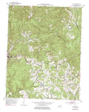
Mckee Topo Map Kentucky
To zoom in, hover over the map of Mckee
USGS Topo Quad 37083d8 - 1:24,000 scale
| Topo Map Name: | Mckee |
| USGS Topo Quad ID: | 37083d8 |
| Print Size: | ca. 21 1/4" wide x 27" high |
| Southeast Coordinates: | 37.375° N latitude / 83.875° W longitude |
| Map Center Coordinates: | 37.4375° N latitude / 83.9375° W longitude |
| U.S. State: | KY |
| Filename: | o37083d8.jpg |
| Download Map JPG Image: | Mckee topo map 1:24,000 scale |
| Map Type: | Topographic |
| Topo Series: | 7.5´ |
| Map Scale: | 1:24,000 |
| Source of Map Images: | United States Geological Survey (USGS) |
| Alternate Map Versions: |
Mc Kee KY 1953, updated 1954 Download PDF Buy paper map Mc Kee KY 1953, updated 1967 Download PDF Buy paper map Mc Kee KY 1953, updated 1978 Download PDF Buy paper map McKee KY 2011 Download PDF Buy paper map McKee KY 2013 Download PDF Buy paper map McKee KY 2016 Download PDF Buy paper map |
| FStopo: | US Forest Service topo McKee is available: Download FStopo PDF Download FStopo TIF |
1:24,000 Topo Quads surrounding Mckee
> Back to 37083a1 at 1:100,000 scale
> Back to 37082a1 at 1:250,000 scale
> Back to U.S. Topo Maps home
Mckee topo map: Gazetteer
Mckee: Populated Places
Atkinstown elevation 398m 1305′Bradshaw elevation 389m 1276′
Gray Hawk elevation 388m 1272′
Huff elevation 329m 1079′
Macedonia elevation 401m 1315′
McKee elevation 314m 1030′
New Zion elevation 335m 1099′
Oak Grove elevation 383m 1256′
Privett elevation 395m 1295′
Smith elevation 406m 1332′
Sparks elevation 420m 1377′
Turkey Foot elevation 268m 879′
Mckee: Post Offices
Bradshaw Post Office (historical) elevation 384m 1259′Gray Hawk Post Office (historical) elevation 388m 1272′
McKee Post Office elevation 315m 1033′
Muncey Post Office (historical) elevation 378m 1240′
New Zion Post Office (historical) elevation 344m 1128′
Orpha Post Office (historical) elevation 378m 1240′
Privette Post Office (historical) elevation 391m 1282′
Wilma Post Office (historical) elevation 391m 1282′
Mckee: Reservoirs
Beulah Lake elevation 372m 1220′Tyner Lake elevation 367m 1204′
Mckee: Ridges
Brushy Ridge elevation 420m 1377′Lime Kiln Ridge elevation 401m 1315′
New Zion Ridge elevation 379m 1243′
Mckee: Streams
Big Buck Lick elevation 243m 797′Bills Branch elevation 311m 1020′
Elsam Fork elevation 268m 879′
Flat Hollow Fork elevation 337m 1105′
Griffee Branch elevation 305m 1000′
Guys Branch elevation 305m 1000′
Hayes Branch elevation 312m 1023′
Hughes Fork elevation 268m 879′
Jacks Branch elevation 329m 1079′
Lake Creek elevation 322m 1056′
Lime Kiln Branch elevation 256m 839′
Lime Kiln Fork elevation 280m 918′
McCammon Branch elevation 302m 990′
Middle Fork Elsam Fork elevation 313m 1026′
Mill Creek elevation 299m 980′
Otter Branch elevation 245m 803′
Panther Branch elevation 248m 813′
Randale Branch elevation 238m 780′
Rocky Branch elevation 336m 1102′
Rolling Fork elevation 316m 1036′
Spivey Branch elevation 310m 1017′
Steer Fork elevation 280m 918′
Sugar Camp Creek elevation 298m 977′
Mckee: Valleys
Neil Hollow elevation 349m 1145′Tattlers Hollow elevation 325m 1066′
Mckee digital topo map on disk
Buy this Mckee topo map showing relief, roads, GPS coordinates and other geographical features, as a high-resolution digital map file on DVD:
Western Virginia & Southern West Virginia
Buy digital topo maps: Western Virginia & Southern West Virginia


