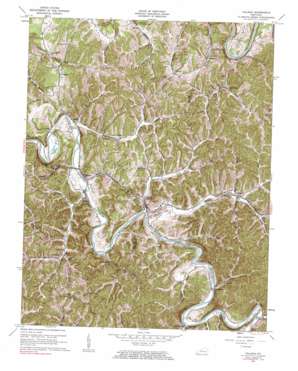
Tallega Topo Map Kentucky
To zoom in, hover over the map of Tallega
USGS Topo Quad 37083e5 - 1:24,000 scale
| Topo Map Name: | Tallega |
| USGS Topo Quad ID: | 37083e5 |
| Print Size: | ca. 21 1/4" wide x 27" high |
| Southeast Coordinates: | 37.5° N latitude / 83.5° W longitude |
| Map Center Coordinates: | 37.5625° N latitude / 83.5625° W longitude |
| U.S. State: | KY |
| Filename: | o37083e5.jpg |
| Download Map JPG Image: | Tallega topo map 1:24,000 scale |
| Map Type: | Topographic |
| Topo Series: | 7.5´ |
| Map Scale: | 1:24,000 |
| Source of Map Images: | United States Geological Survey (USGS) |
| Alternate Map Versions: |
Tallega KY 1952, updated 1954 Download PDF Buy paper map Tallega KY 1961, updated 1963 Download PDF Buy paper map Tallega KY 1961, updated 1984 Download PDF Buy paper map Tallega KY 2010 Download PDF Buy paper map Tallega KY 2013 Download PDF Buy paper map Tallega KY 2016 Download PDF Buy paper map |
1:24,000 Topo Quads surrounding Tallega
> Back to 37083e1 at 1:100,000 scale
> Back to 37082a1 at 1:250,000 scale
> Back to U.S. Topo Maps home
Tallega topo map: Gazetteer
Tallega: Bends
Horseshoe Bend elevation 205m 672′Spencer Bend elevation 275m 902′
Tallega: Populated Places
Athol elevation 232m 761′Canyon Falls elevation 239m 784′
Copebranch elevation 209m 685′
Fillmore elevation 266m 872′
Jetts Creek elevation 210m 688′
Lone elevation 229m 751′
Monica elevation 218m 715′
Oakdale elevation 240m 787′
Primrose elevation 275m 902′
Tallega elevation 215m 705′
Vada elevation 261m 856′
Widecreek elevation 244m 800′
Williba elevation 243m 797′
Tallega: Post Offices
Willba Post Office (historical) elevation 246m 807′Tallega: Streams
Bean Fork elevation 241m 790′Bear Creek elevation 197m 646′
Beginning Branch elevation 201m 659′
Bowman Branch elevation 232m 761′
Brewer Fork elevation 241m 790′
Bryant Creek elevation 198m 649′
Chapmans Fork elevation 252m 826′
Clover Branch elevation 232m 761′
Coal Branch elevation 200m 656′
Cope Branch elevation 212m 695′
Jetts Creek elevation 207m 679′
Keen Fork elevation 235m 770′
Lick Branch elevation 207m 679′
Lick Creek elevation 203m 666′
Little Bear Creek elevation 199m 652′
Little Rock Lick Creek elevation 217m 711′
Lower Twin Creek elevation 205m 672′
Lynam Creek elevation 209m 685′
Mill Creek elevation 201m 659′
Puncheon Camp Creek elevation 208m 682′
Snake Branch elevation 208m 682′
Upper Twin Creek elevation 207m 679′
Wolfpen Branch elevation 197m 646′
Tallega: Summits
Anvil Knob elevation 306m 1003′Tallega: Tunnels
Mud Tunnel elevation 260m 853′Tyler Tunnel elevation 238m 780′
Tallega digital topo map on disk
Buy this Tallega topo map showing relief, roads, GPS coordinates and other geographical features, as a high-resolution digital map file on DVD:
Western Virginia & Southern West Virginia
Buy digital topo maps: Western Virginia & Southern West Virginia


