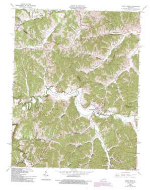
Hazel Green Topo Map Kentucky
To zoom in, hover over the map of Hazel Green
USGS Topo Quad 37083g4 - 1:24,000 scale
| Topo Map Name: | Hazel Green |
| USGS Topo Quad ID: | 37083g4 |
| Print Size: | ca. 21 1/4" wide x 27" high |
| Southeast Coordinates: | 37.75° N latitude / 83.375° W longitude |
| Map Center Coordinates: | 37.8125° N latitude / 83.4375° W longitude |
| U.S. State: | KY |
| Filename: | o37083g4.jpg |
| Download Map JPG Image: | Hazel Green topo map 1:24,000 scale |
| Map Type: | Topographic |
| Topo Series: | 7.5´ |
| Map Scale: | 1:24,000 |
| Source of Map Images: | United States Geological Survey (USGS) |
| Alternate Map Versions: |
Hazel Green KY 1951, updated 1953 Download PDF Buy paper map Hazel Green KY 1965, updated 1967 Download PDF Buy paper map Hazel Green KY 1965, updated 1977 Download PDF Buy paper map Hazel Green KY 1965, updated 1993 Download PDF Buy paper map Hazel Green KY 2010 Download PDF Buy paper map Hazel Green KY 2013 Download PDF Buy paper map Hazel Green KY 2016 Download PDF Buy paper map |
1:24,000 Topo Quads surrounding Hazel Green
> Back to 37083e1 at 1:100,000 scale
> Back to 37082a1 at 1:250,000 scale
> Back to U.S. Topo Maps home
Hazel Green topo map: Gazetteer
Hazel Green: Bridges
Spradling Bridge elevation 259m 849′Hazel Green: Crossings
Flat Rock Ford elevation 297m 974′Hazel Green: Populated Places
Caskey Fork (historical) elevation 286m 938′Daysboro elevation 283m 928′
Flat Rock elevation 295m 967′
Hazel Green elevation 281m 921′
Maytown elevation 285m 935′
Murphyfork elevation 279m 915′
Stillwater elevation 281m 921′
Toliver elevation 273m 895′
Trent elevation 314m 1030′
Hazel Green: Post Offices
Daysboro Post Office (historical) elevation 272m 892′Morgan Post Office (historical) elevation 285m 935′
Murphy Fork Post Office (historical) elevation 280m 918′
Spradling Post Office (historical) elevation 301m 987′
Still Post Office (historical) elevation 280m 918′
Stoll Post Office (historical) elevation 299m 980′
Toliver Post Office (historical) elevation 273m 895′
Trent Post Office (historical) elevation 312m 1023′
Hazel Green: Streams
Bear Branch elevation 255m 836′Big Branch elevation 260m 853′
Bryant Fork elevation 263m 862′
Buck Creek elevation 268m 879′
Chapel Branch elevation 269m 882′
Clark Branch elevation 268m 879′
Cow Branch elevation 268m 879′
Gillmore Creek elevation 280m 918′
Johnson Fork elevation 280m 918′
Lackey Creek elevation 294m 964′
Lacy Creek elevation 273m 895′
Laurel Fork elevation 271m 889′
Left Fork Stamper elevation 296m 971′
Little Blackwater Creek elevation 255m 836′
Little Blackwater Creek elevation 266m 872′
Loring Nickell Branch elevation 264m 866′
Motley Fork elevation 267m 875′
Murphy Fork elevation 258m 846′
Nickell Fork elevation 254m 833′
Perkins Fork elevation 284m 931′
Right Fork Lacey Creek elevation 273m 895′
Rocky Branch elevation 264m 866′
Stamper Branch elevation 269m 882′
Swango Fork elevation 286m 938′
Trace Fork elevation 272m 892′
Yocum Branch elevation 258m 846′
Hazel Green digital topo map on disk
Buy this Hazel Green topo map showing relief, roads, GPS coordinates and other geographical features, as a high-resolution digital map file on DVD:
Western Virginia & Southern West Virginia
Buy digital topo maps: Western Virginia & Southern West Virginia


