Lily Topo Map Kentucky
To zoom in, hover over the map of Lily
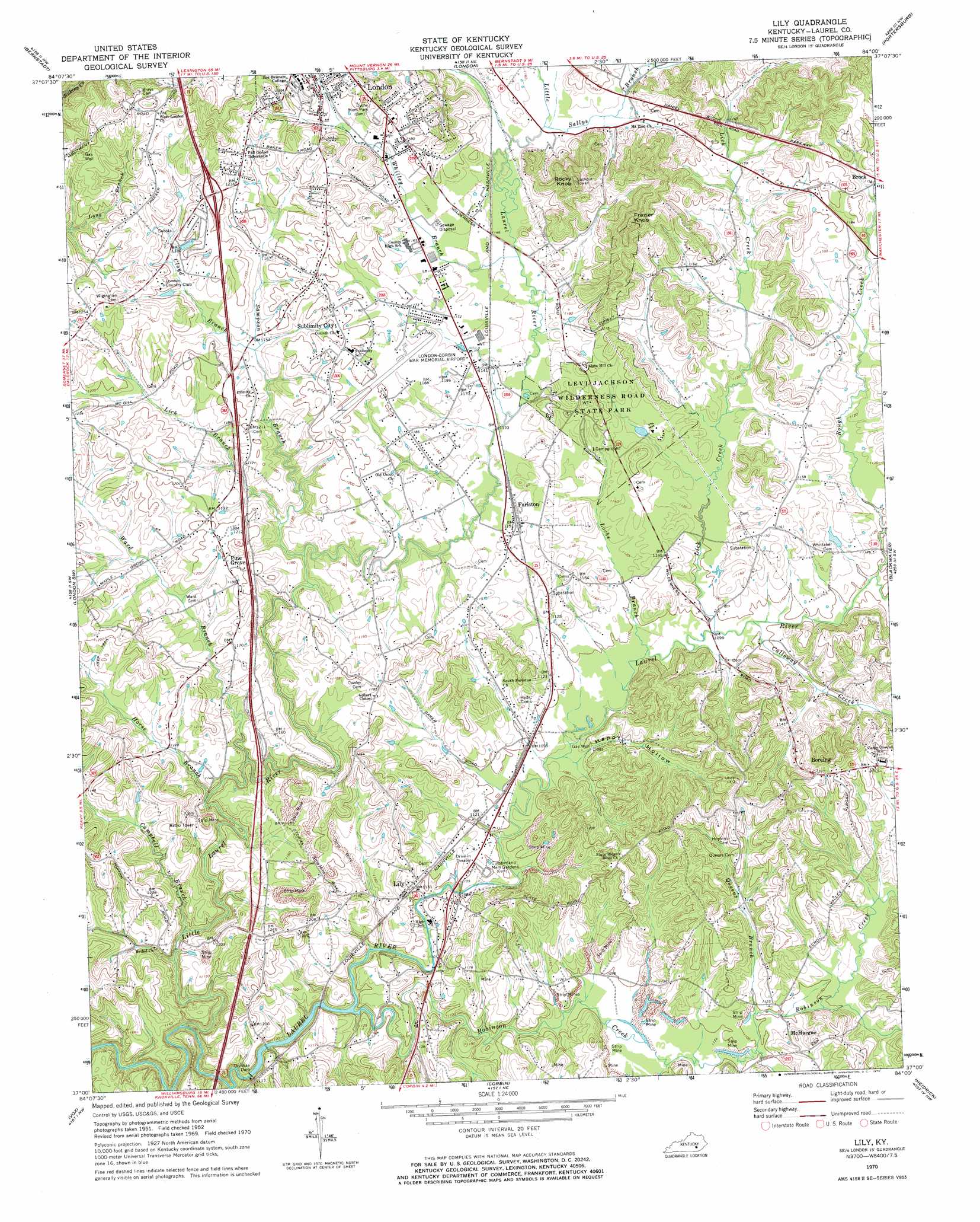
USGS Topo Quad 37084a1 - 1:24,000 scale
| Topo Map Name: | Lily |
| USGS Topo Quad ID: | 37084a1 |
| Print Size: | ca. 21 1/4" wide x 27" high |
| Southeast Coordinates: | 37° N latitude / 84° W longitude |
| Map Center Coordinates: | 37.0625° N latitude / 84.0625° W longitude |
| U.S. State: | KY |
| Filename: | o37084a1.jpg |
| Download Map JPG Image: | Lily topo map 1:24,000 scale |
| Map Type: | Topographic |
| Topo Series: | 7.5´ |
| Map Scale: | 1:24,000 |
| Source of Map Images: | United States Geological Survey (USGS) |
| Alternate Map Versions: |
Lily KY 1952, updated 1953 Download PDF Buy paper map Lily KY 1961, updated 1963 Download PDF Buy paper map Lily KY 1970, updated 1972 Download PDF Buy paper map Lily KY 2010 Download PDF Buy paper map Lily KY 2013 Download PDF Buy paper map Lily KY 2016 Download PDF Buy paper map |
| FStopo: | US Forest Service topo Lily is available: Download FStopo PDF Download FStopo TIF |
1:24,000 Topo Quads surrounding Lily
Mount Vernon |
Livingston |
Parrot |
Tyner |
Maulden |
Billows |
Bernstadt |
London |
Portersburg |
Manchester |
Ano |
London Sw |
Lily |
Blackwater |
Hima |
Sawyer |
Vox |
Corbin |
Heidrick |
Fount |
Cumberland Falls |
Wofford |
Rockholds |
Barbourville |
Artemus |
> Back to 37084a1 at 1:100,000 scale
> Back to 37084a1 at 1:250,000 scale
> Back to U.S. Topo Maps home
Lily topo map: Gazetteer
Lily: Airports
London-Corbin Airport-Magee Field elevation 364m 1194′Lily: Areas
London-Corbin War Memorial elevation 364m 1194′Lily: Dams
Dorthae Dam elevation 324m 1062′Lily: Parks
Levi Jackson Wilderness Road State Park elevation 351m 1151′Lily: Populated Places
Boreing elevation 364m 1194′Fariston elevation 348m 1141′
Lily elevation 341m 1118′
McHargue elevation 346m 1135′
Pine Grove elevation 366m 1200′
Sublimity City elevation 370m 1213′
Lily: Streams
Calloway Creek elevation 334m 1095′Campbell Branch elevation 332m 1089′
Cloyd Branch elevation 348m 1141′
Horse Branch elevation 332m 1089′
Lick Branch elevation 339m 1112′
Lick Creek elevation 334m 1095′
Little Laurel River elevation 317m 1040′
Little Robinson Creek elevation 331m 1085′
Locke Branch elevation 333m 1092′
Queens Branch elevation 333m 1092′
Robinson Creek elevation 329m 1079′
Rough Creek elevation 335m 1099′
Sallys Branch elevation 348m 1141′
Sampson Branch elevation 337m 1105′
Ward Branch elevation 327m 1072′
Whitley Branch elevation 346m 1135′
Lily: Summits
Frazier Knob elevation 465m 1525′Rocky Knob elevation 454m 1489′
Lily: Valleys
Happy Hollow elevation 330m 1082′Lily digital topo map on disk
Buy this Lily topo map showing relief, roads, GPS coordinates and other geographical features, as a high-resolution digital map file on DVD: