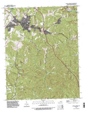
Mount Vernon Topo Map Kentucky
To zoom in, hover over the map of Mount Vernon
USGS Topo Quad 37084c3 - 1:24,000 scale
| Topo Map Name: | Mount Vernon |
| USGS Topo Quad ID: | 37084c3 |
| Print Size: | ca. 21 1/4" wide x 27" high |
| Southeast Coordinates: | 37.25° N latitude / 84.25° W longitude |
| Map Center Coordinates: | 37.3125° N latitude / 84.3125° W longitude |
| U.S. State: | KY |
| Filename: | o37084c3.jpg |
| Download Map JPG Image: | Mount Vernon topo map 1:24,000 scale |
| Map Type: | Topographic |
| Topo Series: | 7.5´ |
| Map Scale: | 1:24,000 |
| Source of Map Images: | United States Geological Survey (USGS) |
| Alternate Map Versions: |
Mount Vernon KY 1953, updated 1954 Download PDF Buy paper map Mount Vernon KY 1953, updated 1967 Download PDF Buy paper map Mount Vernon KY 1970, updated 1972 Download PDF Buy paper map Mount Vernon KY 1970, updated 1981 Download PDF Buy paper map Mount Vernon KY 1993, updated 1996 Download PDF Buy paper map Mount Vernon KY 2010 Download PDF Buy paper map Mount Vernon KY 2013 Download PDF Buy paper map Mount Vernon KY 2016 Download PDF Buy paper map |
| FStopo: | US Forest Service topo Mount Vernon is available: Download FStopo PDF Download FStopo TIF |
1:24,000 Topo Quads surrounding Mount Vernon
> Back to 37084a1 at 1:100,000 scale
> Back to 37084a1 at 1:250,000 scale
> Back to U.S. Topo Maps home
Mount Vernon topo map: Gazetteer
Mount Vernon: Populated Places
Burr elevation 346m 1135′Flat Rock elevation 392m 1286′
Hansford elevation 336m 1102′
Mount Vernon elevation 360m 1181′
Orlando elevation 280m 918′
Pine Hill elevation 302m 990′
Sand Springs elevation 296m 971′
Wellhope elevation 292m 958′
Mount Vernon: Springs
Blue Springs elevation 290m 951′Mount Vernon: Streams
Cove Branch elevation 272m 892′Dry Fork elevation 280m 918′
Pitman Branch elevation 277m 908′
Price Branch elevation 287m 941′
Rash Branch elevation 279m 915′
Sites Branch elevation 272m 892′
West Fork Skegg Creek elevation 280m 918′
Mount Vernon: Valleys
Lime Plant Hollow elevation 298m 977′Marlow Hollow elevation 287m 941′
Penick Hollow elevation 286m 938′
Mount Vernon digital topo map on disk
Buy this Mount Vernon topo map showing relief, roads, GPS coordinates and other geographical features, as a high-resolution digital map file on DVD:


