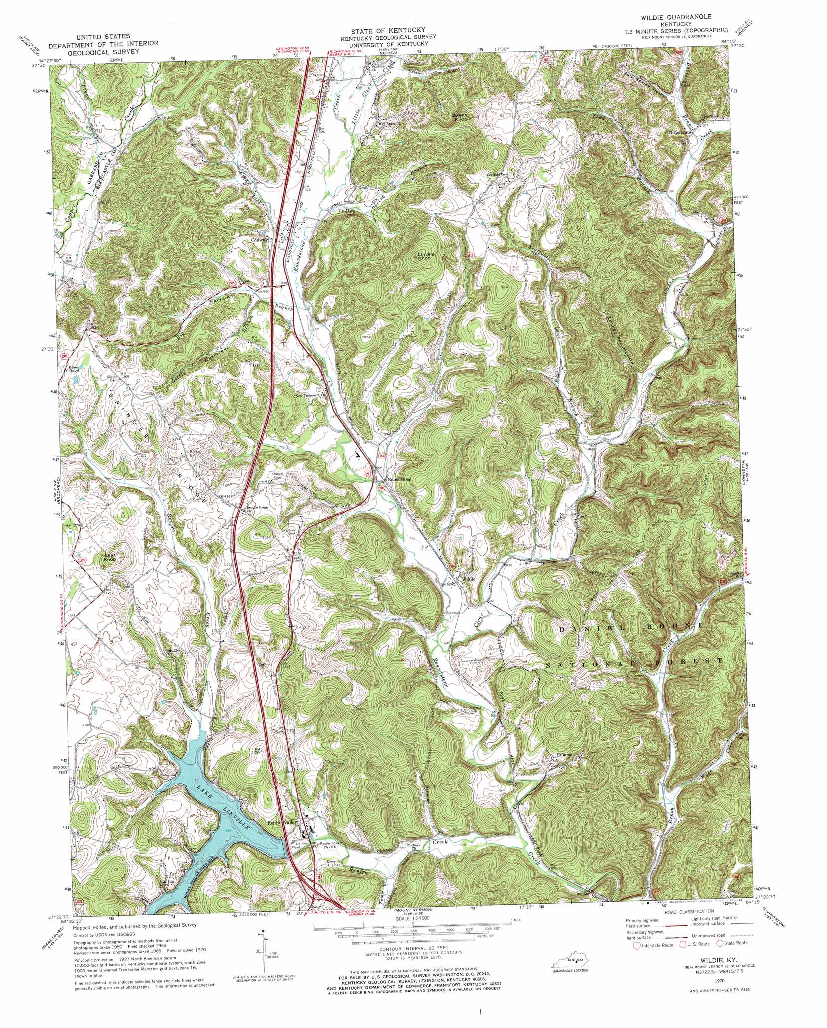
Wildie Topo Map Kentucky
To zoom in, hover over the map of Wildie
USGS Topo Quad 37084d3 - 1:24,000 scale
| Topo Map Name: | Wildie |
| USGS Topo Quad ID: | 37084d3 |
| Print Size: | ca. 21 1/4" wide x 27" high |
| Southeast Coordinates: | 37.375° N latitude / 84.25° W longitude |
| Map Center Coordinates: | 37.4375° N latitude / 84.3125° W longitude |
| U.S. State: | KY |
| Filename: | o37084d3.jpg |
| Download Map JPG Image: | Wildie topo map 1:24,000 scale |
| Map Type: | Topographic |
| Topo Series: | 7.5´ |
| Map Scale: | 1:24,000 |
| Source of Map Images: | United States Geological Survey (USGS) |
| Alternate Map Versions: |
Wildie KY 1953, updated 1954 Download PDF Buy paper map Wildie KY 1970, updated 1972 Download PDF Buy paper map Wildie KY 2010 Download PDF Buy paper map Wildie KY 2013 Download PDF Buy paper map Wildie KY 2016 Download PDF Buy paper map |
| FStopo: | US Forest Service topo Wildie is available: Download FStopo PDF Download FStopo TIF |
1:24,000 Topo Quads surrounding Wildie
Buckeye |
Kirksville |
Richmond South |
Moberly |
Panola |
Lancaster |
Paint Lick |
Berea |
Bighill |
Alcorn |
Crab Orchard |
Brodhead |
Wildie |
Johnetta |
Sandgap |
Woodstock |
Maretburg |
Mount Vernon |
Livingston |
Parrot |
Bobtown |
Shopville |
Billows |
Bernstadt |
London |
> Back to 37084a1 at 1:100,000 scale
> Back to 37084a1 at 1:250,000 scale
> Back to U.S. Topo Maps home
Wildie topo map: Gazetteer
Wildie: Airports
Crawford Airport elevation 373m 1223′Wildie: Populated Places
Conway elevation 299m 980′Disputanta elevation 311m 1020′
Hummel elevation 322m 1056′
Renfro Valley elevation 290m 951′
Roundstone elevation 287m 941′
Wildie elevation 288m 944′
Wildie: Reservoirs
Lake Linville elevation 301m 987′Wildie: Ridges
Brindle Ridge elevation 350m 1148′Wildie: Streams
Big Hurricane Branch elevation 311m 1020′Brush Creek elevation 275m 902′
Clay Lick Branch elevation 297m 974′
Clear Creek elevation 280m 918′
Crane Branch elevation 303m 994′
Davis Branch elevation 311m 1020′
Little Clear Creek elevation 300m 984′
Little Hurricane Branch elevation 330m 1082′
Little Renfro Creek elevation 293m 961′
Loman Branch elevation 305m 1000′
North Fork Copper Creek elevation 298m 977′
Renfro Creek elevation 276m 905′
Scaffold Cane Branch elevation 293m 961′
Todd Branch elevation 318m 1043′
Town Branch elevation 282m 925′
Valley Spring Branch elevation 297m 974′
Wolf Creek elevation 277m 908′
Wildie: Summits
Lear Knob elevation 440m 1443′Linville Knob elevation 453m 1486′
Owens Knob elevation 444m 1456′
Wildie: Valleys
Salt Spring Hollow elevation 328m 1076′Turkey Pen Hollow elevation 301m 987′
Wildie digital topo map on disk
Buy this Wildie topo map showing relief, roads, GPS coordinates and other geographical features, as a high-resolution digital map file on DVD: