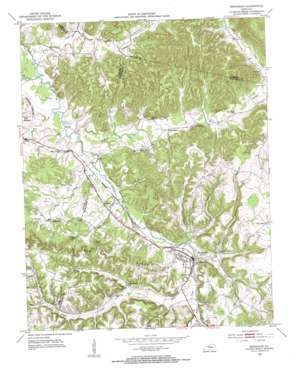
Brodhead Topo Map Kentucky
To zoom in, hover over the map of Brodhead
USGS Topo Quad 37084d4 - 1:24,000 scale
| Topo Map Name: | Brodhead |
| USGS Topo Quad ID: | 37084d4 |
| Print Size: | ca. 21 1/4" wide x 27" high |
| Southeast Coordinates: | 37.375° N latitude / 84.375° W longitude |
| Map Center Coordinates: | 37.4375° N latitude / 84.4375° W longitude |
| U.S. State: | KY |
| Filename: | o37084d4.jpg |
| Download Map JPG Image: | Brodhead topo map 1:24,000 scale |
| Map Type: | Topographic |
| Topo Series: | 7.5´ |
| Map Scale: | 1:24,000 |
| Source of Map Images: | United States Geological Survey (USGS) |
| Alternate Map Versions: |
Brodhead KY 1953, updated 1954 Download PDF Buy paper map Brodhead KY 2010 Download PDF Buy paper map Brodhead KY 2013 Download PDF Buy paper map Brodhead KY 2016 Download PDF Buy paper map |
1:24,000 Topo Quads surrounding Brodhead
> Back to 37084a1 at 1:100,000 scale
> Back to 37084a1 at 1:250,000 scale
> Back to U.S. Topo Maps home
Brodhead topo map: Gazetteer
Brodhead: Populated Places
Brodhead elevation 285m 935′Gum Sulphur elevation 294m 964′
Thompson Store (historical) elevation 380m 1246′
Turkeytown elevation 286m 938′
Brodhead: Post Offices
Dripping Spring Post Office (historical) elevation 273m 895′Brodhead: Ridges
Bowling Ridge elevation 325m 1066′Brodhead: Streams
Boone Fork elevation 285m 935′Bowman Branch elevation 305m 1000′
Copper Creek elevation 271m 889′
Fall Lick elevation 267m 875′
Flax Creek elevation 264m 866′
Grassy Branch elevation 300m 984′
Indian Branch elevation 271m 889′
Little Negro Creek elevation 297m 974′
Long Branch elevation 285m 935′
Negro Creek elevation 285m 935′
Slaty Branch elevation 274m 898′
Tarkin Branch elevation 302m 990′
Turkey Creek elevation 269m 882′
Brodhead: Summits
Indian Knob elevation 344m 1128′Millers Knob elevation 340m 1115′
Brodhead: Valleys
Hamilton Valley elevation 284m 931′Brodhead digital topo map on disk
Buy this Brodhead topo map showing relief, roads, GPS coordinates and other geographical features, as a high-resolution digital map file on DVD:


