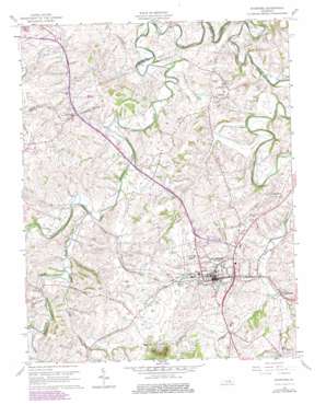
Stanford Topo Map Kentucky
To zoom in, hover over the map of Stanford
USGS Topo Quad 37084e6 - 1:24,000 scale
| Topo Map Name: | Stanford |
| USGS Topo Quad ID: | 37084e6 |
| Print Size: | ca. 21 1/4" wide x 27" high |
| Southeast Coordinates: | 37.5° N latitude / 84.625° W longitude |
| Map Center Coordinates: | 37.5625° N latitude / 84.6875° W longitude |
| U.S. State: | KY |
| Filename: | o37084e6.jpg |
| Download Map JPG Image: | Stanford topo map 1:24,000 scale |
| Map Type: | Topographic |
| Topo Series: | 7.5´ |
| Map Scale: | 1:24,000 |
| Source of Map Images: | United States Geological Survey (USGS) |
| Alternate Map Versions: |
Stanford KY 1952, updated 1953 Download PDF Buy paper map Stanford KY 1961, updated 1962 Download PDF Buy paper map Stanford KY 1961, updated 1976 Download PDF Buy paper map Stanford KY 1961, updated 1979 Download PDF Buy paper map Stanford KY 2010 Download PDF Buy paper map Stanford KY 2013 Download PDF Buy paper map Stanford KY 2016 Download PDF Buy paper map |
1:24,000 Topo Quads surrounding Stanford
> Back to 37084e1 at 1:100,000 scale
> Back to 37084a1 at 1:250,000 scale
> Back to U.S. Topo Maps home
Stanford topo map: Gazetteer
Stanford: Populated Places
Boneyville elevation 315m 1033′Hubble elevation 299m 980′
Logantown elevation 283m 928′
Rowland elevation 263m 862′
Stanford elevation 287m 941′
Stanford: Post Offices
Bright Post Office (historical) elevation 305m 1000′Englemans Post Office (historical) elevation 287m 941′
Hubble Post Office (historical) elevation 295m 967′
Lytle Post Office (historical) elevation 262m 859′
Richmond Junction Post Office (historical) elevation 266m 872′
Rowland Post Office (historical) elevation 283m 928′
Stanford: Springs
Buffalo Spring elevation 290m 951′Stanford: Streams
Blacks Branch elevation 266m 872′Blue Lick Creek elevation 266m 872′
Hawkins Branch elevation 243m 797′
Knoblick Creek elevation 258m 846′
Neals Creek elevation 262m 859′
Peyton Creek elevation 270m 885′
Saint Asaph Creek elevation 265m 869′
Stanford: Summits
Beech Hill elevation 344m 1128′Locust Hill elevation 318m 1043′
Needmore Hill elevation 281m 921′
Pleasant Hill elevation 319m 1046′
Stanford digital topo map on disk
Buy this Stanford topo map showing relief, roads, GPS coordinates and other geographical features, as a high-resolution digital map file on DVD:


