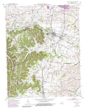
Junction City Topo Map Kentucky
To zoom in, hover over the map of Junction City
USGS Topo Quad 37084e7 - 1:24,000 scale
| Topo Map Name: | Junction City |
| USGS Topo Quad ID: | 37084e7 |
| Print Size: | ca. 21 1/4" wide x 27" high |
| Southeast Coordinates: | 37.5° N latitude / 84.75° W longitude |
| Map Center Coordinates: | 37.5625° N latitude / 84.8125° W longitude |
| U.S. State: | KY |
| Filename: | o37084e7.jpg |
| Download Map JPG Image: | Junction City topo map 1:24,000 scale |
| Map Type: | Topographic |
| Topo Series: | 7.5´ |
| Map Scale: | 1:24,000 |
| Source of Map Images: | United States Geological Survey (USGS) |
| Alternate Map Versions: |
Junction City KY 1952, updated 1954 Download PDF Buy paper map Junction City KY 1952, updated 1990 Download PDF Buy paper map Junction City KY 2010 Download PDF Buy paper map Junction City KY 2013 Download PDF Buy paper map Junction City KY 2016 Download PDF Buy paper map |
1:24,000 Topo Quads surrounding Junction City
> Back to 37084e1 at 1:100,000 scale
> Back to 37084a1 at 1:250,000 scale
> Back to U.S. Topo Maps home
Junction City topo map: Gazetteer
Junction City: Airports
Stuart Powell Field elevation 307m 1007′Junction City: Populated Places
Alum Springs elevation 348m 1141′Junction City elevation 302m 990′
Milledgeville elevation 320m 1049′
Moreland elevation 333m 1092′
Shelby City elevation 305m 1000′
Junction City: Post Offices
Alum Springs Post Office (historical) elevation 350m 1148′Milledgeville Post Office (historical) elevation 322m 1056′
Moreland Post Office (historical) elevation 333m 1092′
Shelby City Post Office (historical) elevation 303m 994′
Travelers Rest Post Office (historical) elevation 305m 1000′
Junction City: Streams
Frog Branch elevation 273m 895′Harris Creek elevation 276m 905′
White Oak Creek elevation 280m 918′
Junction City: Summits
Berger Knob elevation 397m 1302′Boyle Knob elevation 398m 1305′
Catholic Knob elevation 405m 1328′
Gibson Knob elevation 415m 1361′
Persimmon Knob elevation 402m 1318′
Pine Knob elevation 365m 1197′
Sand Knob elevation 452m 1482′
Junction City digital topo map on disk
Buy this Junction City topo map showing relief, roads, GPS coordinates and other geographical features, as a high-resolution digital map file on DVD:


