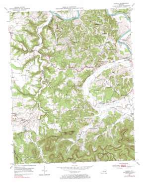
Panola Topo Map Kentucky
To zoom in, hover over the map of Panola
USGS Topo Quad 37084f1 - 1:24,000 scale
| Topo Map Name: | Panola |
| USGS Topo Quad ID: | 37084f1 |
| Print Size: | ca. 21 1/4" wide x 27" high |
| Southeast Coordinates: | 37.625° N latitude / 84° W longitude |
| Map Center Coordinates: | 37.6875° N latitude / 84.0625° W longitude |
| U.S. State: | KY |
| Filename: | o37084f1.jpg |
| Download Map JPG Image: | Panola topo map 1:24,000 scale |
| Map Type: | Topographic |
| Topo Series: | 7.5´ |
| Map Scale: | 1:24,000 |
| Source of Map Images: | United States Geological Survey (USGS) |
| Alternate Map Versions: |
Panola KY 1952, updated 1954 Download PDF Buy paper map Panola KY 1952, updated 1971 Download PDF Buy paper map Panola KY 1952, updated 1984 Download PDF Buy paper map Panola KY 2010 Download PDF Buy paper map Panola KY 2013 Download PDF Buy paper map Panola KY 2016 Download PDF Buy paper map |
1:24,000 Topo Quads surrounding Panola
> Back to 37084e1 at 1:100,000 scale
> Back to 37084a1 at 1:250,000 scale
> Back to U.S. Topo Maps home
Panola topo map: Gazetteer
Panola: Airports
Calla Airport elevation 211m 692′Panola: Bridges
Drowning Creek Bridge elevation 186m 610′Panola: Populated Places
Bybee elevation 277m 908′Calloway Crossing elevation 196m 643′
Cedar Grove elevation 214m 702′
Cedar Lakes Estates elevation 265m 869′
Crooked Creek elevation 230m 754′
Drowing Creek elevation 258m 846′
Knob Lick elevation 274m 898′
Little Rock (historical) elevation 250m 820′
Maddie elevation 274m 898′
Noland elevation 215m 705′
Panola elevation 243m 797′
Pea Ridge elevation 252m 826′
Rice Station (historical) elevation 265m 869′
Sand Hill elevation 265m 869′
Thomas elevation 227m 744′
Winston elevation 269m 882′
Wisemantown elevation 204m 669′
Witt elevation 204m 669′
Witt Springs elevation 264m 866′
Panola: Post Offices
Alger Post Office (historical) elevation 251m 823′Blue Bank Post Office (historical) elevation 186m 610′
Fainville Post Office (historical) elevation 274m 898′
King Station Post Office (historical) elevation 223m 731′
Little Rock Railroad Station (historical) elevation 251m 823′
Noland Post Office (historical) elevation 215m 705′
Panola Post Office (historical) elevation 240m 787′
Portwood Post Office (historical) elevation 201m 659′
Reges Post Office (historical) elevation 251m 823′
Rice Station Post Office (historical) elevation 277m 908′
Stump Post Office (historical) elevation 194m 636′
Thomas Point on Postal Route elevation 266m 872′
Vogel Post Office (historical) elevation 272m 892′
Weeden Post Office (historical) elevation 238m 780′
Winston Post Office (historical) elevation 268m 879′
Wisemantown Post Office (historical) elevation 206m 675′
Witt Post Office (historical) elevation 206m 675′
Witt Springs Post Office (historical) elevation 251m 823′
Panola: Ridges
Pea Ridge elevation 254m 833′Trotting Ridge elevation 263m 862′
Turpin Ridge elevation 263m 862′
Panola: Streams
Black Branch elevation 193m 633′Blue Run elevation 182m 597′
Butler Branch elevation 187m 613′
Calloway Creek elevation 181m 593′
Dark Hollow elevation 226m 741′
Drowning Creek elevation 181m 593′
Hinton Branch elevation 183m 600′
Hoys Fork elevation 188m 616′
Knob Lick Branch elevation 221m 725′
Oldham Branch elevation 218m 715′
Possum Run elevation 181m 593′
Rock Lick elevation 181m 593′
Tanyard Branch elevation 198m 649′
Panola: Summits
Big Round Mountain elevation 425m 1394′Dug Hill elevation 268m 879′
Lily Mountain elevation 425m 1394′
Little Round Mountain elevation 402m 1318′
Peter Mountain elevation 442m 1450′
Picnic Hill elevation 284m 931′
Preacher Estes Mountain elevation 438m 1437′
Round Hill elevation 337m 1105′
Sand Hill elevation 242m 793′
Zion Mountain elevation 447m 1466′
Panola: Valleys
Dark Hollow elevation 195m 639′Panola digital topo map on disk
Buy this Panola topo map showing relief, roads, GPS coordinates and other geographical features, as a high-resolution digital map file on DVD:


