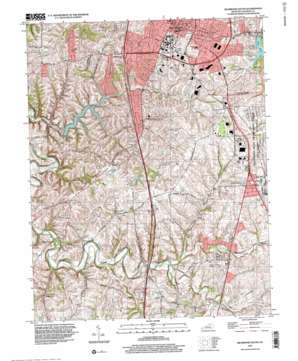
Richmond South Topo Map Kentucky
To zoom in, hover over the map of Richmond South
USGS Topo Quad 37084f3 - 1:24,000 scale
| Topo Map Name: | Richmond South |
| USGS Topo Quad ID: | 37084f3 |
| Print Size: | ca. 21 1/4" wide x 27" high |
| Southeast Coordinates: | 37.625° N latitude / 84.25° W longitude |
| Map Center Coordinates: | 37.6875° N latitude / 84.3125° W longitude |
| U.S. State: | KY |
| Filename: | o37084f3.jpg |
| Download Map JPG Image: | Richmond South topo map 1:24,000 scale |
| Map Type: | Topographic |
| Topo Series: | 7.5´ |
| Map Scale: | 1:24,000 |
| Source of Map Images: | United States Geological Survey (USGS) |
| Alternate Map Versions: |
Richmond South KY 1953, updated 1954 Download PDF Buy paper map Richmond South KY 1965, updated 1967 Download PDF Buy paper map Richmond South KY 1965, updated 1979 Download PDF Buy paper map Richmond South KY 1965, updated 1987 Download PDF Buy paper map Richmond South KY 1997, updated 2000 Download PDF Buy paper map Richmond South KY 2010 Download PDF Buy paper map Richmond South KY 2013 Download PDF Buy paper map Richmond South KY 2016 Download PDF Buy paper map |
1:24,000 Topo Quads surrounding Richmond South
> Back to 37084e1 at 1:100,000 scale
> Back to 37084a1 at 1:250,000 scale
> Back to U.S. Topo Maps home
Richmond South topo map: Gazetteer
Richmond South: Airports
Berea-Richmond Airport elevation 300m 984′Madison Airport elevation 290m 951′
Richmond South: Bridges
Silver Creek Bridge elevation 247m 810′Richmond South: Populated Places
Buggytown elevation 280m 918′Caleast elevation 305m 1000′
Duncanon elevation 264m 866′
Peytontown elevation 283m 928′
Richmond elevation 289m 948′
Silver Creek elevation 265m 869′
Terrill elevation 308m 1010′
Whites elevation 277m 908′
Richmond South: Post Offices
Arcadia Post Office (historical) elevation 311m 1020′Caleast Post Office (historical) elevation 302m 990′
Estill Post Office (historical) elevation 302m 990′
Harris Post Office (historical) elevation 305m 1000′
Peytontown Post Office (historical) elevation 287m 941′
Silver Creek Post Office (historical) elevation 251m 823′
Terrill Post Office (historical) elevation 309m 1013′
Whites Post Office (historical) elevation 280m 918′
Richmond South: Reservoirs
Lake Reba elevation 260m 853′Taylor Fork Lake elevation 255m 836′
Richmond South: Springs
Bond Estill Spring (historical) elevation 284m 931′Richmond South: Streams
Ballard Branch elevation 256m 839′Blacks Branch elevation 260m 853′
Dog Branch elevation 267m 875′
Elk Garden Branch elevation 245m 803′
Harts Fork elevation 264m 866′
Hays Fork elevation 262m 859′
Jones Branch elevation 249m 816′
Mound Creek elevation 275m 902′
Old Town Branch elevation 252m 826′
Pumpkin Run elevation 267m 875′
Taylor Fork elevation 224m 734′
Vaughn Branch elevation 256m 839′
Walker Branch elevation 269m 882′
Richmond South: Summits
Embry Hill elevation 293m 961′Richmond South digital topo map on disk
Buy this Richmond South topo map showing relief, roads, GPS coordinates and other geographical features, as a high-resolution digital map file on DVD:


