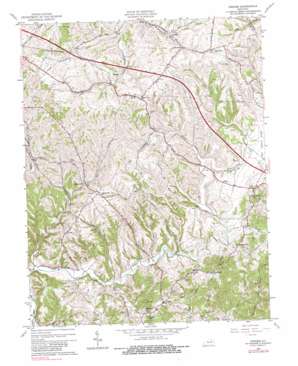
Hedges Topo Map Kentucky
To zoom in, hover over the map of Hedges
USGS Topo Quad 37084h1 - 1:24,000 scale
| Topo Map Name: | Hedges |
| USGS Topo Quad ID: | 37084h1 |
| Print Size: | ca. 21 1/4" wide x 27" high |
| Southeast Coordinates: | 37.875° N latitude / 84° W longitude |
| Map Center Coordinates: | 37.9375° N latitude / 84.0625° W longitude |
| U.S. State: | KY |
| Filename: | o37084h1.jpg |
| Download Map JPG Image: | Hedges topo map 1:24,000 scale |
| Map Type: | Topographic |
| Topo Series: | 7.5´ |
| Map Scale: | 1:24,000 |
| Source of Map Images: | United States Geological Survey (USGS) |
| Alternate Map Versions: |
Hedges KY 1952, updated 1954 Download PDF Buy paper map Hedges KY 1965, updated 1966 Download PDF Buy paper map Hedges KY 1965, updated 1981 Download PDF Buy paper map Hedges KY 2010 Download PDF Buy paper map Hedges KY 2013 Download PDF Buy paper map Hedges KY 2016 Download PDF Buy paper map |
1:24,000 Topo Quads surrounding Hedges
> Back to 37084e1 at 1:100,000 scale
> Back to 37084a1 at 1:250,000 scale
> Back to U.S. Topo Maps home
Hedges topo map: Gazetteer
Hedges: Populated Places
Agawam elevation 262m 859′Goffs Corner elevation 244m 800′
Hedges elevation 289m 948′
Midway elevation 265m 869′
Pilot View elevation 319m 1046′
Rabbit Town elevation 246m 807′
Rightangle elevation 238m 780′
Ruckerville elevation 245m 803′
Schollsville elevation 296m 971′
Snowden elevation 244m 800′
Trapp elevation 247m 810′
Hedges: Post Offices
Arlen Post Office (historical) elevation 200m 656′Bloomingdale Post Office (historical) elevation 183m 600′
Chilton Post Office (historical) elevation 247m 810′
Dunaway Post Office (historical) elevation 254m 833′
Hedges Post Office (historical) elevation 289m 948′
Pilot View Post Office (historical) elevation 317m 1040′
Rightangle Post Office (historical) elevation 239m 784′
Ruckerville Post Office (historical) elevation 249m 816′
Trapp Post Office (historical) elevation 249m 816′
Hedges: Ridges
Crow Ridge elevation 246m 807′Pine Ridge elevation 238m 780′
Pleasant Ridge elevation 324m 1062′
Hedges: Streams
Dry Fork elevation 188m 616′Kings Fork elevation 201m 659′
Little Dry Fork elevation 194m 636′
Little Howard Creek elevation 226m 741′
Hedges: Summits
Pleasant Hill elevation 330m 1082′Rose Hill elevation 311m 1020′
Hedges digital topo map on disk
Buy this Hedges topo map showing relief, roads, GPS coordinates and other geographical features, as a high-resolution digital map file on DVD:


