Coletown Topo Map Kentucky
To zoom in, hover over the map of Coletown
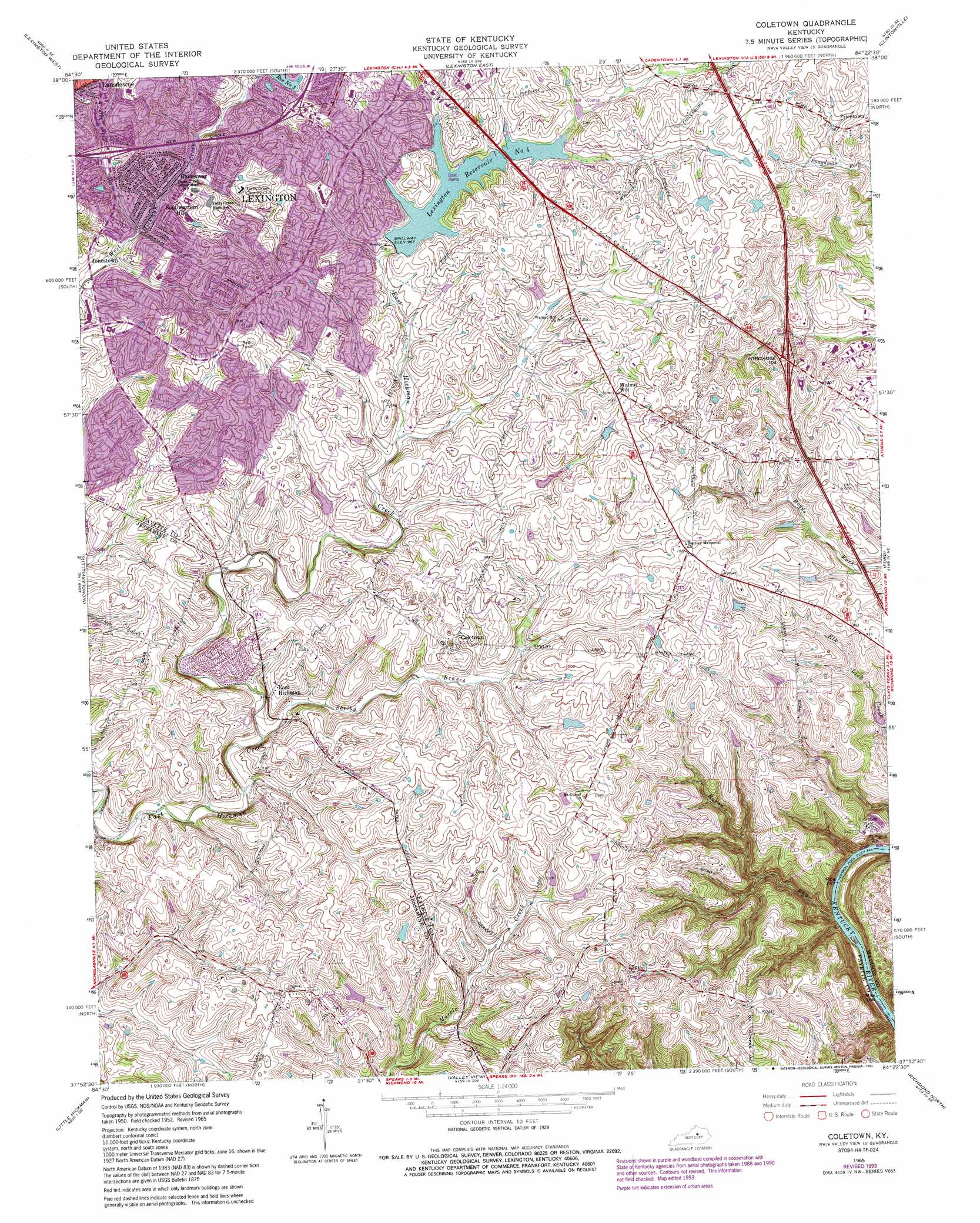
USGS Topo Quad 37084h4 - 1:24,000 scale
| Topo Map Name: | Coletown |
| USGS Topo Quad ID: | 37084h4 |
| Print Size: | ca. 21 1/4" wide x 27" high |
| Southeast Coordinates: | 37.875° N latitude / 84.375° W longitude |
| Map Center Coordinates: | 37.9375° N latitude / 84.4375° W longitude |
| U.S. State: | KY |
| Filename: | o37084h4.jpg |
| Download Map JPG Image: | Coletown topo map 1:24,000 scale |
| Map Type: | Topographic |
| Topo Series: | 7.5´ |
| Map Scale: | 1:24,000 |
| Source of Map Images: | United States Geological Survey (USGS) |
| Alternate Map Versions: |
Coletown KY 1952, updated 1953 Download PDF Buy paper map Coletown KY 1959, updated 1960 Download PDF Buy paper map Coletown KY 1965, updated 1966 Download PDF Buy paper map Coletown KY 1965, updated 1972 Download PDF Buy paper map Coletown KY 1965, updated 1979 Download PDF Buy paper map Coletown KY 1965, updated 1987 Download PDF Buy paper map Coletown KY 1965, updated 1993 Download PDF Buy paper map Coletown KY 2010 Download PDF Buy paper map Coletown KY 2013 Download PDF Buy paper map Coletown KY 2016 Download PDF Buy paper map |
1:24,000 Topo Quads surrounding Coletown
Midway |
Georgetown |
Centerville |
Paris West |
Paris East |
Versailles |
Lexington West |
Lexington East |
Clintonville |
Austerlitz |
Keene |
Nicholasville |
Coletown |
Ford |
Winchester |
Wilmore |
Little Hickman |
Valley View |
Richmond North |
Union City |
Bryantsville |
Buckeye |
Kirksville |
Richmond South |
Moberly |
> Back to 37084e1 at 1:100,000 scale
> Back to 37084a1 at 1:250,000 scale
> Back to U.S. Topo Maps home
Coletown topo map: Gazetteer
Coletown: Populated Places
Coletown elevation 291m 954′East Hickman elevation 287m 941′
Gamesway elevation 282m 925′
Jonestown elevation 276m 905′
Lexington elevation 295m 967′
Southeastern Hills elevation 296m 971′
Walnut Hill elevation 319m 1046′
Coletown: Reservoirs
Lexington Reservoir Number 4 elevation 293m 961′Coletown: Streams
East Hickman Creek elevation 259m 849′Raven Run elevation 183m 600′
Shelby Branch elevation 264m 866′
West Hickman Creek elevation 259m 849′
Coletown digital topo map on disk
Buy this Coletown topo map showing relief, roads, GPS coordinates and other geographical features, as a high-resolution digital map file on DVD: