Columbia Topo Map Kentucky
To zoom in, hover over the map of Columbia
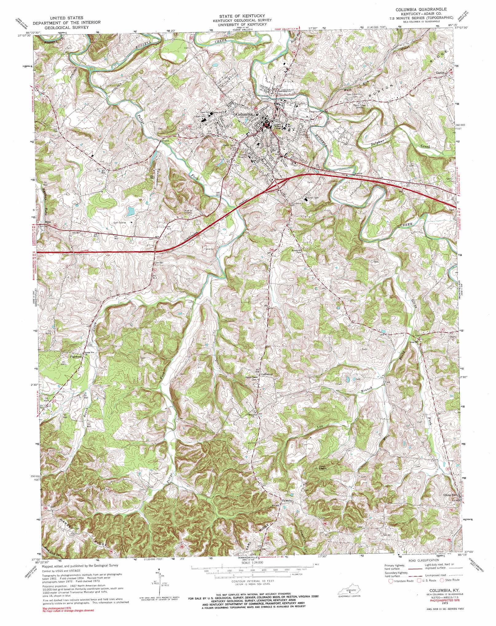
USGS Topo Quad 37085a3 - 1:24,000 scale
| Topo Map Name: | Columbia |
| USGS Topo Quad ID: | 37085a3 |
| Print Size: | ca. 21 1/4" wide x 27" high |
| Southeast Coordinates: | 37° N latitude / 85.25° W longitude |
| Map Center Coordinates: | 37.0625° N latitude / 85.3125° W longitude |
| U.S. State: | KY |
| Filename: | o37085a3.jpg |
| Download Map JPG Image: | Columbia topo map 1:24,000 scale |
| Map Type: | Topographic |
| Topo Series: | 7.5´ |
| Map Scale: | 1:24,000 |
| Source of Map Images: | United States Geological Survey (USGS) |
| Alternate Map Versions: |
Columbia KY 1954, updated 1955 Download PDF Buy paper map Columbia KY 1973, updated 1974 Download PDF Buy paper map Columbia KY 1973, updated 1976 Download PDF Buy paper map Columbia KY 2010 Download PDF Buy paper map Columbia KY 2013 Download PDF Buy paper map Columbia KY 2016 Download PDF Buy paper map |
1:24,000 Topo Quads surrounding Columbia
Summersville |
Greensburg |
Campbellsville |
Mannsville |
Clementsville |
Exie |
Gresham |
Cane Valley |
Knifley |
Dunnville |
East Fork |
Gradyville |
Columbia |
Montpelier |
Russell Springs |
Edmonton |
Breeding |
Amandaville |
Creelsboro |
Jamestown |
Dubre |
Waterview |
Burkesville |
Wolf Creek Dam |
Cumberland City |
> Back to 37085a1 at 1:100,000 scale
> Back to 37084a1 at 1:250,000 scale
> Back to U.S. Topo Maps home
Columbia topo map: Gazetteer
Columbia: Airports
Columbia-Adair County Airport elevation 249m 816′Columbia: Populated Places
Bliss elevation 212m 695′Columbia elevation 228m 748′
Fairplay elevation 300m 984′
Flatwood elevation 239m 784′
Gadberry (historical) elevation 290m 951′
Garlin elevation 272m 892′
Glens Fork elevation 247m 810′
Columbia: Ridges
Earl Ridge elevation 294m 964′Columbia: Streams
Brush Creek elevation 213m 698′Bull Run Creek elevation 207m 679′
Butler Branch elevation 201m 659′
Glens Fork elevation 213m 698′
Loy Branch elevation 229m 751′
Pettys Fork elevation 194m 636′
Sulphur Creek elevation 206m 675′
West Prong Glens Fork elevation 224m 734′
Columbia digital topo map on disk
Buy this Columbia topo map showing relief, roads, GPS coordinates and other geographical features, as a high-resolution digital map file on DVD: