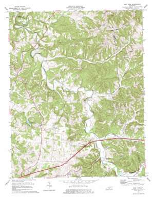
East Fork Topo Map Kentucky
To zoom in, hover over the map of East Fork
USGS Topo Quad 37085a5 - 1:24,000 scale
| Topo Map Name: | East Fork |
| USGS Topo Quad ID: | 37085a5 |
| Print Size: | ca. 21 1/4" wide x 27" high |
| Southeast Coordinates: | 37° N latitude / 85.5° W longitude |
| Map Center Coordinates: | 37.0625° N latitude / 85.5625° W longitude |
| U.S. State: | KY |
| Filename: | o37085a5.jpg |
| Download Map JPG Image: | East Fork topo map 1:24,000 scale |
| Map Type: | Topographic |
| Topo Series: | 7.5´ |
| Map Scale: | 1:24,000 |
| Source of Map Images: | United States Geological Survey (USGS) |
| Alternate Map Versions: |
East Fork KY 1953, updated 1955 Download PDF Buy paper map East Fork KY 1953, updated 1967 Download PDF Buy paper map East Fork KY 1973, updated 1974 Download PDF Buy paper map East Fork KY 2010 Download PDF Buy paper map East Fork KY 2013 Download PDF Buy paper map East Fork KY 2016 Download PDF Buy paper map |
1:24,000 Topo Quads surrounding East Fork
> Back to 37085a1 at 1:100,000 scale
> Back to 37084a1 at 1:250,000 scale
> Back to U.S. Topo Maps home
East Fork topo map: Gazetteer
East Fork: Populated Places
Cork elevation 288m 944′Gascon elevation 305m 1000′
Keltner elevation 294m 964′
Mell elevation 307m 1007′
East Fork: Reservoirs
County Lake elevation 229m 751′East Fork: Streams
Adams Creek elevation 188m 616′Butler Branch elevation 207m 679′
Caney Fork Creek elevation 186m 610′
Dry Fork Branch elevation 183m 600′
Lawrence Creek elevation 218m 715′
Leatherwood Creek elevation 212m 695′
Long Creek elevation 201m 659′
Moss Branch elevation 237m 777′
Prices Creek elevation 205m 672′
East Fork: Valleys
Roach Hollow elevation 232m 761′Sparks Hollow elevation 210m 688′
East Fork digital topo map on disk
Buy this East Fork topo map showing relief, roads, GPS coordinates and other geographical features, as a high-resolution digital map file on DVD:


