Glasgow North Topo Map Kentucky
To zoom in, hover over the map of Glasgow North
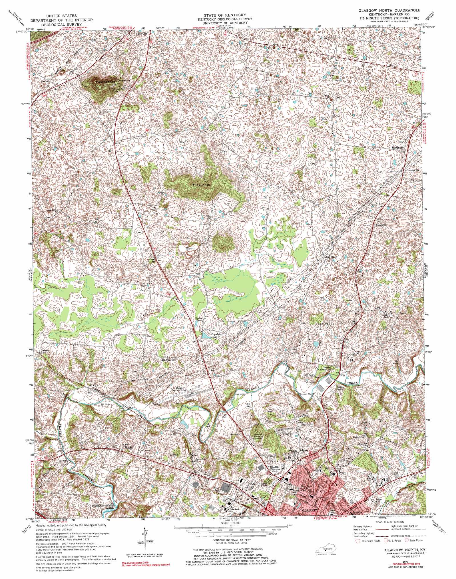
USGS Topo Quad 37085a8 - 1:24,000 scale
| Topo Map Name: | Glasgow North |
| USGS Topo Quad ID: | 37085a8 |
| Print Size: | ca. 21 1/4" wide x 27" high |
| Southeast Coordinates: | 37° N latitude / 85.875° W longitude |
| Map Center Coordinates: | 37.0625° N latitude / 85.9375° W longitude |
| U.S. State: | KY |
| Filename: | o37085a8.jpg |
| Download Map JPG Image: | Glasgow North topo map 1:24,000 scale |
| Map Type: | Topographic |
| Topo Series: | 7.5´ |
| Map Scale: | 1:24,000 |
| Source of Map Images: | United States Geological Survey (USGS) |
| Alternate Map Versions: |
Glasgow North KY 1954, updated 1956 Download PDF Buy paper map Glasgow North KY 1965, updated 1966 Download PDF Buy paper map Glasgow North KY 1973, updated 1974 Download PDF Buy paper map Glasgow North KY 1973, updated 1979 Download PDF Buy paper map Glasgow North KY 2010 Download PDF Buy paper map Glasgow North KY 2013 Download PDF Buy paper map Glasgow North KY 2016 Download PDF Buy paper map |
1:24,000 Topo Quads surrounding Glasgow North
Nolin Lake |
Cub Run |
Munfordville |
Canmer |
Hudgins |
Rhoda |
Mammoth Cave |
Horse Cave |
Park |
Center |
Smiths Grove |
Park City |
Glasgow North |
Hiseville |
Sulphur Well |
Meador |
Lucas |
Glasgow South |
Temple Hill |
Summer Shade |
Scottsville |
Austin |
Tracy |
Freedom |
Sulphur Lick |
> Back to 37085a1 at 1:100,000 scale
> Back to 37084a1 at 1:250,000 scale
> Back to U.S. Topo Maps home
Glasgow North topo map: Gazetteer
Glasgow North: Airports
Glasgow Municipal Airport elevation 215m 705′Glasgow North: Populated Places
Carden elevation 219m 718′Goodnight elevation 225m 738′
Oil City elevation 197m 646′
Glasgow North: Reservoirs
Poynters Lake elevation 233m 764′Glasgow North: Streams
Little Beaver Creek elevation 182m 597′Glasgow North: Summits
Flint Knob elevation 277m 908′Prewitts Knob elevation 297m 974′
Glasgow North digital topo map on disk
Buy this Glasgow North topo map showing relief, roads, GPS coordinates and other geographical features, as a high-resolution digital map file on DVD: