Park Topo Map Kentucky
To zoom in, hover over the map of Park
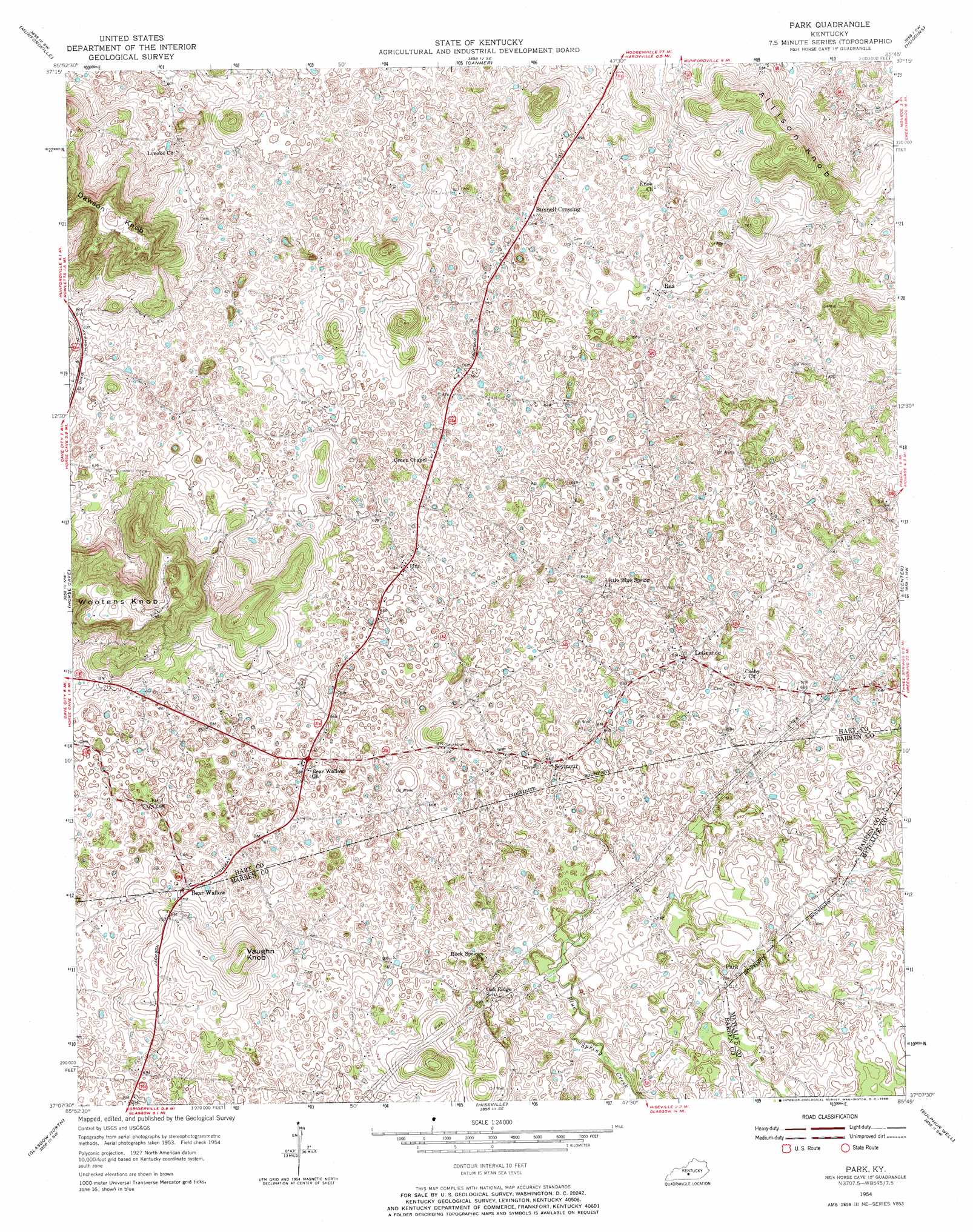
USGS Topo Quad 37085b7 - 1:24,000 scale
| Topo Map Name: | Park |
| USGS Topo Quad ID: | 37085b7 |
| Print Size: | ca. 21 1/4" wide x 27" high |
| Southeast Coordinates: | 37.125° N latitude / 85.75° W longitude |
| Map Center Coordinates: | 37.1875° N latitude / 85.8125° W longitude |
| U.S. State: | KY |
| Filename: | o37085b7.jpg |
| Download Map JPG Image: | Park topo map 1:24,000 scale |
| Map Type: | Topographic |
| Topo Series: | 7.5´ |
| Map Scale: | 1:24,000 |
| Source of Map Images: | United States Geological Survey (USGS) |
| Alternate Map Versions: |
Park KY 1954, updated 1955 Download PDF Buy paper map Park KY 1954, updated 1968 Download PDF Buy paper map Park KY 2010 Download PDF Buy paper map Park KY 2013 Download PDF Buy paper map Park KY 2016 Download PDF Buy paper map |
1:24,000 Topo Quads surrounding Park
Millerstown |
Upton |
Hammonville |
Magnolia |
Hibernia |
Cub Run |
Munfordville |
Canmer |
Hudgins |
Summersville |
Mammoth Cave |
Horse Cave |
Park |
Center |
Exie |
Park City |
Glasgow North |
Hiseville |
Sulphur Well |
East Fork |
Lucas |
Glasgow South |
Temple Hill |
Summer Shade |
Edmonton |
> Back to 37085a1 at 1:100,000 scale
> Back to 37084a1 at 1:250,000 scale
> Back to U.S. Topo Maps home
Park topo map: Gazetteer
Park: Airports
Natchez Trace Farm Airport elevation 212m 695′Park: Populated Places
Bear Wallow elevation 211m 692′Bunnell Crossing elevation 207m 679′
LeGrande elevation 202m 662′
Park elevation 219m 718′
Rex elevation 215m 705′
Seymour elevation 196m 643′
Uno elevation 196m 643′
Park: Streams
Blue Spring Creek elevation 198m 649′Lemon Branch elevation 209m 685′
Park: Summits
Allison Knob elevation 286m 938′Dawson Knob elevation 293m 961′
Vaughn Knob elevation 266m 872′
Wootens Knob elevation 305m 1000′
Park digital topo map on disk
Buy this Park topo map showing relief, roads, GPS coordinates and other geographical features, as a high-resolution digital map file on DVD: