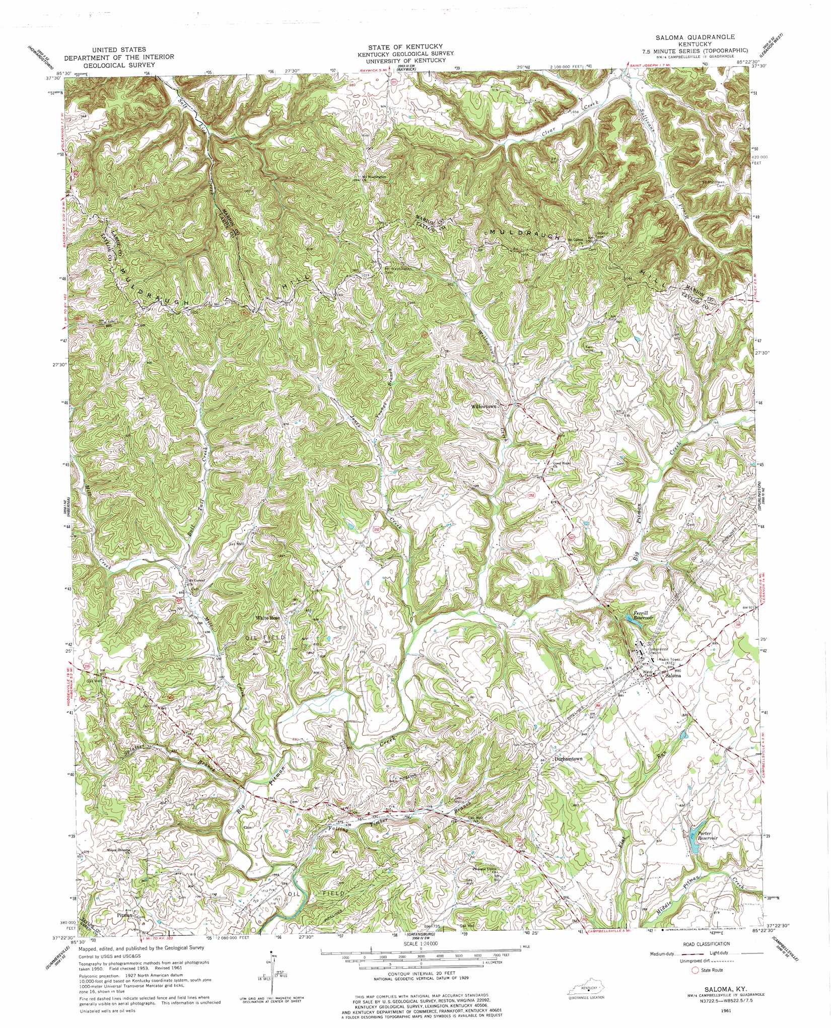
Saloma Topo Map Kentucky
To zoom in, hover over the map of Saloma
USGS Topo Quad 37085d4 - 1:24,000 scale
| Topo Map Name: | Saloma |
| USGS Topo Quad ID: | 37085d4 |
| Print Size: | ca. 21 1/4" wide x 27" high |
| Southeast Coordinates: | 37.375° N latitude / 85.375° W longitude |
| Map Center Coordinates: | 37.4375° N latitude / 85.4375° W longitude |
| U.S. State: | KY |
| Filename: | o37085d4.jpg |
| Download Map JPG Image: | Saloma topo map 1:24,000 scale |
| Map Type: | Topographic |
| Topo Series: | 7.5´ |
| Map Scale: | 1:24,000 |
| Source of Map Images: | United States Geological Survey (USGS) |
| Alternate Map Versions: |
Saloma KY 1953, updated 1954 Download PDF Buy paper map Saloma KY 1961, updated 1963 Download PDF Buy paper map Saloma KY 1961, updated 1977 Download PDF Buy paper map Saloma KY 2010 Download PDF Buy paper map Saloma KY 2013 Download PDF Buy paper map Saloma KY 2016 Download PDF Buy paper map |
1:24,000 Topo Quads surrounding Saloma
Nelsonville |
New Haven |
Loretto |
Saint Catherine |
Springfield |
Hodgenville |
Howardstown |
Raywick |
Lebanon West |
Lebanon East |
Magnolia |
Hibernia |
Saloma |
Spurlington |
Bradfordsville |
Hudgins |
Summersville |
Greensburg |
Campbellsville |
Mannsville |
Center |
Exie |
Gresham |
Cane Valley |
Knifley |
> Back to 37085a1 at 1:100,000 scale
> Back to 37084a1 at 1:250,000 scale
> Back to U.S. Topo Maps home
Saloma topo map: Gazetteer
Saloma: Airports
TGP Heliport elevation 270m 885′Saloma: Populated Places
Clear Creek (historical) elevation 198m 649′Durhamtown elevation 269m 882′
Pitman elevation 250m 820′
Saloma elevation 276m 905′
White Rose elevation 228m 748′
Willowtown elevation 244m 800′
Saloma: Reservoirs
Ferrill Reservoir elevation 239m 784′Porter Reservoir elevation 232m 761′
Saloma: Streams
Bull Tail Creek elevation 212m 695′Falling Timber Branch elevation 195m 639′
Jones Creek elevation 211m 692′
Mill Creek elevation 199m 652′
Splatter Branch elevation 201m 659′
Sullivans Prong elevation 189m 620′
Willowtown Creek elevation 212m 695′
Saloma digital topo map on disk
Buy this Saloma topo map showing relief, roads, GPS coordinates and other geographical features, as a high-resolution digital map file on DVD: