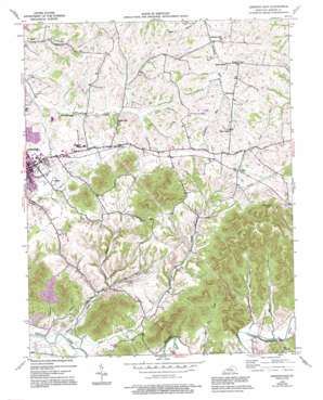
Lebanon East Topo Map Kentucky
To zoom in, hover over the map of Lebanon East
USGS Topo Quad 37085e2 - 1:24,000 scale
| Topo Map Name: | Lebanon East |
| USGS Topo Quad ID: | 37085e2 |
| Print Size: | ca. 21 1/4" wide x 27" high |
| Southeast Coordinates: | 37.5° N latitude / 85.125° W longitude |
| Map Center Coordinates: | 37.5625° N latitude / 85.1875° W longitude |
| U.S. State: | KY |
| Filename: | o37085e2.jpg |
| Download Map JPG Image: | Lebanon East topo map 1:24,000 scale |
| Map Type: | Topographic |
| Topo Series: | 7.5´ |
| Map Scale: | 1:24,000 |
| Source of Map Images: | United States Geological Survey (USGS) |
| Alternate Map Versions: |
Lebanon East KY 1953, updated 1954 Download PDF Buy paper map Lebanon East KY 1953, updated 1968 Download PDF Buy paper map Lebanon East KY 2010 Download PDF Buy paper map Lebanon East KY 2013 Download PDF Buy paper map Lebanon East KY 2016 Download PDF Buy paper map |
1:24,000 Topo Quads surrounding Lebanon East
> Back to 37085e1 at 1:100,000 scale
> Back to 37084a1 at 1:250,000 scale
> Back to U.S. Topo Maps home
Lebanon East topo map: Gazetteer
Lebanon East: Gaps
The Narrows elevation 212m 695′Lebanon East: Parks
Boy Scout Park (historical) elevation 0m 0′Lebanon East: Populated Places
Helm (historical) elevation 0m 0′Penick elevation 293m 961′
Pleasant Run (historical) elevation 263m 862′
Poplar Corner elevation 262m 859′
Lebanon East: Post Offices
Penick Post Office (historical) elevation 0m 0′Lebanon East: Reservoirs
Fagan Branch Pond elevation 206m 675′Fagan Branch Reservoir elevation 206m 675′
Marion County Sportsmans Lake elevation 202m 662′
Marion County Sportsmans Lake elevation 202m 662′
Lebanon East: Streams
Caney Creek elevation 189m 620′Fagan Branch elevation 189m 620′
Pope Creek elevation 189m 620′
Wheeler Branch elevation 207m 679′
Lebanon East: Summits
Colgans Hill elevation 0m 0′Putnam Knob elevation 379m 1243′
Lebanon East: Valleys
Turkey Pen Hollow elevation 208m 682′Lebanon East digital topo map on disk
Buy this Lebanon East topo map showing relief, roads, GPS coordinates and other geographical features, as a high-resolution digital map file on DVD:


