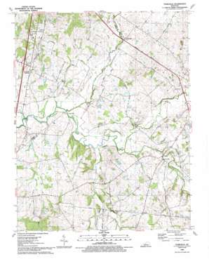
Tonieville Topo Map Kentucky
To zoom in, hover over the map of Tonieville
USGS Topo Quad 37085e7 - 1:24,000 scale
| Topo Map Name: | Tonieville |
| USGS Topo Quad ID: | 37085e7 |
| Print Size: | ca. 21 1/4" wide x 27" high |
| Southeast Coordinates: | 37.5° N latitude / 85.75° W longitude |
| Map Center Coordinates: | 37.5625° N latitude / 85.8125° W longitude |
| U.S. State: | KY |
| Filename: | o37085e7.jpg |
| Download Map JPG Image: | Tonieville topo map 1:24,000 scale |
| Map Type: | Topographic |
| Topo Series: | 7.5´ |
| Map Scale: | 1:24,000 |
| Source of Map Images: | United States Geological Survey (USGS) |
| Alternate Map Versions: |
Tonieville KY 1949, updated 1952 Download PDF Buy paper map Tonieville KY 1960, updated 1962 Download PDF Buy paper map Tonieville KY 1960, updated 1988 Download PDF Buy paper map Tonieville KY 1979, updated 1983 Download PDF Buy paper map Tonieville KY 1992, updated 1992 Download PDF Buy paper map Tonieville KY 2010 Download PDF Buy paper map Tonieville KY 2013 Download PDF Buy paper map Tonieville KY 2016 Download PDF Buy paper map |
1:24,000 Topo Quads surrounding Tonieville
> Back to 37085e1 at 1:100,000 scale
> Back to 37084a1 at 1:250,000 scale
> Back to U.S. Topo Maps home
Tonieville topo map: Gazetteer
Tonieville: Airports
Hornback Airport elevation 235m 770′Tonieville: Populated Places
Glendale Junction elevation 224m 734′Mathers Mill elevation 212m 695′
Tanner elevation 251m 823′
Tonieville elevation 226m 741′
Tonieville: Springs
Heady Spring (historical) elevation 213m 698′Tonieville: Streams
Barren Run elevation 205m 672′Chestnut Fork elevation 216m 708′
Clear Run elevation 201m 659′
Jackson Branch elevation 199m 652′
Middle Creek elevation 201m 659′
Morrison Branch elevation 208m 682′
North Fork Nolin River elevation 208m 682′
Pup Run elevation 201m 659′
South Fork Nolin River elevation 207m 679′
Tonieville digital topo map on disk
Buy this Tonieville topo map showing relief, roads, GPS coordinates and other geographical features, as a high-resolution digital map file on DVD:


