Cardwell Topo Map Kentucky
To zoom in, hover over the map of Cardwell
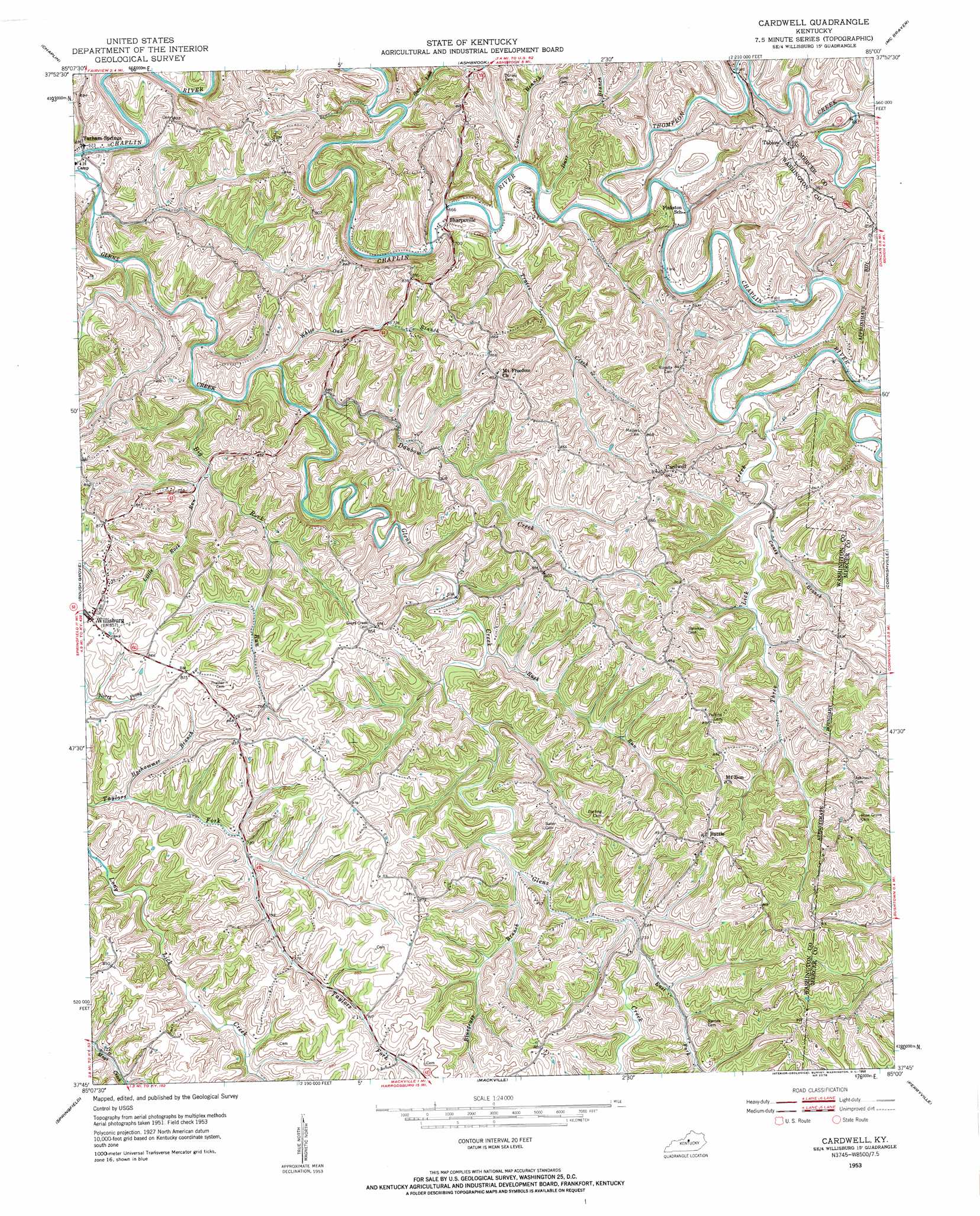
USGS Topo Quad 37085g1 - 1:24,000 scale
| Topo Map Name: | Cardwell |
| USGS Topo Quad ID: | 37085g1 |
| Print Size: | ca. 21 1/4" wide x 27" high |
| Southeast Coordinates: | 37.75° N latitude / 85° W longitude |
| Map Center Coordinates: | 37.8125° N latitude / 85.0625° W longitude |
| U.S. State: | KY |
| Filename: | o37085g1.jpg |
| Download Map JPG Image: | Cardwell topo map 1:24,000 scale |
| Map Type: | Topographic |
| Topo Series: | 7.5´ |
| Map Scale: | 1:24,000 |
| Source of Map Images: | United States Geological Survey (USGS) |
| Alternate Map Versions: |
Cardwell KY 1953, updated 1954 Download PDF Buy paper map Cardwell KY 1953, updated 1958 Download PDF Buy paper map Cardwell KY 2010 Download PDF Buy paper map Cardwell KY 2013 Download PDF Buy paper map Cardwell KY 2016 Download PDF Buy paper map |
1:24,000 Topo Quads surrounding Cardwell
Taylorsville |
Mount Eden |
Glensboro |
Lawrenceburg |
Tyrone |
Bloomfield |
Chaplin |
Ashbrook |
Mcbrayer |
Salvisa |
Maud |
Brush Grove |
Cardwell |
Cornishville |
Harrodsburg |
Saint Catherine |
Springfield |
Mackville |
Perryville |
Danville |
Lebanon West |
Lebanon East |
Gravel Switch |
Parksville |
Junction City |
> Back to 37085e1 at 1:100,000 scale
> Back to 37084a1 at 1:250,000 scale
> Back to U.S. Topo Maps home
Cardwell topo map: Gazetteer
Cardwell: Bridges
Sharpsville Covered Bridge (historical) elevation 195m 639′Cardwell: Islands
Careys Island elevation 188m 616′Cardwell: Populated Places
Battle elevation 280m 918′Cardwell elevation 256m 839′
Hickory Grove (historical) elevation 265m 869′
Sharpsville elevation 208m 682′
Tablow elevation 257m 843′
Tatham Springs elevation 193m 633′
Cardwell: Post Offices
Battle Post Office (historical) elevation 276m 905′Cardwell Post Office (historical) elevation 260m 853′
Sharpsville Post Office (historical) elevation 204m 669′
Willisburg Post Office (historical) elevation 262m 859′
Cardwell: Streams
Big Rock Run elevation 198m 649′Bluegrass Branch elevation 219m 718′
Caney Branch elevation 215m 705′
Corn Branch elevation 198m 649′
Danbow Creek elevation 198m 649′
Durr Branch elevation 201m 659′
East Fork Glens Creek elevation 219m 718′
Gum Lick elevation 194m 636′
Hoehammer Branch elevation 212m 695′
Little Rock Run elevation 205m 672′
Plum Run elevation 188m 616′
Rock Run elevation 198m 649′
Rush Run elevation 214m 702′
Thompson Creek elevation 200m 656′
Three Lick Creek elevation 207m 679′
Traces Creek elevation 199m 652′
White Oak Branch elevation 201m 659′
Cardwell: Summits
Durr Hill elevation 246m 807′Tatham Springs Hill elevation 246m 807′
Cardwell digital topo map on disk
Buy this Cardwell topo map showing relief, roads, GPS coordinates and other geographical features, as a high-resolution digital map file on DVD: