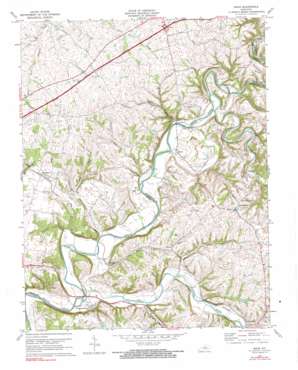
Maud Topo Map Kentucky
To zoom in, hover over the map of Maud
USGS Topo Quad 37085g3 - 1:24,000 scale
| Topo Map Name: | Maud |
| USGS Topo Quad ID: | 37085g3 |
| Print Size: | ca. 21 1/4" wide x 27" high |
| Southeast Coordinates: | 37.75° N latitude / 85.25° W longitude |
| Map Center Coordinates: | 37.8125° N latitude / 85.3125° W longitude |
| U.S. State: | KY |
| Filename: | o37085g3.jpg |
| Download Map JPG Image: | Maud topo map 1:24,000 scale |
| Map Type: | Topographic |
| Topo Series: | 7.5´ |
| Map Scale: | 1:24,000 |
| Source of Map Images: | United States Geological Survey (USGS) |
| Alternate Map Versions: |
Maud KY 1953, updated 1954 Download PDF Buy paper map Maud KY 1953, updated 1969 Download PDF Buy paper map Maud KY 1972, updated 1973 Download PDF Buy paper map Maud KY 1972, updated 1990 Download PDF Buy paper map Maud KY 2010 Download PDF Buy paper map Maud KY 2013 Download PDF Buy paper map Maud KY 2016 Download PDF Buy paper map |
1:24,000 Topo Quads surrounding Maud
> Back to 37085e1 at 1:100,000 scale
> Back to 37084a1 at 1:250,000 scale
> Back to U.S. Topo Maps home
Maud topo map: Gazetteer
Maud: Populated Places
Booker elevation 203m 666′Croakes elevation 176m 577′
Fredericktown elevation 160m 524′
Maud elevation 171m 561′
Mooresville elevation 239m 784′
Valley Hill elevation 184m 603′
Woodlawn elevation 240m 787′
Maud: Post Offices
Beech Fork Post Office (historical) elevation 165m 541′Booker Post Office (historical) elevation 208m 682′
Croakville Post Office (historical) elevation 170m 557′
Fredericktown Post Office (historical) elevation 158m 518′
Maud Post Office (historical) elevation 173m 567′
Mooresville Post Office (historical) elevation 233m 764′
Valley Hill Post Office (historical) elevation 186m 610′
Maud: Streams
Camp Branch elevation 164m 538′Cartwright Creek elevation 151m 495′
Chaplin River elevation 168m 551′
Doe Run elevation 167m 547′
Dry Run elevation 158m 518′
Hog Run elevation 158m 518′
Nealy Run elevation 164m 538′
Parker Run elevation 162m 531′
Piles Run elevation 165m 541′
Riddle Branch elevation 181m 593′
Sunfish Creek elevation 158m 518′
Maud: Summits
Mayo Hill elevation 241m 790′Maud digital topo map on disk
Buy this Maud topo map showing relief, roads, GPS coordinates and other geographical features, as a high-resolution digital map file on DVD:


