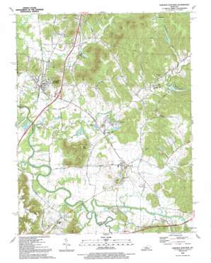
Lebanon Junction Topo Map Kentucky
To zoom in, hover over the map of Lebanon Junction
USGS Topo Quad 37085g6 - 1:24,000 scale
| Topo Map Name: | Lebanon Junction |
| USGS Topo Quad ID: | 37085g6 |
| Print Size: | ca. 21 1/4" wide x 27" high |
| Southeast Coordinates: | 37.75° N latitude / 85.625° W longitude |
| Map Center Coordinates: | 37.8125° N latitude / 85.6875° W longitude |
| U.S. State: | KY |
| Filename: | o37085g6.jpg |
| Download Map JPG Image: | Lebanon Junction topo map 1:24,000 scale |
| Map Type: | Topographic |
| Topo Series: | 7.5´ |
| Map Scale: | 1:24,000 |
| Source of Map Images: | United States Geological Survey (USGS) |
| Alternate Map Versions: |
Lebanon Junction KY 1967, updated 1983 Download PDF Buy paper map Lebanon Junction KY 2010 Download PDF Buy paper map Lebanon Junction KY 2013 Download PDF Buy paper map Lebanon Junction KY 2016 Download PDF Buy paper map |
1:24,000 Topo Quads surrounding Lebanon Junction
> Back to 37085e1 at 1:100,000 scale
> Back to 37084a1 at 1:250,000 scale
> Back to U.S. Topo Maps home
Lebanon Junction topo map: Gazetteer
Lebanon Junction: Lakes
Eagle Lake elevation 135m 442′Hurricane Hills Lake elevation 148m 485′
Paradise Lake elevation 132m 433′
Lebanon Junction: Populated Places
Boston elevation 140m 459′Lebanon Junction elevation 140m 459′
Scuffletown elevation 176m 577′
Younger Creek elevation 141m 462′
Lebanon Junction: Streams
Beech Fork elevation 126m 413′Cain Run elevation 128m 419′
Clear Creek elevation 125m 410′
East Fork Harts Run elevation 159m 521′
Lick Creek elevation 129m 423′
Mud Run elevation 128m 419′
Rattlesnake Run elevation 133m 436′
Rolling Fork Slough elevation 126m 413′
Wilson Creek elevation 126m 413′
Younger Creek elevation 126m 413′
Lebanon Junction: Summits
Keith Knob elevation 244m 800′Lebanon Junction: Valleys
Crutchmer Hollow elevation 131m 429′Mill Hollow elevation 159m 521′
Picnic Hollow elevation 158m 518′
Scuffletown Hollow elevation 140m 459′
Lebanon Junction digital topo map on disk
Buy this Lebanon Junction topo map showing relief, roads, GPS coordinates and other geographical features, as a high-resolution digital map file on DVD:


