Bristow Topo Map Kentucky
To zoom in, hover over the map of Bristow
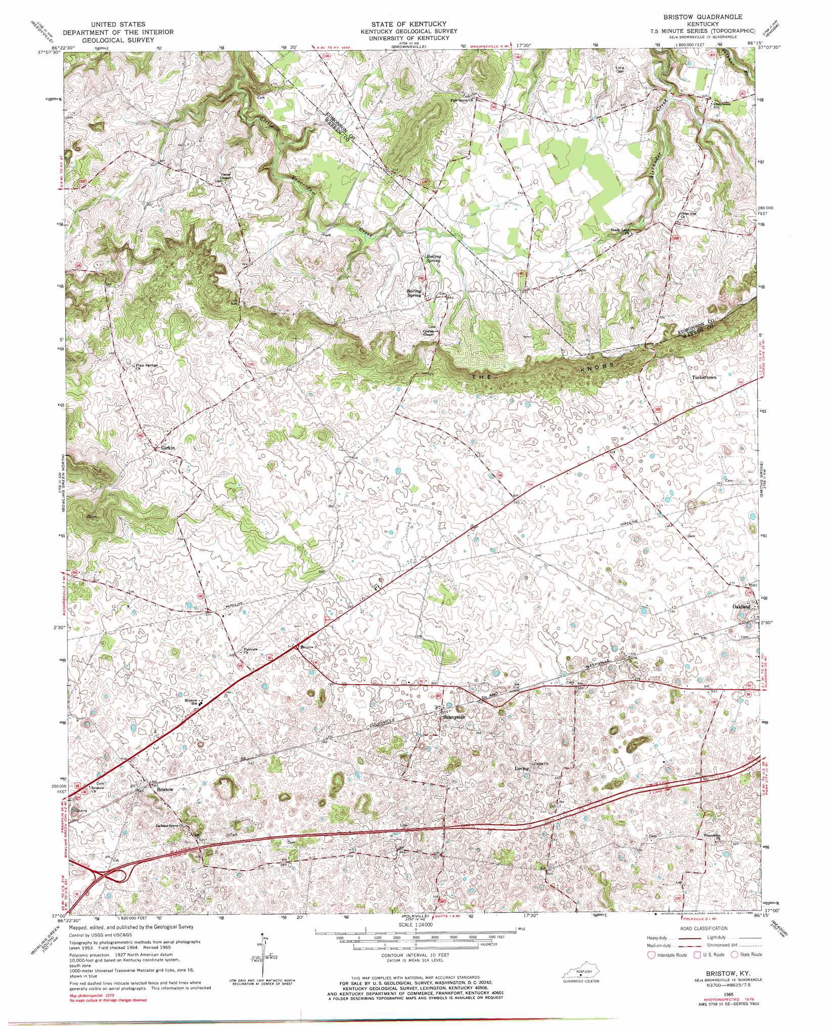
USGS Topo Quad 37086a3 - 1:24,000 scale
| Topo Map Name: | Bristow |
| USGS Topo Quad ID: | 37086a3 |
| Print Size: | ca. 21 1/4" wide x 27" high |
| Southeast Coordinates: | 37° N latitude / 86.25° W longitude |
| Map Center Coordinates: | 37.0625° N latitude / 86.3125° W longitude |
| U.S. State: | KY |
| Filename: | o37086a3.jpg |
| Download Map JPG Image: | Bristow topo map 1:24,000 scale |
| Map Type: | Topographic |
| Topo Series: | 7.5´ |
| Map Scale: | 1:24,000 |
| Source of Map Images: | United States Geological Survey (USGS) |
| Alternate Map Versions: |
Bristow KY 1954, updated 1955 Download PDF Buy paper map Bristow KY 1954, updated 1965 Download PDF Buy paper map Bristow KY 1965, updated 1967 Download PDF Buy paper map Bristow KY 1965, updated 1983 Download PDF Buy paper map Bristow KY 2010 Download PDF Buy paper map Bristow KY 2013 Download PDF Buy paper map Bristow KY 2016 Download PDF Buy paper map |
1:24,000 Topo Quads surrounding Bristow
Welchs Creek |
Ready |
Bee Spring |
Nolin Lake |
Cub Run |
Riverside |
Reedyville |
Brownsville |
Rhoda |
Mammoth Cave |
Hadley |
Bowling Green North |
Bristow |
Smiths Grove |
Park City |
Rockfield |
Bowling Green South |
Polkville |
Meador |
Lucas |
Woodburn |
Drake |
Allen Springs |
Scottsville |
Austin |
> Back to 37086a1 at 1:100,000 scale
> Back to 37086a1 at 1:250,000 scale
> Back to U.S. Topo Maps home
Bristow topo map: Gazetteer
Bristow: Populated Places
Bristow elevation 165m 541′Girkin elevation 182m 597′
Loving elevation 174m 570′
Sunnyside elevation 170m 557′
Tuckertown elevation 172m 564′
Bristow: Springs
Boiling Spring elevation 193m 633′Bristow digital topo map on disk
Buy this Bristow topo map showing relief, roads, GPS coordinates and other geographical features, as a high-resolution digital map file on DVD: