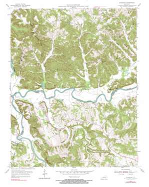
Riverside Topo Map Kentucky
To zoom in, hover over the map of Riverside
USGS Topo Quad 37086b5 - 1:24,000 scale
| Topo Map Name: | Riverside |
| USGS Topo Quad ID: | 37086b5 |
| Print Size: | ca. 21 1/4" wide x 27" high |
| Southeast Coordinates: | 37.125° N latitude / 86.5° W longitude |
| Map Center Coordinates: | 37.1875° N latitude / 86.5625° W longitude |
| U.S. State: | KY |
| Filename: | o37086b5.jpg |
| Download Map JPG Image: | Riverside topo map 1:24,000 scale |
| Map Type: | Topographic |
| Topo Series: | 7.5´ |
| Map Scale: | 1:24,000 |
| Source of Map Images: | United States Geological Survey (USGS) |
| Alternate Map Versions: |
Riverside KY 1954, updated 1956 Download PDF Buy paper map Riverside KY 1954, updated 1971 Download PDF Buy paper map Riverside KY 1954, updated 1990 Download PDF Buy paper map Riverside KY 2010 Download PDF Buy paper map Riverside KY 2013 Download PDF Buy paper map Riverside KY 2016 Download PDF Buy paper map |
1:24,000 Topo Quads surrounding Riverside
> Back to 37086a1 at 1:100,000 scale
> Back to 37086a1 at 1:250,000 scale
> Back to U.S. Topo Maps home
Riverside topo map: Gazetteer
Riverside: Bends
Sproul Bend elevation 127m 416′Riverside: Capes
Reedy Point elevation 128m 419′Riverside: Cliffs
Marcum Bluff elevation 204m 669′Riverside: Lakes
Cherry Lake elevation 122m 400′Little Martin Lake elevation 125m 410′
Martin Lake elevation 121m 396′
Upton Lake elevation 123m 403′
Riverside: Populated Places
Clark Landing elevation 122m 400′Horsemill elevation 184m 603′
Jetson elevation 192m 629′
Riverside elevation 168m 551′
Riverside: Ridges
Gary Ridge elevation 174m 570′Hogback Ridge elevation 212m 695′
Jolertown Ridge elevation 194m 636′
Lettered Rock Ridge elevation 185m 606′
Pea Ridge elevation 164m 538′
Pisgah Ridge elevation 147m 482′
Sprouse Ridge elevation 172m 564′
Riverside: Streams
Barren River elevation 119m 390′Betsy Branch elevation 126m 413′
Big Bull Creek elevation 125m 410′
Claylick Creek elevation 125m 410′
Flat Branch elevation 123m 403′
Gabbard Branch elevation 125m 410′
Gary Creek elevation 125m 410′
Little Bull Creek elevation 122m 400′
Little Claylick Creek elevation 122m 400′
Little Muddy Creek elevation 121m 396′
Little Reedy Creek elevation 122m 400′
Long Branch elevation 128m 419′
Lost Creek elevation 124m 406′
Maxey Creek elevation 121m 396′
Stone Creek elevation 134m 439′
Riverside: Summits
Flippo Hill elevation 169m 554′Little Barn Knob elevation 206m 675′
Riverside digital topo map on disk
Buy this Riverside topo map showing relief, roads, GPS coordinates and other geographical features, as a high-resolution digital map file on DVD:


