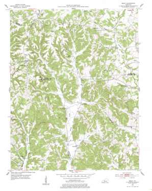
Ready Topo Map Kentucky
To zoom in, hover over the map of Ready
USGS Topo Quad 37086c4 - 1:24,000 scale
| Topo Map Name: | Ready |
| USGS Topo Quad ID: | 37086c4 |
| Print Size: | ca. 21 1/4" wide x 27" high |
| Southeast Coordinates: | 37.25° N latitude / 86.375° W longitude |
| Map Center Coordinates: | 37.3125° N latitude / 86.4375° W longitude |
| U.S. State: | KY |
| Filename: | o37086c4.jpg |
| Download Map JPG Image: | Ready topo map 1:24,000 scale |
| Map Type: | Topographic |
| Topo Series: | 7.5´ |
| Map Scale: | 1:24,000 |
| Source of Map Images: | United States Geological Survey (USGS) |
| Alternate Map Versions: |
Ready KY 1953, updated 1954 Download PDF Buy paper map Ready KY 1953, updated 1977 Download PDF Buy paper map Ready KY 1953, updated 1984 Download PDF Buy paper map Ready KY 2010 Download PDF Buy paper map Ready KY 2013 Download PDF Buy paper map Ready KY 2016 Download PDF Buy paper map |
1:24,000 Topo Quads surrounding Ready
> Back to 37086a1 at 1:100,000 scale
> Back to 37086a1 at 1:250,000 scale
> Back to U.S. Topo Maps home
Ready topo map: Gazetteer
Ready: Populated Places
Big Reedy elevation 139m 456′Decker elevation 223m 731′
Lee elevation 200m 656′
Nash elevation 150m 492′
Ready elevation 170m 557′
Windyville elevation 239m 784′
Ready: Streams
Big Reedy Branch elevation 134m 439′Dry Branch elevation 149m 488′
Joe Branch elevation 135m 442′
Welchs Creek elevation 156m 511′
West Fork Big Reedy Creek elevation 138m 452′
Ready: Valleys
Rowe Hollow elevation 157m 515′Woodbury Hollow elevation 171m 561′
Ready digital topo map on disk
Buy this Ready topo map showing relief, roads, GPS coordinates and other geographical features, as a high-resolution digital map file on DVD:


