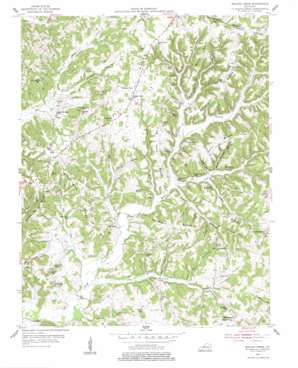
Welchs Creek Topo Map Kentucky
To zoom in, hover over the map of Welchs Creek
USGS Topo Quad 37086c5 - 1:24,000 scale
| Topo Map Name: | Welchs Creek |
| USGS Topo Quad ID: | 37086c5 |
| Print Size: | ca. 21 1/4" wide x 27" high |
| Southeast Coordinates: | 37.25° N latitude / 86.5° W longitude |
| Map Center Coordinates: | 37.3125° N latitude / 86.5625° W longitude |
| U.S. State: | KY |
| Filename: | o37086c5.jpg |
| Download Map JPG Image: | Welchs Creek topo map 1:24,000 scale |
| Map Type: | Topographic |
| Topo Series: | 7.5´ |
| Map Scale: | 1:24,000 |
| Source of Map Images: | United States Geological Survey (USGS) |
| Alternate Map Versions: |
Welchs Creek KY 1954, updated 1955 Download PDF Buy paper map Welchs Creek KY 1954, updated 1977 Download PDF Buy paper map Welchs Creek KY 2010 Download PDF Buy paper map Welchs Creek KY 2013 Download PDF Buy paper map Welchs Creek KY 2016 Download PDF Buy paper map |
1:24,000 Topo Quads surrounding Welchs Creek
> Back to 37086a1 at 1:100,000 scale
> Back to 37086a1 at 1:250,000 scale
> Back to U.S. Topo Maps home
Welchs Creek topo map: Gazetteer
Welchs Creek: Cliffs
Buzzards Roost Bluff elevation 169m 554′Welchs Creek: Flats
Flat Woods elevation 178m 583′Welchs Creek: Populated Places
Brooklyn elevation 129m 423′Casey elevation 145m 475′
Grancer elevation 135m 442′
Huldeville elevation 156m 511′
Love elevation 179m 587′
Tilford elevation 183m 600′
Welchs Creek elevation 185m 606′
Whittinghill elevation 190m 623′
Welchs Creek: Ridges
Bloomington Ridge elevation 182m 597′Bryant Ridge elevation 189m 620′
Frog Level Ridge elevation 174m 570′
Gary Ridge elevation 197m 646′
Hoop Pole Ridge elevation 181m 593′
Northern Ridge elevation 189m 620′
Squire Ridge elevation 172m 564′
Turkey Knob Ridge elevation 172m 564′
Welchs Creek: Streams
Bee Tree Branch elevation 131m 429′Bob Branch elevation 135m 442′
Com Creek elevation 131m 429′
Cooper Creek elevation 133m 436′
Grancer Creek elevation 131m 429′
John Woosley Creek elevation 125m 410′
New Zion Creek elevation 125m 410′
Pitman Creek elevation 125m 410′
Woosley Creek elevation 134m 439′
Welchs Creek: Summits
Bald Point elevation 220m 721′Buffalo Hill elevation 192m 629′
Netters Point elevation 205m 672′
Welchs Creek: Valleys
Buck Branch Hollow elevation 134m 439′Coal Bank Hollow elevation 140m 459′
Jim Buck Hollow elevation 134m 439′
Johnson Hollow elevation 137m 449′
Northern Hollow elevation 144m 472′
Rockfall Hollow elevation 138m 452′
Rueben Hollow elevation 155m 508′
Stillhouse Hollow elevation 152m 498′
Welchs Creek digital topo map on disk
Buy this Welchs Creek topo map showing relief, roads, GPS coordinates and other geographical features, as a high-resolution digital map file on DVD:


