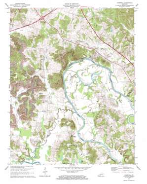
Cromwell Topo Map Kentucky
To zoom in, hover over the map of Cromwell
USGS Topo Quad 37086c7 - 1:24,000 scale
| Topo Map Name: | Cromwell |
| USGS Topo Quad ID: | 37086c7 |
| Print Size: | ca. 21 1/4" wide x 27" high |
| Southeast Coordinates: | 37.25° N latitude / 86.75° W longitude |
| Map Center Coordinates: | 37.3125° N latitude / 86.8125° W longitude |
| U.S. State: | KY |
| Filename: | o37086c7.jpg |
| Download Map JPG Image: | Cromwell topo map 1:24,000 scale |
| Map Type: | Topographic |
| Topo Series: | 7.5´ |
| Map Scale: | 1:24,000 |
| Source of Map Images: | United States Geological Survey (USGS) |
| Alternate Map Versions: |
Cromwell KY 1954, updated 1955 Download PDF Buy paper map Cromwell KY 1954, updated 1967 Download PDF Buy paper map Cromwell KY 1971, updated 1973 Download PDF Buy paper map Cromwell KY 2010 Download PDF Buy paper map Cromwell KY 2013 Download PDF Buy paper map Cromwell KY 2016 Download PDF Buy paper map |
1:24,000 Topo Quads surrounding Cromwell
> Back to 37086a1 at 1:100,000 scale
> Back to 37086a1 at 1:250,000 scale
> Back to U.S. Topo Maps home
Cromwell topo map: Gazetteer
Cromwell: Bends
Big Bend elevation 122m 400′Little Bend elevation 146m 479′
Cromwell: Lakes
Bakers Lake elevation 120m 393′Taylor Lake elevation 119m 390′
Cromwell: Populated Places
Cromwell elevation 141m 462′Highview elevation 128m 419′
Logansport elevation 149m 488′
Oak Grove elevation 162m 531′
Prentiss elevation 130m 426′
Shultztown elevation 129m 423′
Cromwell: Streams
Bull Run elevation 119m 390′Hurricane Slough elevation 120m 393′
Lake Creek elevation 122m 400′
Slaty Creek elevation 120m 393′
Thoroughfare Stream elevation 120m 393′
Cromwell: Summits
High View Hill elevation 168m 551′Keel Hill elevation 175m 574′
Millers Rock elevation 130m 426′
Negro Hill elevation 139m 456′
Seminary Hill elevation 174m 570′
Taylor Hill elevation 173m 567′
Tilford Knob elevation 184m 603′
Cromwell digital topo map on disk
Buy this Cromwell topo map showing relief, roads, GPS coordinates and other geographical features, as a high-resolution digital map file on DVD:


