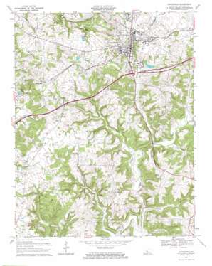
Leitchfield Topo Map Kentucky
To zoom in, hover over the map of Leitchfield
USGS Topo Quad 37086d3 - 1:24,000 scale
| Topo Map Name: | Leitchfield |
| USGS Topo Quad ID: | 37086d3 |
| Print Size: | ca. 21 1/4" wide x 27" high |
| Southeast Coordinates: | 37.375° N latitude / 86.25° W longitude |
| Map Center Coordinates: | 37.4375° N latitude / 86.3125° W longitude |
| U.S. State: | KY |
| Filename: | o37086d3.jpg |
| Download Map JPG Image: | Leitchfield topo map 1:24,000 scale |
| Map Type: | Topographic |
| Topo Series: | 7.5´ |
| Map Scale: | 1:24,000 |
| Source of Map Images: | United States Geological Survey (USGS) |
| Alternate Map Versions: |
Leitchfield KY 1954, updated 1956 Download PDF Buy paper map Leitchfield KY 1967, updated 1968 Download PDF Buy paper map Leitchfield KY 1967, updated 1969 Download PDF Buy paper map Leitchfield KY 2010 Download PDF Buy paper map Leitchfield KY 2013 Download PDF Buy paper map Leitchfield KY 2016 Download PDF Buy paper map |
1:24,000 Topo Quads surrounding Leitchfield
> Back to 37086a1 at 1:100,000 scale
> Back to 37086a1 at 1:250,000 scale
> Back to U.S. Topo Maps home
Leitchfield topo map: Gazetteer
Leitchfield: Airports
Grayson County Airport elevation 225m 738′Leitchfield: Cliffs
Day Cliffs elevation 193m 633′Leitchfield: Populated Places
Black Rock elevation 222m 728′Leitchfield elevation 227m 744′
Leitchfield: Reservoirs
Allens Lake elevation 215m 705′Leitchfield: Streams
Hargus Creek elevation 145m 475′Hat Branch elevation 144m 472′
Helm Fork elevation 158m 518′
Long Branch elevation 145m 475′
McClure Fork elevation 150m 492′
Miller Fork elevation 153m 501′
Taylor Fork elevation 151m 495′
Leitchfield: Valleys
Criswell Hollow elevation 157m 515′Leitchfield digital topo map on disk
Buy this Leitchfield topo map showing relief, roads, GPS coordinates and other geographical features, as a high-resolution digital map file on DVD:


