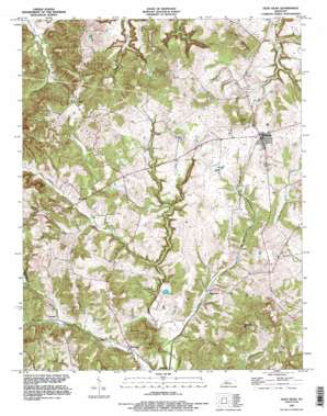
Glen Dean Topo Map Kentucky
To zoom in, hover over the map of Glen Dean
USGS Topo Quad 37086f5 - 1:24,000 scale
| Topo Map Name: | Glen Dean |
| USGS Topo Quad ID: | 37086f5 |
| Print Size: | ca. 21 1/4" wide x 27" high |
| Southeast Coordinates: | 37.625° N latitude / 86.5° W longitude |
| Map Center Coordinates: | 37.6875° N latitude / 86.5625° W longitude |
| U.S. State: | KY |
| Filename: | o37086f5.jpg |
| Download Map JPG Image: | Glen Dean topo map 1:24,000 scale |
| Map Type: | Topographic |
| Topo Series: | 7.5´ |
| Map Scale: | 1:24,000 |
| Source of Map Images: | United States Geological Survey (USGS) |
| Alternate Map Versions: |
Glen Dean KY 1953, updated 1955 Download PDF Buy paper map Glen Dean KY 1963, updated 1965 Download PDF Buy paper map Glen Dean KY 1963, updated 1967 Download PDF Buy paper map Glen Dean KY 1993, updated 1996 Download PDF Buy paper map Glen Dean KY 2010 Download PDF Buy paper map Glen Dean KY 2013 Download PDF Buy paper map Glen Dean KY 2016 Download PDF Buy paper map |
1:24,000 Topo Quads surrounding Glen Dean
> Back to 37086e1 at 1:100,000 scale
> Back to 37086a1 at 1:250,000 scale
> Back to U.S. Topo Maps home
Glen Dean topo map: Gazetteer
Glen Dean: Populated Places
Dempster elevation 137m 449′Glen Dean elevation 146m 479′
McQuady elevation 206m 675′
Rockvale elevation 142m 465′
Tar Fork elevation 210m 688′
Vanzant elevation 159m 521′
Glen Dean: Streams
Black Lick Creek elevation 139m 456′Daniels Creek elevation 134m 439′
Dry Fork elevation 144m 472′
Glen Dean: Summits
Black Jack Knob elevation 198m 649′Cretcheloe Hill elevation 244m 800′
Egypt Knob elevation 236m 774′
Knob Lick Hill elevation 245m 803′
Powell Hill elevation 247m 810′
Glen Dean digital topo map on disk
Buy this Glen Dean topo map showing relief, roads, GPS coordinates and other geographical features, as a high-resolution digital map file on DVD:


