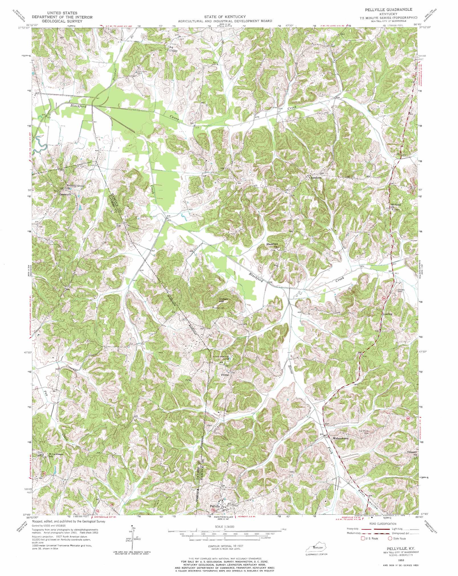
Pellville Topo Map Kentucky
To zoom in, hover over the map of Pellville
USGS Topo Quad 37086g7 - 1:24,000 scale
| Topo Map Name: | Pellville |
| USGS Topo Quad ID: | 37086g7 |
| Print Size: | ca. 21 1/4" wide x 27" high |
| Southeast Coordinates: | 37.75° N latitude / 86.75° W longitude |
| Map Center Coordinates: | 37.8125° N latitude / 86.8125° W longitude |
| U.S. State: | KY |
| Filename: | o37086g7.jpg |
| Download Map JPG Image: | Pellville topo map 1:24,000 scale |
| Map Type: | Topographic |
| Topo Series: | 7.5´ |
| Map Scale: | 1:24,000 |
| Source of Map Images: | United States Geological Survey (USGS) |
| Alternate Map Versions: |
Pellville KY 1953, updated 1955 Download PDF Buy paper map Pellville KY 1953, updated 1970 Download PDF Buy paper map Pellville KY 2010 Download PDF Buy paper map Pellville KY 2013 Download PDF Buy paper map Pellville KY 2016 Download PDF Buy paper map |
1:24,000 Topo Quads surrounding Pellville
Chrisney |
Santa Claus |
Fulda |
Gatchel |
Derby |
Rockport |
Lewisport |
Tell City |
Cannelton |
Rome |
Owensboro East |
Maceo |
Pellville |
Cloverport |
Mattingly |
Sutherland |
Philpot |
Whitesville |
Fordsville |
Glen Dean |
Utica |
Pleasant Ridge |
Dundee |
Olaton |
Falls Of Rough |
> Back to 37086e1 at 1:100,000 scale
> Back to 37086a1 at 1:250,000 scale
> Back to U.S. Topo Maps home
Pellville topo map: Gazetteer
Pellville: Populated Places
Chambers elevation 182m 597′Floral elevation 173m 567′
Gatewood elevation 172m 564′
Goering elevation 146m 479′
Pellville elevation 169m 554′
Weberstown elevation 139m 456′
Pellville: Streams
Caney Creek elevation 123m 403′Driskell Branch elevation 122m 400′
Horse Fork elevation 128m 419′
Pellville: Summits
Indian Hill elevation 205m 672′Pellville: Valleys
Bates Hollow elevation 137m 449′Pellville digital topo map on disk
Buy this Pellville topo map showing relief, roads, GPS coordinates and other geographical features, as a high-resolution digital map file on DVD: