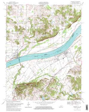
Lewisport Topo Map Kentucky
To zoom in, hover over the map of Lewisport
USGS Topo Quad 37086h8 - 1:24,000 scale
| Topo Map Name: | Lewisport |
| USGS Topo Quad ID: | 37086h8 |
| Print Size: | ca. 21 1/4" wide x 27" high |
| Southeast Coordinates: | 37.875° N latitude / 86.875° W longitude |
| Map Center Coordinates: | 37.9375° N latitude / 86.9375° W longitude |
| U.S. States: | KY, IN |
| Filename: | o37086h8.jpg |
| Download Map JPG Image: | Lewisport topo map 1:24,000 scale |
| Map Type: | Topographic |
| Topo Series: | 7.5´ |
| Map Scale: | 1:24,000 |
| Source of Map Images: | United States Geological Survey (USGS) |
| Alternate Map Versions: |
Lewisport KY 1953, updated 1955 Download PDF Buy paper map Lewisport KY 1960, updated 1962 Download PDF Buy paper map Lewisport KY 1967, updated 1969 Download PDF Buy paper map Lewisport KY 2010 Download PDF Buy paper map Lewisport KY 2013 Download PDF Buy paper map Lewisport KY 2016 Download PDF Buy paper map |
1:24,000 Topo Quads surrounding Lewisport
> Back to 37086e1 at 1:100,000 scale
> Back to 37086a1 at 1:250,000 scale
> Back to U.S. Topo Maps home
Lewisport topo map: Gazetteer
Lewisport: Cliffs
Shaw Bluff elevation 134m 439′Lewisport: Islands
Corn Island elevation 114m 374′Lewisport: Populated Places
Grandview elevation 120m 393′Lewisport elevation 121m 396′
Waitman elevation 119m 390′
Lewisport: Reservoirs
Fish and Game Farm Lake elevation 137m 449′Sunnys Lake elevation 122m 400′
Lewisport: Streams
Big Slough elevation 109m 357′Blackford Creek elevation 107m 351′
Butchers Branch elevation 118m 387′
Goose Creek elevation 107m 351′
Little Blackford Creek elevation 114m 374′
Little Sandy Creek elevation 112m 367′
Little Slough elevation 116m 380′
Little Yellow Creek elevation 116m 380′
Sandy Creek elevation 107m 351′
Slough Creek elevation 116m 380′
Yellow Creek elevation 107m 351′
Lewisport: Summits
Gentry Hill elevation 155m 508′Lewisport digital topo map on disk
Buy this Lewisport topo map showing relief, roads, GPS coordinates and other geographical features, as a high-resolution digital map file on DVD:


