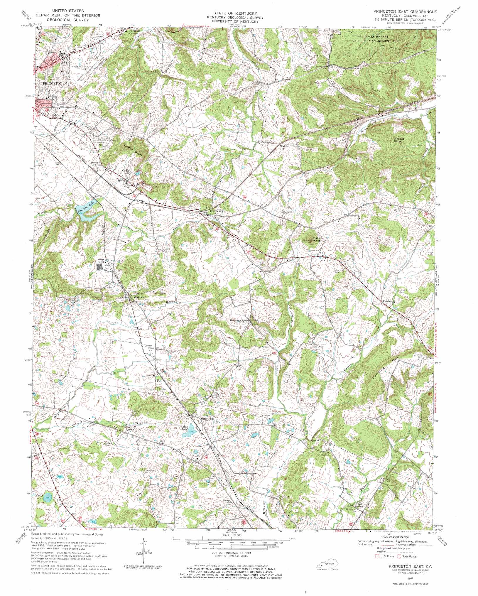
Princeton East Topo Map Kentucky
To zoom in, hover over the map of Princeton East
USGS Topo Quad 37087a7 - 1:24,000 scale
| Topo Map Name: | Princeton East |
| USGS Topo Quad ID: | 37087a7 |
| Print Size: | ca. 21 1/4" wide x 27" high |
| Southeast Coordinates: | 37° N latitude / 87.75° W longitude |
| Map Center Coordinates: | 37.0625° N latitude / 87.8125° W longitude |
| U.S. State: | KY |
| Filename: | o37087a7.jpg |
| Download Map JPG Image: | Princeton East topo map 1:24,000 scale |
| Map Type: | Topographic |
| Topo Series: | 7.5´ |
| Map Scale: | 1:24,000 |
| Source of Map Images: | United States Geological Survey (USGS) |
| Alternate Map Versions: |
Princeton East KY 1954, updated 1955 Download PDF Buy paper map Princeton East KY 1954, updated 1965 Download PDF Buy paper map Princeton East KY 1967, updated 1969 Download PDF Buy paper map Princeton East KY 2010 Download PDF Buy paper map Princeton East KY 2013 Download PDF Buy paper map Princeton East KY 2016 Download PDF Buy paper map |
1:24,000 Topo Quads surrounding Princeton East
Marion |
Shady Grove |
Dalton |
Coiltown |
Madisonville West |
Fredonia |
Crider |
Olney |
Dawson Springs |
Saint Charles |
Eddyville |
Princeton West |
Princeton East |
Dawson Springs Sw |
Dawson Springs Se |
Mont |
Lamasco |
Cobb |
Gracey |
Pleasant Green Hill |
Fenton |
Canton |
Cadiz |
Caledonia |
Church Hill |
> Back to 37087a1 at 1:100,000 scale
> Back to 37086a1 at 1:250,000 scale
> Back to U.S. Topo Maps home
Princeton East topo map: Gazetteer
Princeton East: Airports
Princeton-Caldwell County Airport elevation 168m 551′Princeton East: Cliffs
Ceda Bluff elevation 156m 511′Princeton East: Lakes
Otter Pond elevation 162m 531′Smith Lake elevation 151m 495′
Princeton East: Populated Places
Cedar Bluff elevation 158m 518′Claxton elevation 146m 479′
Friendship elevation 161m 528′
McGowan elevation 157m 515′
Otter Pond elevation 172m 564′
Pumpkin Center elevation 147m 482′
Scottsburg elevation 160m 524′
Walche Cut elevation 167m 547′
Princeton East: Reservoirs
Railroad Lake elevation 137m 449′Princeton East: Ridges
Wildcat Ridge elevation 184m 603′Princeton East: Springs
Cantrell Spring elevation 149m 488′Dripping Spring elevation 172m 564′
Groom Spring elevation 137m 449′
Princeton East: Streams
Battle Creek elevation 137m 449′Cantrell Creek elevation 134m 439′
Craven Creek elevation 137m 449′
Eison Branch elevation 188m 616′
Wede Branch elevation 137m 449′
Princeton East: Summits
Bald Knob elevation 233m 764′Dunning Hill elevation 209m 685′
Princeton East digital topo map on disk
Buy this Princeton East topo map showing relief, roads, GPS coordinates and other geographical features, as a high-resolution digital map file on DVD: