Princeton West Topo Map Kentucky
To zoom in, hover over the map of Princeton West
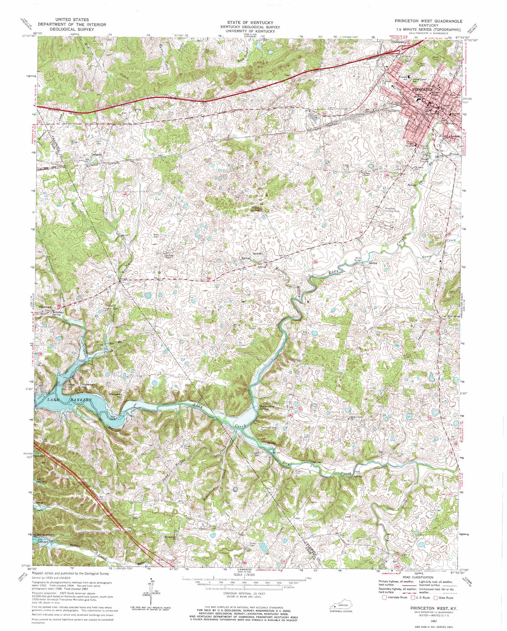
USGS Topo Quad 37087a8 - 1:24,000 scale
| Topo Map Name: | Princeton West |
| USGS Topo Quad ID: | 37087a8 |
| Print Size: | ca. 21 1/4" wide x 27" high |
| Southeast Coordinates: | 37° N latitude / 87.875° W longitude |
| Map Center Coordinates: | 37.0625° N latitude / 87.9375° W longitude |
| U.S. State: | KY |
| Filename: | o37087a8.jpg |
| Download Map JPG Image: | Princeton West topo map 1:24,000 scale |
| Map Type: | Topographic |
| Topo Series: | 7.5´ |
| Map Scale: | 1:24,000 |
| Source of Map Images: | United States Geological Survey (USGS) |
| Alternate Map Versions: |
Princeton West KY 1954, updated 1955 Download PDF Buy paper map Princeton West KY 1967, updated 1970 Download PDF Buy paper map Princeton West KY 2010 Download PDF Buy paper map Princeton West KY 2013 Download PDF Buy paper map Princeton West KY 2016 Download PDF Buy paper map |
| FStopo: | US Forest Service topo Princeton West is available: Download FStopo PDF Download FStopo TIF |
1:24,000 Topo Quads surrounding Princeton West
Salem |
Marion |
Shady Grove |
Dalton |
Coiltown |
Dycusburg |
Fredonia |
Crider |
Olney |
Dawson Springs |
Grand Rivers |
Eddyville |
Princeton West |
Princeton East |
Dawson Springs Sw |
Birmingham Point |
Mont |
Lamasco |
Cobb |
Gracey |
Fairdealing |
Fenton |
Canton |
Cadiz |
Caledonia |
> Back to 37087a1 at 1:100,000 scale
> Back to 37086a1 at 1:250,000 scale
> Back to U.S. Topo Maps home
Princeton West topo map: Gazetteer
Princeton West: Bridges
Wiley Bridge elevation 123m 403′Princeton West: Parks
Ratliff Park elevation 135m 442′V F W Park elevation 135m 442′
Princeton West: Populated Places
Dulaney elevation 165m 541′Princeton elevation 147m 482′
Saratoga elevation 123m 403′
Princeton West: Springs
Big Spring elevation 145m 475′Harpending Springs elevation 116m 380′
Hayes Spring elevation 130m 426′
Saratoga Spring elevation 119m 390′
Princeton West: Streams
Big Spring Branch elevation 131m 429′Dry Creek elevation 112m 367′
Dry Fork Creek elevation 128m 419′
Glass Creek elevation 110m 360′
Goose Creek elevation 125m 410′
Pilfer Creek elevation 107m 351′
Robertson Creek elevation 121m 396′
Sand Hollow Creek elevation 112m 367′
Scott Branch elevation 112m 367′
Sweetwater Creek elevation 116m 380′
Wallace Branch elevation 122m 400′
Princeton West: Summits
Hallaway Hill elevation 144m 472′Hopewell Hill elevation 137m 449′
Princeton West digital topo map on disk
Buy this Princeton West topo map showing relief, roads, GPS coordinates and other geographical features, as a high-resolution digital map file on DVD: