Madisonville East Topo Map Kentucky
To zoom in, hover over the map of Madisonville East
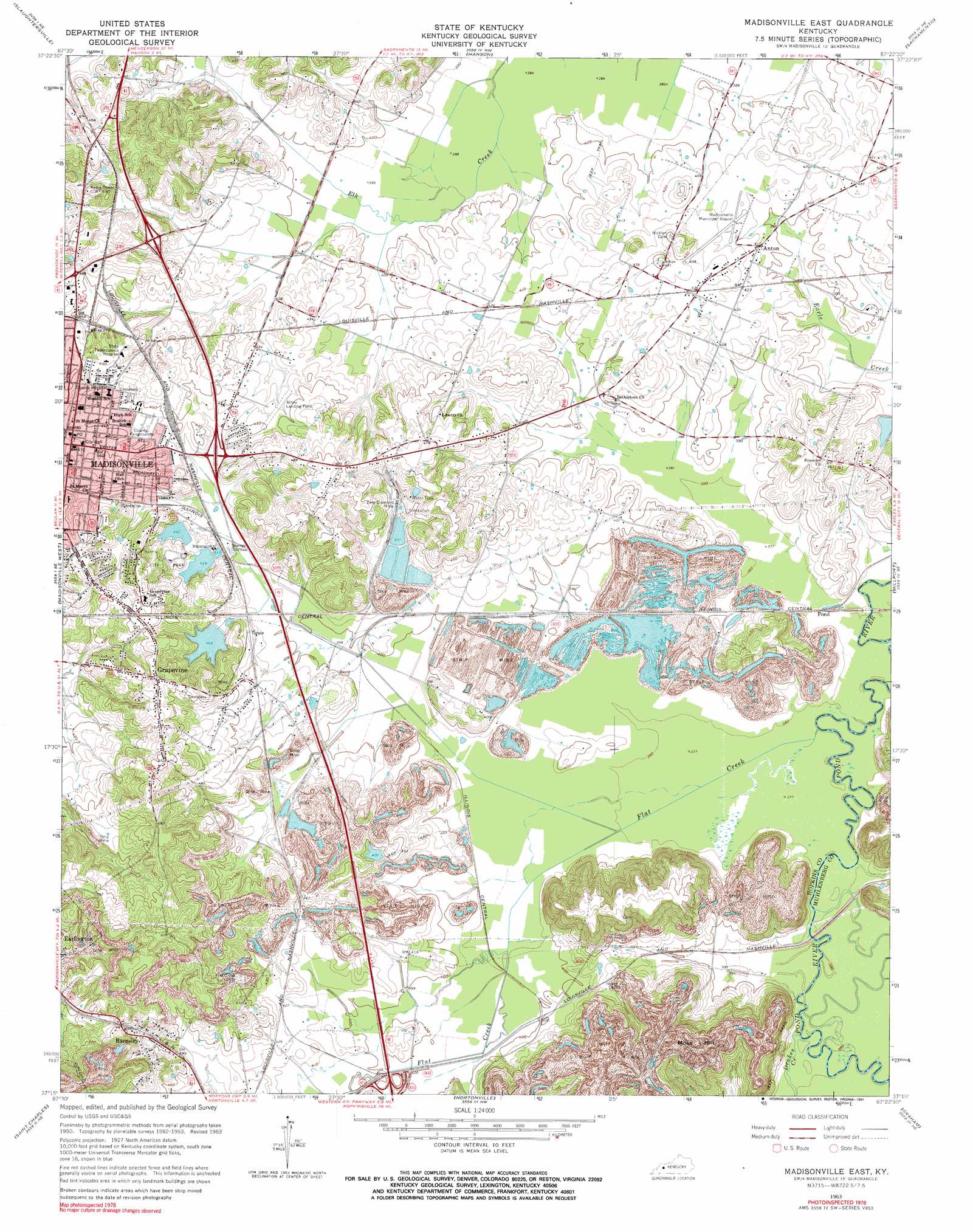
USGS Topo Quad 37087c4 - 1:24,000 scale
| Topo Map Name: | Madisonville East |
| USGS Topo Quad ID: | 37087c4 |
| Print Size: | ca. 21 1/4" wide x 27" high |
| Southeast Coordinates: | 37.25° N latitude / 87.375° W longitude |
| Map Center Coordinates: | 37.3125° N latitude / 87.4375° W longitude |
| U.S. State: | KY |
| Filename: | o37087c4.jpg |
| Download Map JPG Image: | Madisonville East topo map 1:24,000 scale |
| Map Type: | Topographic |
| Topo Series: | 7.5´ |
| Map Scale: | 1:24,000 |
| Source of Map Images: | United States Geological Survey (USGS) |
| Alternate Map Versions: |
Madisonville East KY 1953, updated 1954 Download PDF Buy paper map Madisonville East KY 1963, updated 1971 Download PDF Buy paper map Madisonville East KY 2010 Download PDF Buy paper map Madisonville East KY 2013 Download PDF Buy paper map Madisonville East KY 2016 Download PDF Buy paper map |
1:24,000 Topo Quads surrounding Madisonville East
Dixon |
Sebree |
Beech Grove |
Calhoun |
Glenville |
Nebo |
Slaughtersville |
Hanson |
Sacramento |
Livermore |
Coiltown |
Madisonville West |
Madisonville East |
Millport |
Central City West |
Dawson Springs |
Saint Charles |
Nortonville |
Graham |
Greenville |
Dawson Springs Sw |
Dawson Springs Se |
Crofton |
Haleys Mill |
Kirkmansville |
> Back to 37087a1 at 1:100,000 scale
> Back to 37086a1 at 1:250,000 scale
> Back to U.S. Topo Maps home
Madisonville East topo map: Gazetteer
Madisonville East: Airports
Madisonville Municipal Airport elevation 127m 416′RMC Heliport elevation 136m 446′
Madisonville East: Mines
East Diamond Mine elevation 134m 439′Madisonville East: Populated Places
Anton elevation 124m 406′Barnsley elevation 151m 495′
Grapevine elevation 157m 515′
Madisonville elevation 144m 472′
Madisonville East: Streams
Drakes Creek elevation 116m 380′Flat Creek elevation 113m 370′
Madisonville East: Summits
Moss Hill elevation 183m 600′Madisonville East digital topo map on disk
Buy this Madisonville East topo map showing relief, roads, GPS coordinates and other geographical features, as a high-resolution digital map file on DVD: