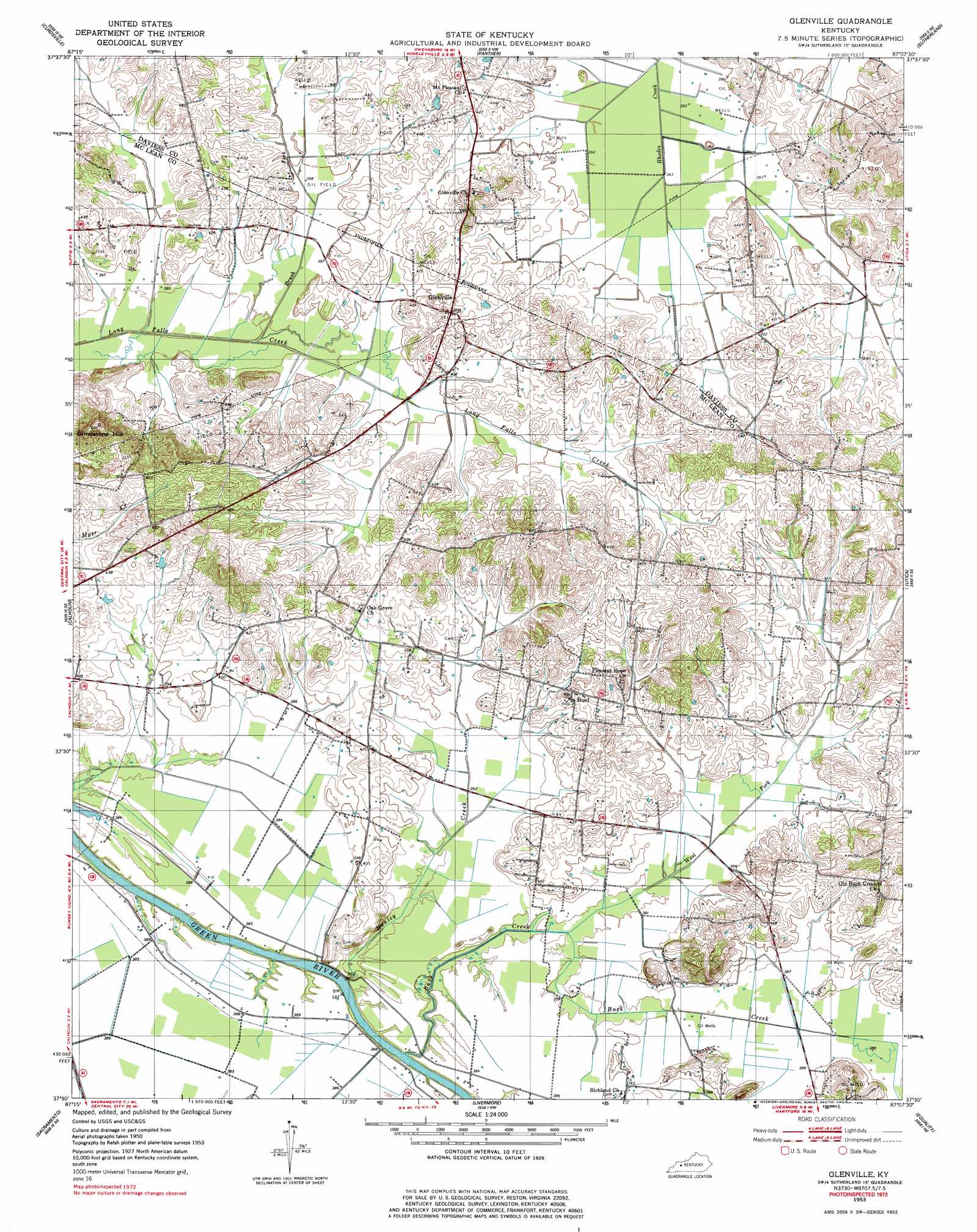
Glenville Topo Map Kentucky
To zoom in, hover over the map of Glenville
USGS Topo Quad 37087e2 - 1:24,000 scale
| Topo Map Name: | Glenville |
| USGS Topo Quad ID: | 37087e2 |
| Print Size: | ca. 21 1/4" wide x 27" high |
| Southeast Coordinates: | 37.5° N latitude / 87.125° W longitude |
| Map Center Coordinates: | 37.5625° N latitude / 87.1875° W longitude |
| U.S. State: | KY |
| Filename: | o37087e2.jpg |
| Download Map JPG Image: | Glenville topo map 1:24,000 scale |
| Map Type: | Topographic |
| Topo Series: | 7.5´ |
| Map Scale: | 1:24,000 |
| Source of Map Images: | United States Geological Survey (USGS) |
| Alternate Map Versions: |
Glenville KY 1953, updated 1954 Download PDF Buy paper map Glenville KY 1953, updated 1979 Download PDF Buy paper map Glenville KY 2010 Download PDF Buy paper map Glenville KY 2013 Download PDF Buy paper map Glenville KY 2016 Download PDF Buy paper map |
1:24,000 Topo Quads surrounding Glenville
Spottsville |
Reed |
Owensboro West |
Owensboro East |
Maceo |
Delaware |
Curdsville |
Panther |
Sutherland |
Philpot |
Beech Grove |
Calhoun |
Glenville |
Utica |
Pleasant Ridge |
Hanson |
Sacramento |
Livermore |
Equality |
Hartford |
Madisonville East |
Millport |
Central City West |
Central City East |
Paradise |
> Back to 37087e1 at 1:100,000 scale
> Back to 37086a1 at 1:250,000 scale
> Back to U.S. Topo Maps home
Glenville topo map: Gazetteer
Glenville: Populated Places
Buel elevation 133m 436′Glenville elevation 134m 439′
Glenville: Streams
Brush Fork elevation 119m 390′Buck Creek elevation 116m 380′
Hanley Creek elevation 110m 360′
West Fork Buck Creek elevation 114m 374′
Glenville: Summits
Grindstone Hill elevation 182m 597′Glenville digital topo map on disk
Buy this Glenville topo map showing relief, roads, GPS coordinates and other geographical features, as a high-resolution digital map file on DVD: