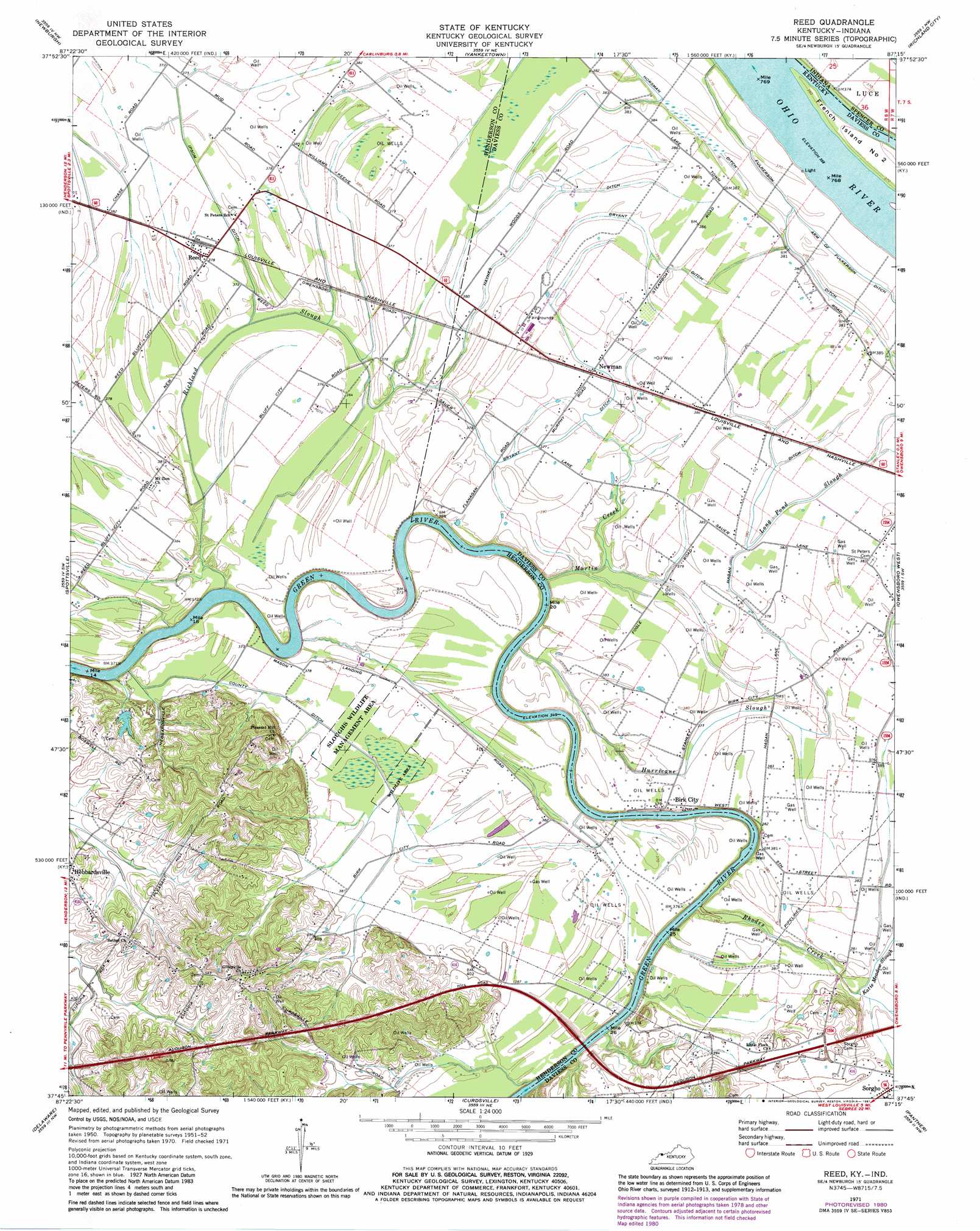
Reed Topo Map Kentucky
To zoom in, hover over the map of Reed
USGS Topo Quad 37087g3 - 1:24,000 scale
| Topo Map Name: | Reed |
| USGS Topo Quad ID: | 37087g3 |
| Print Size: | ca. 21 1/4" wide x 27" high |
| Southeast Coordinates: | 37.75° N latitude / 87.25° W longitude |
| Map Center Coordinates: | 37.8125° N latitude / 87.3125° W longitude |
| U.S. States: | KY, IN |
| Filename: | o37087g3.jpg |
| Download Map JPG Image: | Reed topo map 1:24,000 scale |
| Map Type: | Topographic |
| Topo Series: | 7.5´ |
| Map Scale: | 1:24,000 |
| Source of Map Images: | United States Geological Survey (USGS) |
| Alternate Map Versions: |
Reed KY 1952, updated 1953 Download PDF Buy paper map Reed KY 1971, updated 1973 Download PDF Buy paper map Reed KY 1971, updated 1981 Download PDF Buy paper map Reed KY 2010 Download PDF Buy paper map Reed KY 2013 Download PDF Buy paper map Reed KY 2016 Download PDF Buy paper map |
1:24,000 Topo Quads surrounding Reed
Evansville North |
Daylight |
Boonville |
De Gonia Springs |
Chrisney |
Evansville South |
Newburgh |
Yankeetown |
Richland City |
Rockport |
Henderson |
Spottsville |
Reed |
Owensboro West |
Owensboro East |
Robards |
Delaware |
Curdsville |
Panther |
Sutherland |
Sebree |
Beech Grove |
Calhoun |
Glenville |
Utica |
> Back to 37087e1 at 1:100,000 scale
> Back to 37086a1 at 1:250,000 scale
> Back to U.S. Topo Maps home
Reed topo map: Gazetteer
Reed: Canals
Bryant Ditch elevation 116m 380′Double Dam Ditch elevation 113m 370′
Fulkerson Ditch elevation 113m 370′
Hagan Ditch elevation 116m 380′
Haynes Woods Ditch elevation 116m 380′
Ipsom Ditch elevation 113m 370′
Reed: Parks
Sloughs Wildlife Management Area elevation 114m 374′Reed: Populated Places
Birk City elevation 117m 383′Newman elevation 116m 380′
Reed elevation 115m 377′
Reed: Streams
Hurricane Slough elevation 109m 357′Katie Meadow Slough elevation 111m 364′
Long Pond Slough elevation 116m 380′
Martin Creek elevation 109m 357′
Rhodes Creek elevation 106m 347′
Richland Slough elevation 110m 360′
Reed digital topo map on disk
Buy this Reed topo map showing relief, roads, GPS coordinates and other geographical features, as a high-resolution digital map file on DVD: