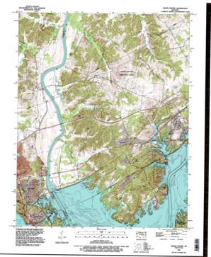
Grand Rivers Topo Map Kentucky
To zoom in, hover over the map of Grand Rivers
USGS Topo Quad 37088a2 - 1:24,000 scale
| Topo Map Name: | Grand Rivers |
| USGS Topo Quad ID: | 37088a2 |
| Print Size: | ca. 21 1/4" wide x 27" high |
| Southeast Coordinates: | 37° N latitude / 88.125° W longitude |
| Map Center Coordinates: | 37.0625° N latitude / 88.1875° W longitude |
| U.S. State: | KY |
| Filename: | o37088a2.jpg |
| Download Map JPG Image: | Grand Rivers topo map 1:24,000 scale |
| Map Type: | Topographic |
| Topo Series: | 7.5´ |
| Map Scale: | 1:24,000 |
| Source of Map Images: | United States Geological Survey (USGS) |
| Alternate Map Versions: |
Grand Rivers KY 1936 Download PDF Buy paper map Grand Rivers KY 1955, updated 1956 Download PDF Buy paper map Grand Rivers KY 1967, updated 1970 Download PDF Buy paper map Grand Rivers KY 1993, updated 1996 Download PDF Buy paper map Grand Rivers KY 2011 Download PDF Buy paper map Grand Rivers KY 2013 Download PDF Buy paper map Grand Rivers KY 2016 Download PDF Buy paper map |
| FStopo: | US Forest Service topo Grand Rivers is available: Download FStopo PDF Download FStopo TIF |
1:24,000 Topo Quads surrounding Grand Rivers
> Back to 37088a1 at 1:100,000 scale
> Back to 37088a1 at 1:250,000 scale
> Back to U.S. Topo Maps home
Grand Rivers topo map: Gazetteer
Grand Rivers: Bays
Carmack Bay elevation 107m 351′Champion Springs Cove elevation 107m 351′
Double Creek elevation 107m 351′
Grand Rivers: Bridges
Ralph Smith Bridge elevation 92m 301′Grand Rivers: Cliffs
Money Cliff elevation 118m 387′Grand Rivers: Dams
Barkley Dam elevation 119m 390′Grand Rivers: Lakes
Gray Slough elevation 98m 321′Grand Rivers: Populated Places
Grand Rivers elevation 118m 387′Iuka elevation 105m 344′
Kuttawa elevation 137m 449′
Lake City elevation 126m 413′
Suwanee elevation 132m 433′
Grand Rivers: Reservoirs
Lake Barkley elevation 116m 380′Grand Rivers: Springs
Cook Spring elevation 115m 377′Grand Rivers: Streams
Baldwin Slough elevation 97m 318′Big Crevasse Creek elevation 92m 301′
Cook Creek elevation 97m 318′
Cypress Creek elevation 109m 357′
Flat Creek elevation 95m 311′
Hazel Creek elevation 98m 321′
Poplar Creek elevation 107m 351′
Richland Creek elevation 92m 301′
Spring Branch elevation 100m 328′
Grand Rivers: Summits
Buzzard Rock elevation 133m 436′Iron Hill elevation 159m 521′
Grand Rivers digital topo map on disk
Buy this Grand Rivers topo map showing relief, roads, GPS coordinates and other geographical features, as a high-resolution digital map file on DVD:


