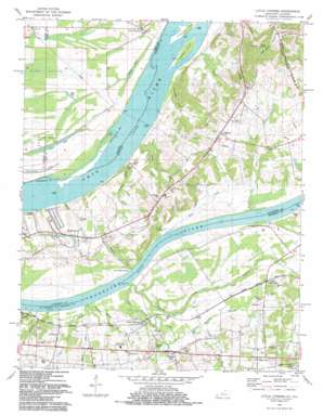
Little Cypress Topo Map Kentucky
To zoom in, hover over the map of Little Cypress
USGS Topo Quad 37088a4 - 1:24,000 scale
| Topo Map Name: | Little Cypress |
| USGS Topo Quad ID: | 37088a4 |
| Print Size: | ca. 21 1/4" wide x 27" high |
| Southeast Coordinates: | 37° N latitude / 88.375° W longitude |
| Map Center Coordinates: | 37.0625° N latitude / 88.4375° W longitude |
| U.S. States: | KY, IL |
| Filename: | o37088a4.jpg |
| Download Map JPG Image: | Little Cypress topo map 1:24,000 scale |
| Map Type: | Topographic |
| Topo Series: | 7.5´ |
| Map Scale: | 1:24,000 |
| Source of Map Images: | United States Geological Survey (USGS) |
| Alternate Map Versions: |
Little Cypress KY 1936 Download PDF Buy paper map Little Cypress KY 1954, updated 1956 Download PDF Buy paper map Little Cypress KY 1958, updated 1959 Download PDF Buy paper map Little Cypress KY 1958, updated 1973 Download PDF Buy paper map Little Cypress KY 1982, updated 1983 Download PDF Buy paper map Little Cypress KY 2010 Download PDF Buy paper map Little Cypress KY 2013 Download PDF Buy paper map Little Cypress KY 2016 Download PDF Buy paper map |
1:24,000 Topo Quads surrounding Little Cypress
> Back to 37088a1 at 1:100,000 scale
> Back to 37088a1 at 1:250,000 scale
> Back to U.S. Topo Maps home
Little Cypress topo map: Gazetteer
Little Cypress: Bars
Cottonwood Bar elevation 92m 301′Little Cypress: Guts
Beaverdam Slough elevation 104m 341′Little Cypress: Islands
Towhead Island elevation 99m 324′Little Cypress: Lakes
Avery Lake elevation 95m 311′Beaverdam Lake elevation 98m 321′
Burgess Pond elevation 101m 331′
Little Cypress: Populated Places
Altona elevation 105m 344′Cloud Crossing elevation 106m 347′
Crowell Landing elevation 108m 354′
Ledbetter elevation 106m 347′
Little Cypress elevation 107m 351′
New Liberty elevation 104m 341′
Possum Trot elevation 105m 344′
Upper Hodge Landing elevation 98m 321′
Little Cypress: Reservoirs
Clear Lake elevation 101m 331′Little Cypress: Springs
Echo Spring elevation 112m 367′Little Cypress: Streams
Angle Creek elevation 101m 331′Barrett Branch elevation 100m 328′
Buzzard Creek elevation 93m 305′
Caney Creek elevation 97m 318′
Cypress Creek elevation 92m 301′
Davis Creek elevation 94m 308′
Drake Branch elevation 94m 308′
Echo Spring Branch elevation 105m 344′
Goodlow Slough elevation 92m 301′
Hodges Creek elevation 93m 305′
Lee Creek elevation 95m 311′
Little Cypress Creek elevation 94m 308′
Little White Oak Creek elevation 94m 308′
Mud Creek elevation 92m 301′
Threlkeld Creek elevation 92m 301′
White Oak Creek elevation 92m 301′
Yancy Creek elevation 94m 308′
Little Cypress: Summits
Kincaid Mounds elevation 109m 357′Little Cypress digital topo map on disk
Buy this Little Cypress topo map showing relief, roads, GPS coordinates and other geographical features, as a high-resolution digital map file on DVD:


