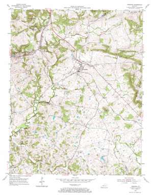
Fredonia Topo Map Kentucky
To zoom in, hover over the map of Fredonia
USGS Topo Quad 37088b1 - 1:24,000 scale
| Topo Map Name: | Fredonia |
| USGS Topo Quad ID: | 37088b1 |
| Print Size: | ca. 21 1/4" wide x 27" high |
| Southeast Coordinates: | 37.125° N latitude / 88° W longitude |
| Map Center Coordinates: | 37.1875° N latitude / 88.0625° W longitude |
| U.S. State: | KY |
| Filename: | o37088b1.jpg |
| Download Map JPG Image: | Fredonia topo map 1:24,000 scale |
| Map Type: | Topographic |
| Topo Series: | 7.5´ |
| Map Scale: | 1:24,000 |
| Source of Map Images: | United States Geological Survey (USGS) |
| Alternate Map Versions: |
Fredonia KY 1954, updated 1955 Download PDF Buy paper map Fredonia KY 1954, updated 1967 Download PDF Buy paper map Fredonia KY 2010 Download PDF Buy paper map Fredonia KY 2013 Download PDF Buy paper map Fredonia KY 2016 Download PDF Buy paper map |
1:24,000 Topo Quads surrounding Fredonia
> Back to 37088a1 at 1:100,000 scale
> Back to 37088a1 at 1:250,000 scale
> Back to U.S. Topo Maps home
Fredonia topo map: Gazetteer
Fredonia: Basins
Fredonia Valley elevation 142m 465′Fredonia: Mines
Blue Mine elevation 147m 482′Fredonia Valley Quarry elevation 157m 515′
Haffaw Mine elevation 146m 479′
King Mine elevation 148m 485′
Pigmy Mines elevation 134m 439′
Tabb Number 1 Mine elevation 145m 475′
Fredonia: Populated Places
Bakers elevation 147m 482′Fredonia elevation 130m 426′
Mexico elevation 151m 495′
The Bluff elevation 123m 403′
Fredonia: Springs
Sulphur Spring elevation 144m 472′Fredonia: Streams
Brewster Creek elevation 128m 419′Dry Fork elevation 104m 341′
Dry Fork Skinframe Creek elevation 117m 383′
Horseapple Creek elevation 116m 380′
McElroy Creek elevation 133m 436′
Sinking Fork Livingston Creek elevation 125m 410′
Skinframe Creek elevation 128m 419′
Skinframe Creek elevation 101m 331′
Fredonia: Summits
Moore Hill elevation 211m 692′The Knob elevation 216m 708′
Fredonia digital topo map on disk
Buy this Fredonia topo map showing relief, roads, GPS coordinates and other geographical features, as a high-resolution digital map file on DVD:


